The Master Programme for Spatial Planning in Luxembourg, known as “Programme directeur d’aménagement du territoire” (PDAT) 2023, is the central element of the country’s spatial planning policy. Serving as a framework for a sustainable development of the national territory and for enhancing the quality of life of all citizens, the PDAT defines an integrated strategy for sectorial policies with a territorial impact and defines guidelines, objectives and measures for the government and municipalities. The newly adopted PDAT (21 June 2023), which was prepared by the Department of Spatial Planning in cooperation with an interministerial working group, builds upon a large public participation process in 2018 and the international consultation “Luxembourg in Transition” in 2020—2022.

Structure and objectives

PDAT 2035 (Source: Département de l’aménagement du territoire (DATer) 2023)

In order to frame the strategy, objectives and measures, the PDAT was developed in accordance with the following four guiding principles:

  • Increasing the resilience of the territory
  • Safeguarding territorial, social and economic cohesion
  • Ensuring a sustainable management of natural resources
  • Accelerating the transition of the territory to carbon neutrality

Based on those guiding principles, three policy objectives and a cross-cutting objective have been identified, addressing the development issues highlighted in the spatial analysis as well as the challenges imposed by climate, environmental, geopolitical and health crises:

1. Concentration of development in the most suitable places: Central to the PDAT’s mission is guiding sector policies and supporting municipalities in locating essential functions and services in the most suitable places. This aims to facilitate access to services, anticipate and reduce mobility needs as well as plan for critical infrastructure.

By guiding future development, the PDAT enables efficient infrastructure planning and a cost-effective implementation of sector policies. The territorial strategy encompasses an urban hierarchy based on Central Places (centres de développement et d’attraction, CDA), which is supposed to steer the spatial distribution of population (i.e. development) and employment growth (i.e. attraction) in a sustainable manner.

2. Reducing land take: The PDAT focuses on limiting the process of converting natural, agricultural or forest land into built-up areas. Decreasing land take offers several benefits, including mitigating the effects of climate change, preserving natural and semi-natural areas, minimising flood risks, protecting biodiversity, and fostering carbon sequestration. The goal is to gradually reduce land take from by 2035 and tend towards no net land take (zéro artificialisation nette du sol) by 2050.

Dynamics of soil artificialisation 2007-2018 (Source: Département de l’aménagement du territoire (DATer) 2023)

To achieve this, the PDAT puts forward a planning culture that promotes urban regeneration, multifunctionality and efficient land management.

3. Cross-border spatial planning: Taking into account the functional linkages between Luxembourg and its cross-border functional region, the PDAT recognises the need for a concerted territorial development in the Greater Region (Grande Région). To address ecological and climate transition challenges, the Master Programme promotes territorial development strategies for cross-border functional areas, consultation with neighbouring regions in the framework of planning processes, and cross-border resource management.

4. Collaborative Governance as a cross-cutting objective: In the PDAT, governance is considered to be a cross-cutting objective, emphasising the coordination required for effective spatial planning. This is meant to happen horizontally across sector policies, vertically between the State and municipalities, as well as through public participation.

Time Horizon

The PDAT2023 is meant to unfold in two phases: 2023-2035 and 2035-2050. The first period until 2035 will act as a transition phase, which contributes to reversing the current development trends. Actions will focus on identifying and adopting instruments for the implementation of the Master Programme as well as initiating pilot projects and stakeholder connections.

The second phase, from 2035 to 2050, will ensure a steady transition and reverse the trends in question by the implementation of the strategies, while monitoring the developments as well as adapting approaches as needed.

Programme directeur d'aménagement du territoire 2023 - Stratégies  territoriales - Portail de l'aménagement du territoire - Luxembourg
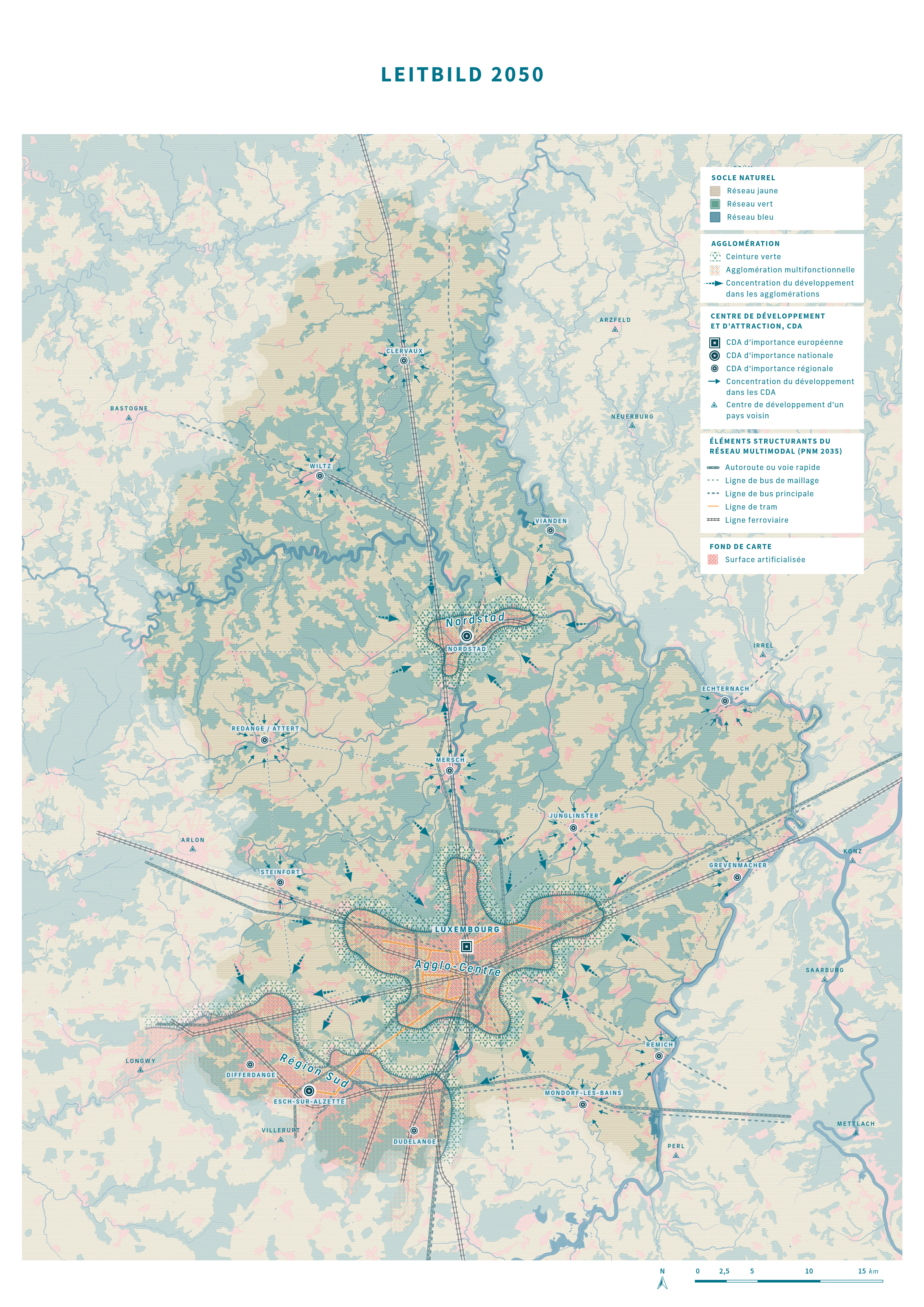
Vision 2050 in the PDAT (Source: Département de l’aménagement du territoire (DATer) 2023)

Implementation

In order to achieve the above-mentioned policy objectives in the given timeframes, two territorial strategies have been developed at different scales. First, the national territorial development strategy “Leitbild 2050” envisions a carbon-neutral and resilient territory, emphasising green, yellow and blue networks, the concentration of development in accordance with the urban hierarchy, and a sustainable mobility. This national territorial development strategy has also been broken down to so-called action areas (espaces d’action) at a functional-regional level. In this context, territorial visions for the three urban agglomerations have also been developed. Second, the territorial development strategy at the level of the Greater Region promotes cooperation in cross-border action areas, in accordance with the Interreg VI Greater Region programme. This cooperation fosters integrated territorial development in cross-border functional areas, complementing previous approaches by addressing challenges linked to the environment and natural resources. The implementation of strategies will be fostered through the adaptation of existing regulatory instruments and the potential creation of new ones.

Conclusion

The Master Programme for Spatial Planning in Luxembourg sets a forward-looking and ambitious territorial vision. By addressing climate change, resource preservation and sustainable growth, the PDAT paves the way for the ecological transition of the territory. Through clear strategic objectives and cross-sectoral coordination, Luxembourg is taking a further step towards sustainable development and enhancing citizens’ quality of life.

References

Master Programme for Spatial Planning in Luxembourg – “Programme directeur d’aménagement du territoire” (PDAT) 2023 (French): https://amenagement-territoire.public.lu/content/dam/amenagement_territoire/pdat-programme-directeur-damnagement-du-territoire-4072023.pdf

Spatial planning portal (French): https://amenagement-territoire.public.lu/fr/strategies-territoriales/programme-directeur.html

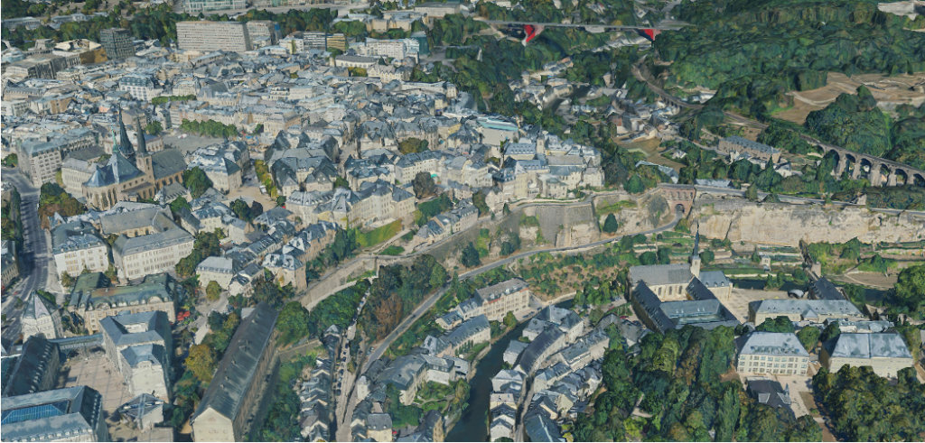
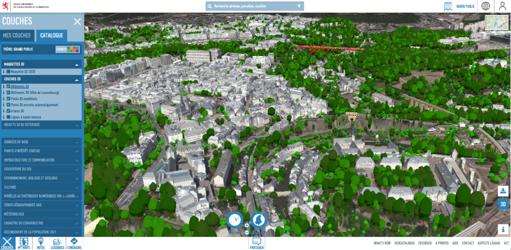
The 3D model featured on the National Geoportal of the Grand-Duchy of Luxembourg provides a comprehensive and detailed representation of Luxembourg’s landscape. This digital rendering aims to serve as a robust and accessible source of geospatial data, facilitating informed decision-making for policymakers, local administrations, and private individuals. The 3D model strives to encapsulate the intricate details of the country, from individual trees and buildings to streets, offering a dynamic platform for diverse applications and insights into Luxembourg’s terrain.

3D scale model of a section of Luxembourg city (https://www.geoportail.lu/en/)

In a groundbreaking move towards comprehensive data representation, the Luxembourgish Geoportal has expanded its services from traditional two-dimensional maps to an immersive three-dimensional model. The meticulous creation of this 3D model involved the precise measurement of Luxembourg from above, capturing 82 billion reference points that define every tree, building, and street in the Grand Duchy. The extensive data collection for the 3D model included aerial imagery, ground elevation, and detailed information about buildings and vegetation.

The general dataset within Geoportail.lu forms the basis for various thematic sections, covering topics such as water management, agriculture, energy, and the recently introduced section dedicated to nature parks. The digital platform proves instrumental in the effective management of nature parks, allowing stakeholders to access pertinent information effortlessly. For instance, those engaged in agriculture can utilise the platform to streamline data retrieval, consequently reducing delays in negotiations related to the management of these critical natural areas.

3D scale model of a section of Luxembourg city with vegetation (https://www.geoportail.lu/en/)

The platform’s significance extends beyond nature conservation, reaching into the realm of spatial planning and policy advice. The Geoportal can simplify complex decision-making processes in the development and sustainability of Luxembourg’s landscape, e.g. aiding in the identification of optimal locations for tree planting, particularly crucial in mitigating the impact of rising heatwaves. With a substantial user base of around 5,000 daily visitors, Geoportail.lu is a helpful tool, catering to the diverse needs of individuals, governmental ministries, and local administrations.

Moreover, the integration of the 3D model into the Geoportal serves as a powerful tool for urbanism, offering urban planners and architects a nuanced understanding of spatial dynamics. This enhanced spatial insight aids in optimising city layouts, infrastructure development, and the creation of more sustainable and liveable urban environments. It can also act as a catalyst for fostering collaborative initiatives. Through facilitating stakeholder engagement, the model allows urban planners, policymakers, and community members to collaboratively envision and refine development projects.

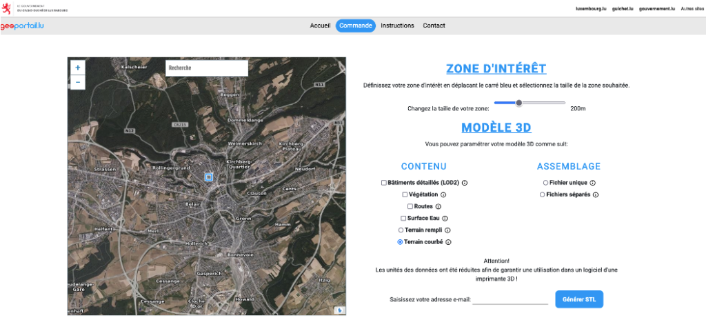
Generation of a map section in STL format on Geoportail.lu (https://3dprint.geoportail.lu/commande)

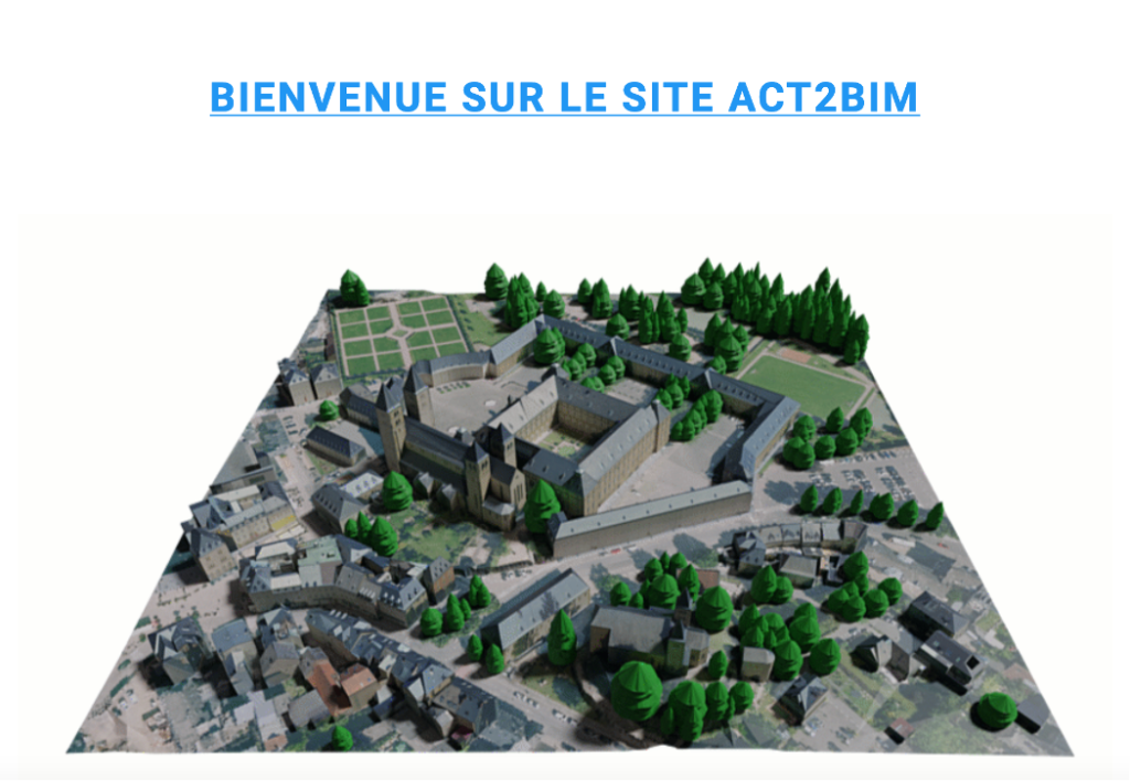
For those interested in specific data details, the Digital Building Luxembourg website (see below) provides further insights into the creation process of the 3D model. Additionally, the OpenData portal of the State (see below) offers downloadable files and resources related to the 3D model, including terrain models and surface models that can be printed in 3D or utilised in professional drawing or rendering software. The Administration du Cadastre et de la Topographie (see below) offers a detailed breakdown of available formats, use cases, and specific data sources, ensuring transparency and credibility in the utilisation of 3D geospatial information. Adding to this, the act2bim.geoportail.lu, a platform where georeferenced or local 3D files in Collada, IFC, or Sketchup formats can be ordered is set to launch end of January 2024.

Preview of the ACT2BIM Website (Geoportail.lu)

The integration of the 3D model into the Geoportal not only elevates the user experience by offering a more immersive representation of Luxembourg’s landscape but also significantly enhances the platform’s utility across various sectors. This advanced spatial visualisation proves invaluable for urban planning and architectural simulations, providing a three-dimensional perspective that aids in optimising spatial development. Additionally, the 3D model enriches the Geoportal’s functionality for environmental conservation, allowing conservationists and policymakers to make more informed decisions regarding biodiversity preservation and sustainable land use. The synergistic integration of the 3D model into the Geoportal underscores its role as a dynamic and comprehensive tool, fostering improved decision-making processes and contributing to the holistic understanding of Luxembourg’s diverse terrain.

Contact

Geoportail: support@geoportail.lu

Digital Building Luxembourg: contact@crtib.lu

CIPU: cipu@zeyenbaumann.lu

References and further information

National Geoportail of the Grand-Duchy Luxembourg: https://www.geoportail.lu/en/

Digital Building Luxembourg website (FR): https://www.digitalbuilding.lu/fr/actualite/maquette-3d-du-territoire-national-luxembourgeois/

OpenData portal of the State: https://data.public.lu/

3D Print Export generation: https://3dprint.geoportail.lu/

Administration du Cadastre et de la Topographie: https://act.public.lu/fr/cartographie/export-print-3d.html

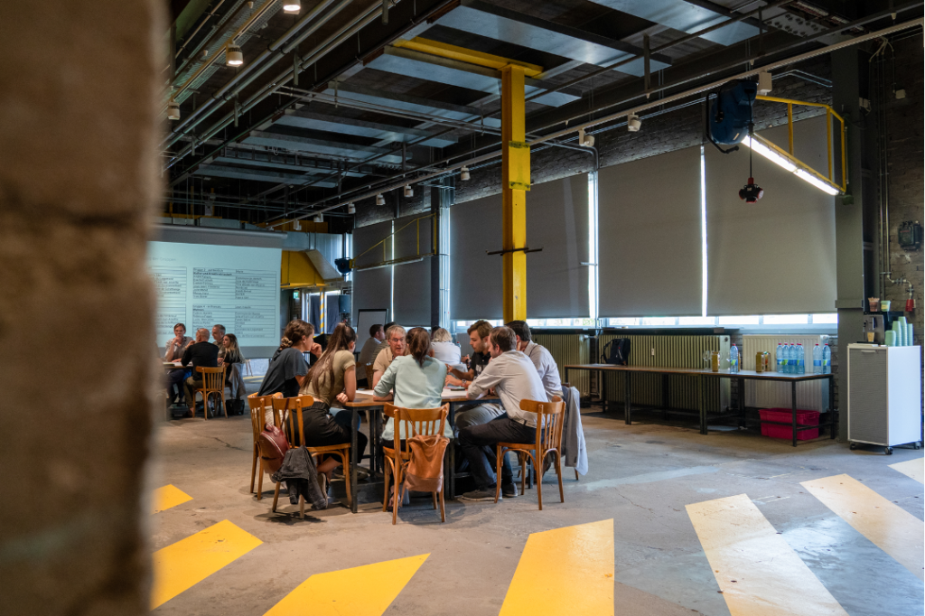
The second workshop organised by the CIPU office on the 18th of October narrowed down the annual topic of multifunctionality in the city by focusing on the integration of production and crafts in the city. The participants had the chance to delve into the concept of the Productive City from the different perspectives of municipal strategy development, the technical implementation and the regulatory framework.

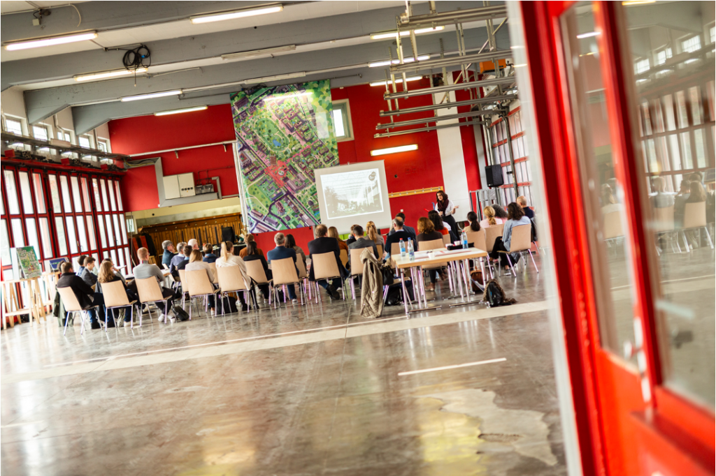
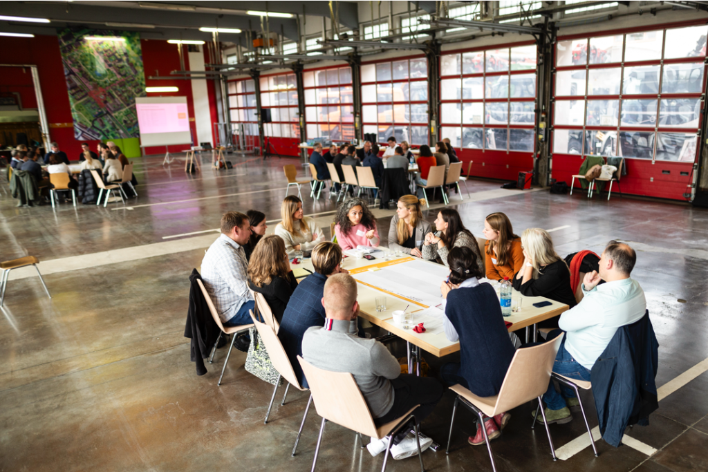
The event was hosted in the former fire station barracks in Luxembourg city. The afternoon began with introductory presentations by the City of Luxembourg and the Chambre of Crafts (Chambre des Métiers). These included the Schluechthaus project in Hollerich and the development of the site around the fire station barracks and the former stadium. The focus here was on the technical conversion work on the barracks and the old Schluechthaus in order to bring the buildings up to the current safety regulations for public buildings for interim use. The third presentation dealt with the survey results of the Chambre des Métiers regarding the property requirements of craft businesses in the country.

Source: Ville de Luxembourg

The workshop began with an introductory presentation looking back on the previous thematic workshop in June and the excursion to Brussels in August facilitated by the CIPU. The tasks of the three discussion tables were then introduced. This was followed by a phase of group work in which all participants were assigned to a discussion group, each of which dealt with different aspects of the realisation of the productive city. The results of the discussions are explained in more detail in this documentation.

The first group focused on developing a comprehensive strategy for the implementation of the “Productive City” concept in municipalities. The discussion emphasized the need for both national and municipal-level actions, with the proposed national strategy serving as a guide for municipalities, linking them through centralised elements like a registry of businesses and potential mixed-use areas, as well as a crafts agency. The strategy identified the importance of clear goals, typologies in a national register, and the establishment of cross-sector working groups and a national crafts agency to ensure a multifaceted and coordinated approach. Key actors include a National Crafts Agency, municipalities, the Ministry of the Interior, the Crafts Chamber, and Luxembourg, each playing crucial roles in coordination, financial support, local implementation, and regulatory oversight.

Source: Ville de Luxembourg

The second group delved into the technical implementation of the “Productive City” concept, examining two projects within the current regulatory framework. The first project focused on a productive ground floor in an urban setting, aiming to divide 2,600 m² into flexible modules for various tenants, posing challenges related to flexibility, compatibility, and efficient building planning. The second project involved repurposing historic industrial halls for productive use, facing challenges concerning compatibility with other uses, heritage preservation, and operational concepts. The group identified challenges such as stakeholder coordination, urban integration, and flexibility of building structures, proposing solutions like national-level frameworks, internal building concepts, and zoned programming to address these concerns and make these projects feasible and adaptable over time.

The third group focused on the regulatory framework, aiming to identify obstacles and problematic provisions within existing municipal regulations (PAG/PAP QE/RBVS) related to the implementation of mixed-use areas combining residential and artisanal activities. The discussion revealed that challenges extend beyond local regulations, requiring national-level interventions. Key obstacles included the PAG zones’ strong emphasis on functional separation, parking space regulations, and the absence of a national definition for artisanal activities. Proposed solutions included national-level adjustments to the Règlement Grand-Ducal, standardised parking regulations, and clear definitions for artisanal activities to facilitate local implementation. Additionally, the group advocated for enabling densification in existing activity zones, securing existing businesses, and addressing the impact of the current real estate market on the attractiveness of various functions. The need for collaborative decision-making involving municipalities was emphasised throughout the discussion.

Source: Ville de Luxembourg

The workshop shed light on the urban challenges of blending housing and craftsmanship, emphasising the need for collaborative and holistic solutions. Group discussions pinpointed obstacles like technical requirements for buildings, zoning restrictions and parking norms, stressing the call for centralised coordination and requirement analyses. Overall, the workshop underscored the importance of a united effort to craft practical, flexible strategies for fostering dynamic, mixed-use urban spaces.

Contact

CIPU: cipu@zeyenbaumann.lu

References

CIPU website (French and German): https://site.cipu.lu/

“Luxembourg in Transition” (LiT) can be characterised as an innovative process with the aim of rethinking and reshaping the territorial transition of Luxembourg and its neighbouring regions across the border by developing visions for a desirable future until 2050. The territorial visioning approach is innovative in the sense that it goes beyond traditional planning culture and instruments in an interdisciplinary manner and the spirit of coopetition.

Aim

The main objective of this innovative process is to develop different territorial visions, based on ecological transition scenarios, strategic spatial planning solutions and demonstration projects, for a decarbonised and resilient cross-border functional region of Luxembourg until 2050. The ecological transition refers to achieving the objectives of zero carbon emission while:

  • reducing land take;
  • enhancing biodiversity, improving ecosystem quality;
  • integrating the aspects of housing, transport, energy and digitalisation;
  • creating concepts and models for a territory resilient to climate change;
  • promoting an economic development that is stable, equitable and solidarity-based; and
  • strengthening territorial and social cohesion.

The territorial visions are based on the long-term horizon of 2050. By comparing the visions with the business-as-usual scenario, it becomes possible to identify the changes required for achieving the objectives and design a roadmap.

source: Luxembourg in Transition, 2020: Logo

Partnership

The LiT process was initiated by the Department of Spatial Planning of the Ministry of Energy and Spatial Planning. The consultation was accompanied by different committees: The Scientific Committee provided expertise from research and planning practice; the Advisory Committee incorporated the interests of partner and stakeholder organisations from Luxembourg and the Greater Region; the Interministerial Committee engaged all relevant sector ministries and steered the process; and the Citizens’ Committee (Biergerkommitee Lëtzebuerg 2050) introduced the population’s perspective and addressed recommendations to political decision-makers. An external service provider was tasked with the scientific management of the process and overseeing the work of the expert teams.

Activities

The international consultation within the framework of the LiT process was designed as a three-stage cooperative competition (“coopetition”), aiming to engage international experts from various disciplines and stimulate cross-fertilisation among teams. The consultation brought together practitioners, universities and other research organisations and gathered knowledge in the fields of regional and urban development as well as architecture, environmental and social sciences. The initial ten teams started working in October 2020 and the four final teams presented their results in January 2022. The three stages of the consultation aimed to refine and concretise the so-called “transition visions” developed in each preceding phase.

Stage 1: In this stage, the expert teams were tasked with developing a quantitative approach to assess the effectiveness of measures in reducing greenhouse gas emissions. The metrics needed to quantify various aspects related to land use, energy consumption, waste management, food production, water resources or biodiversity.

Stage 2: Building upon their work in Stage 1, the expert teams were required to apply their metrics to the territory and show how innovative concepts in spatial planning could be implemented. The focus was on the cross-border functional region of Luxembourg, exploring the potentials and challenges of implementing measures in a cross-border context.

Stage 3: The final stage called for the expert teams to develop concrete strategies and exemplary projects to anchor the vision both within Luxembourg and across borders. This stage emphasised topics such as energy efficiency, the protection of biodiversity, resilience and climate change adaptation, resource scarcity and food security.

University of Luxembourg et al., 2021: Representation of a converted commercial area

For instance, the team led by the University of Luxembourg presented measures for regenerating industrial parks and commercial areas through conversion, multifunctional usage, the use of local products and renaturing. The experts developed their vision using the example of the commercial area Foetz in Mondercange, Luxembourg.

Further projects and detailed information about the entire LiT process can be found on the website: https://luxembourgintransition.lu/en/

Outlook

The LiT process represents an innovative approach to shaping the future of Luxembourg. By engaging a diverse range of actors, implementing a multi-stage competition, and incorporating cross-border aspects, the process aims to develop a sustainable and resilient Luxembourg in a sustainable and resilient manner. The vision’s long-term horizon of 2050 provides a framework for setting goals, identifying necessary changes, and establishing a roadmap for this development. The next step is to shift from theory to practical implementation, which consists of pilot projects and demonstrating the ability of the functional region Luxembourg to transition towards a carbon-free territory. Additionally, the transferability and application of the LiT process in other territories – cross border or not – is illustrated in the Guidance Note “Cross-Border Spatial Planning: A vision for a cross-border functional region” which is a Pilot Action of the Territorial Agenda. It demonstrates the applied methodology and discusses the implications of decarbonisation and sustainability for spatial planning and its cross-border dimension. Find out more about the pilot action here: https://territorialagenda.eu/pilot-actions/cross-border-spatial-planning/

Contact

Luxembourg in Transition: https://luxembourgintransition.lu/en/contact-2/

References

The European Grouping of Territorial Cooperation (EGTC) Alzette Belval plays a vital role in fostering collaboration between the French and Luxembourgish communities in the Alzette-Belval region. By facilitating cross-border projects and initiatives, the EGTC promotes sustainable development and positions Alzette-Belval as a transnational agglomeration.

Aim

Imagine a world where geographical borders do not limit collaboration between regions but facilitate it. That’s the objective of the EGTC Alzette Belval. By establishing a sustainable framework for cooperation and joint projects, it aims to bridge the administrative borders between Luxembourg and France to develop a shared vision for the future of Alzette Belval and stabilise the cross-border relationship. Additionally, the EGTC enables the transferring of local findings and perspectives to higher administrative levels and informs according regional, national or European institutions about the cross-border challenges.

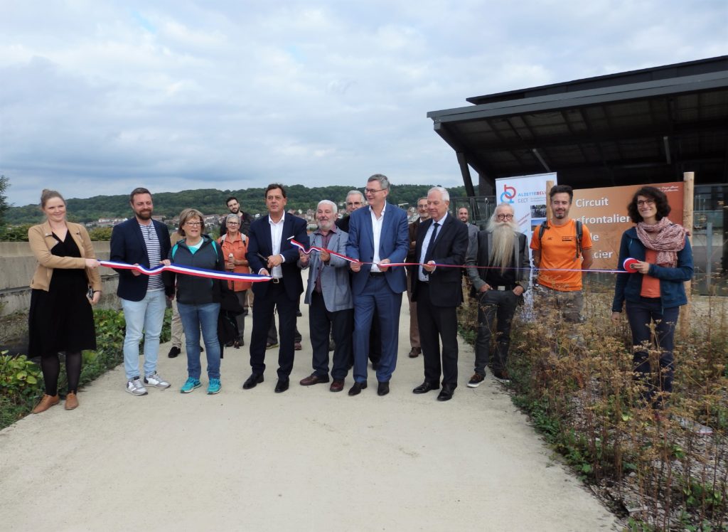
Inauguration of the Cross-border Steel Curcuit in September 2022
Copyright: GECT ALZETTE BELVAL

Genesis and Composition

After first selective collaborative approaches between the French and Luxembourgish communities in the 1990s the need for a more effective and solid legal framework emerged. Therefore, the EGTC was established on March 8, 2013, with the support of the French and Luxembourgish governments and local authorities. It operates within the regulatory framework of the European Union, specifically the EGTC Regulation (No 1082/2006), which makes it a legal body.

The EGTC is compiled of a Luxembourgish delegation consisting of representatives from the state Luxembourg as well as from the four municipalities Esch-surAlzette, Mondercrange, Sanem and Schifflange. From the French side, representatives from the national level and Communauté de Communes du Pays-Haut Val d’Alzette, Région Grand Est, Conseil départemental de Meurthe-et-Moselle and Conseil départemental de la Moselle are involved.

Discovery of the ABACTIV pedestrian cycle track linking Micheville (F) and Belval (L) in September 2022. Copyright: GECT ALZETTE BELVAL

Activities, Measures, and Current Strategy (2021-2027)

A strategy is an essential instrument for an institutional body to function sustainably and effectively. The EGTC Alzette Belval developed a first strategy in 2014 for the timeframe until 2016. It was updated for the second phase 2017-2020 and the current version accounts for 2021-2027. It builds upon its previous successes and focuses on the following key areas:

  • Health
  • Mobility
  • Everyday life without borders and limitations
  • Alzette Belval: Maintenance and use of green landscapes
  • Alzette Belval: Shared and resilient future
  • Alzette Belval: Laboratory for education
  • Alzette Belval: Symbolic space of French-Luxembourgish collaboration

The EGTC Alzette Belval undertakes various measures and assumes roles to strengthen cross-border collaboration:

  • Information hub: The EGTC serves as a valuable information resource, providing updates on transborder initiatives, projects, and opportunities to the residents and institutions in the region.
  • Local link: Operating independently, the EGTC effectively represents the local interests of the Alzette-Belval community.
  • Facilitator: The EGTC facilitates exchange between stakeholders in the region, strengthening the cross-border network.
  • Project initiator: The EGTC takes the lead in developing and implementing transborder projects, often financed by European funds, e.g. through the Interreg Greater Region programme. These projects contribute to the region’s development and enhance cooperation between neighbouring communities.

A standout project within the EGTC’s portfolio is “Alzette Belval, vivons ensemble!”, which ran from 2014-2020. This initiative was developed to promote the concept of a cross-border agglomeration, aiming to cultivate a sense of belonging and regional identity. Through collaborations with several authorities from France and Luxembourg, the project facilitated cross-border projects in domains like sports, tourism, culture, and agriculture.

Games without borders between the youth centres of Belvaux (L) and Rédange (F) in summer 2022. Copyright: GECT ALZETTE BELVAL

Outlook

The EGTC Alzette Belval is dedicated to cross-border collaboration and sustainable development. By facilitating cooperation, implementing joint projects, and engaging local stakeholders, the EGTC strives to create a dynamic, interconnected, and resilient Alzette Belval that benefits residents, businesses, and institutions. Looking ahead to 2021-2027, the EGTC focuses on integrating cross-border projects and fostering a harmonious cross-border agglomeration. This strategy underscores the transformative power of collaboration, envisioning a future where borders no longer limit progress but instead facilitate collective development.

Contact

EGTC Alzette Belval: contact@gectalzettebelval.eu

References

During the first workshop organised by the CIPU office in 2023 and held on the 27th of June, the participants delved into the concept of multifunctionality in the city, focusing on different scales (building/parcel, district, city). They had the opportunity to explore various planning examples and engage in discussions about the obstacles, potentials, and instruments associated with multifunctional urban use.  

Copyright: Melt Studio, 2023

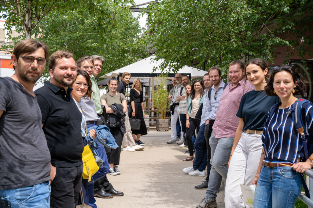
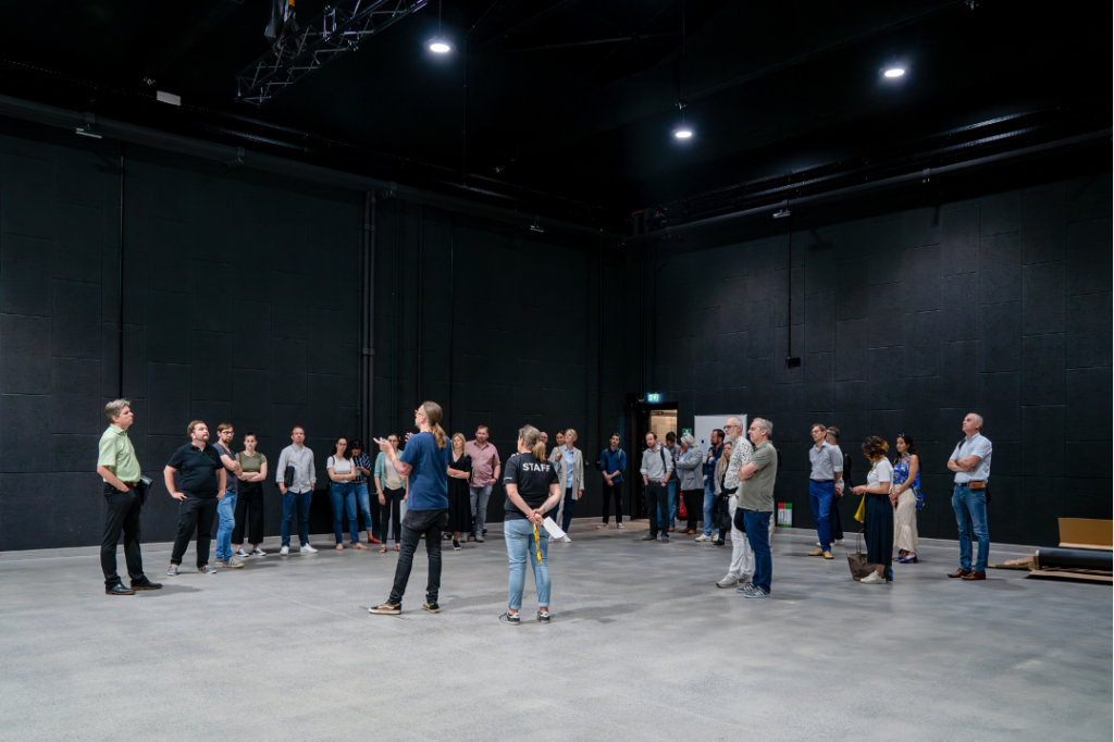
The day started off with an informative guided tour of the hosting location, the 1535° Creative Hub in the city of Differdange. The location symbolises creativity and innovation in Luxembourg. Established in 2013 by the city of Differdange, the Creative Hub got named after the melting temperature of iron at 1535°C, paying homage to the industrial heritage of the site and the whole city. Today it hosts creative and cultural start-ups, small- and medium-sized enterprises, artists, a co-working space as well as e.g. rentable music studios. More than just the physical space, the 1535° Creative Hub follows a community-driven approach, facilitating collaboration and sharing of expertise among its members. It functions as an open platform fostering synergies and networking, connecting actors from the cultural and creative industry and creating an open-minded environment for the sector.

Copyright: Melt Studio, 2023

After discovering the site, the workshop participants received input on functional mix in urban areas and its current relevance in Luxembourg. As a cross-cutting topic in the Master Programme for Spatial Planning 2023 (Programme Directeur de l’Amenagement du Territoire), it is primarily addressed under the objective of reducing soil artificialisation. In addition to that, the topic is considered under the objective of concentrating of different functions through e.g. creating Centres of development and attraction (Centres de développement et d’attraction). Furthermore, two examples developed during the Luxembourg in Transition Process (LiT) were presented, i. e. the densification strategy for the cross-border town Esch-sur-Alzette (LU) and Audun-le-Tiche (FR) as well as the plan for the commercial area Foetz to be transformed into a mixed-use zone. The local input was complemented with several examples from international multifunctional planning processes form Paris, Bern, Linz, Hamburg, Brussels and Anderlecht.

Copyright: Melt Studio, 2023

Finally, the participants delved into discussions on multifunctionality in urban spaces. The focus was on exploring the potential of integrating multiple functions within city structures on different scales (building/parcel, district, city). Through interactive sessions and planning examples, the workshop shed light on the obstacles, potentials, and instruments associated with multifunctional use in various contexts.

Working in groups, the participants explored multifunctionality in three key areas: commerce and services, production and manufacturing, and the creative sector and culture. These discussions considered the different existing scales, including the city, districts, and individual plots. The fourth group addressed the multifunctional use of housing in combination with schools, shopping centres, and industrial sites. These group sessions provided valuable insights into the challenges and opportunities associated with integrating different functions within urban structures. The results were then presented and discussed in plenum. The results of the discussions will be available on the CIPU Website soon.

Copyright: Melt Studio, 2023

By examining multifunctionality at different scales, the workshop encouraged innovative approaches to urban planning and development. The participants considered the potential of multifunctional spaces to (re-)vitalise communities, optimise resource utilisation, and promote sustainable development. The workshop held within the CIPU framework offered a platform for collaboration and knowledge sharing, bringing together diverse perspectives from local and regional/national stakeholders as well as from thematic experts. It highlighted the importance of considering multifunctionality as a crucial aspect of contemporary city planning as well as which challenges need to be addressed by already existing and potential instruments.

Contact

References


Frequent extreme weather events in Luxembourg in recent years have pushed climate change higher up the public agenda. The call for more public action has become louder in view of the devastating effects of recent tornados and torrential rainfall, followed by flooding and extended drought in the summer noticed by residents and visitors.

Preparing and adjusting to current and future effects of climate change, ‘climate change adaptation’, is one pillar next to climate action that governments around the globe are working on to limit the impact of climate change on societies.

Despite progress made during past years, there are critical gaps in implementation of climate action, where policy ambitions have not yet yielded necessary action. This highlights the need for clear information and guidance to streamline actions to progress towards a shared agenda for practitioners and planners. The ‘Climate Change adaptation strategy’ comprehensively promotes climate change adaptation in Luxembourg.

Rationale for action

According to IPCC scenarios, by the end of the 21st century, Luxembourg will experience today’s climate of Milan. What sounds positive at first glance has serious consequences with average annual temperature rising from 8.8 to 13.1° Celsius and rainfall increasing by 30% over the next 80 years.

These numbers should not distract attention from expectations of more frequent extreme weather events including heat stress, rainfall variability, less available freshwater, lower crop yields, lower soil quality, uncertain energy supply, increasing conflicts of use and less biodiversity. These show the current system is not yet ready to cope with climate change.

Despite these observations, climate change adaptation still appears to be a side note in Luxembourg spatial planning. With municipalities responsible for planning, state institutions depend on municipal decision makers and planners being informed and willing to work towards climate change adaptation. To become more resilient to a changing climate, more attention needs to be given to climate-change adaptation to prepare for inevitable impacts as the current system is not yet prepared.

Objective

Preventing harm to humans and natural ecosystems from climate change requires adapting the built environment. The fundamental assumptions on which local planning and developments have been based for decades have changed, especially for water availability and amount of rainfall.

Much more than simple adaptations are necessary. With changing fundamental assumptions on climate, new techniques and methods are needed. This means new methods to cope with the new reality and to adapt existing systems.

Transition is very complex. It requires modifications to the way we have planned for decades. So planning guidance is essential, along with a national reference framework to detail and measure the effectiveness of actions to induce significant change. The Climate Change Adaptation Strategy provides this guidance. It gives information from Luxembourg planners for Luxembourg planners about climate change adaptation.

Time frame

The strategy has been updated frequently since the first edition in 2012. New planning laws and regulations made an update necessary in 2016 and a new edition was published in 2018 which remains valid today. To assist local decision makers and planners, the new edition also has an implementation strategy.

Key players

The strategy has been developed by the Department for Environment of the Luxembourg Ministry of Energy and Spatial Planning, which is also responsible for implementation. It works towards the Paris Agreement and has been adopted by the Government so it applies to all government institutions.

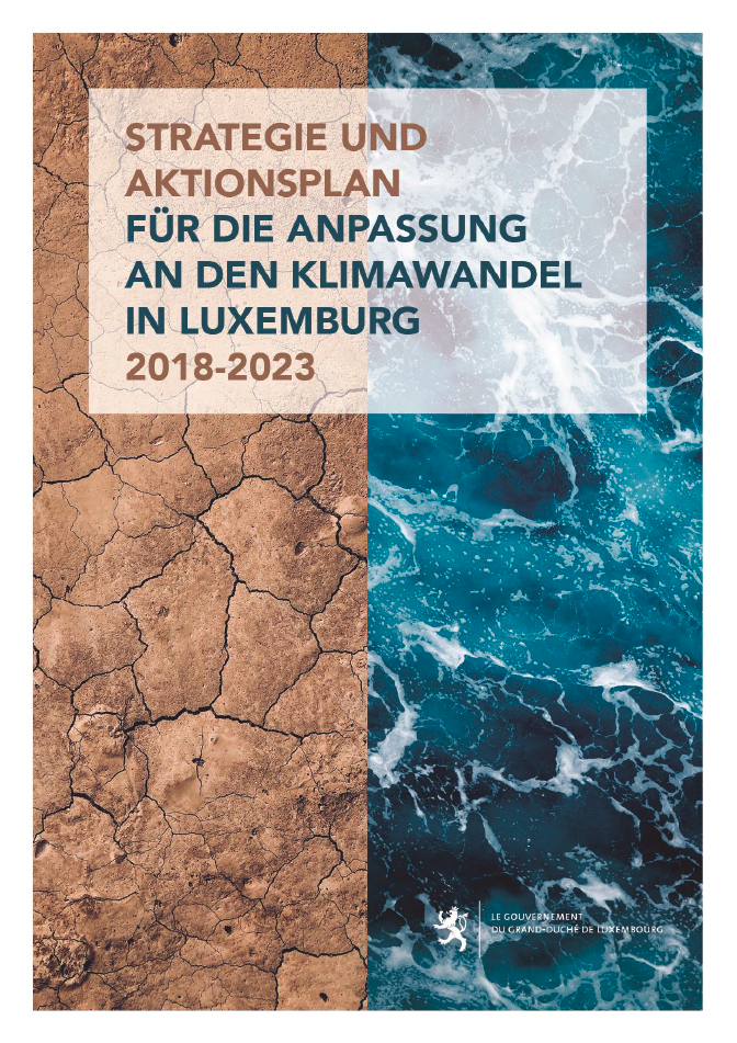
Cover page of the C-Change strategy. Source: MEV, 2021.

Implementation steps and processes

The climate change adaptation strategy offers a comprehensive catalogue of measures. It covers construction and housing, energy, forestry, infrastructure, civil protection, spatial planning, agriculture, human health, ecosystems and biodiversity, tourism, urban development, water management and the economy. There are also specific recommendations on cross-cutting measures.

There are several measures for each topic and every measure is described in a factsheet. These detail the objective, the type of measure, necessary steps, additional information, stakeholders and success indicators.

With the detailed factsheets, the strategy also offers guidance and information on responsibilities. Municipalities can identify measures based on the desired effects of their actions.

Required resources

The resources used to create the strategy are not known.

Results

The strategy has been developed in a participative process, involving municipal and national planners. Recommendations respect the national and local planning regulations.

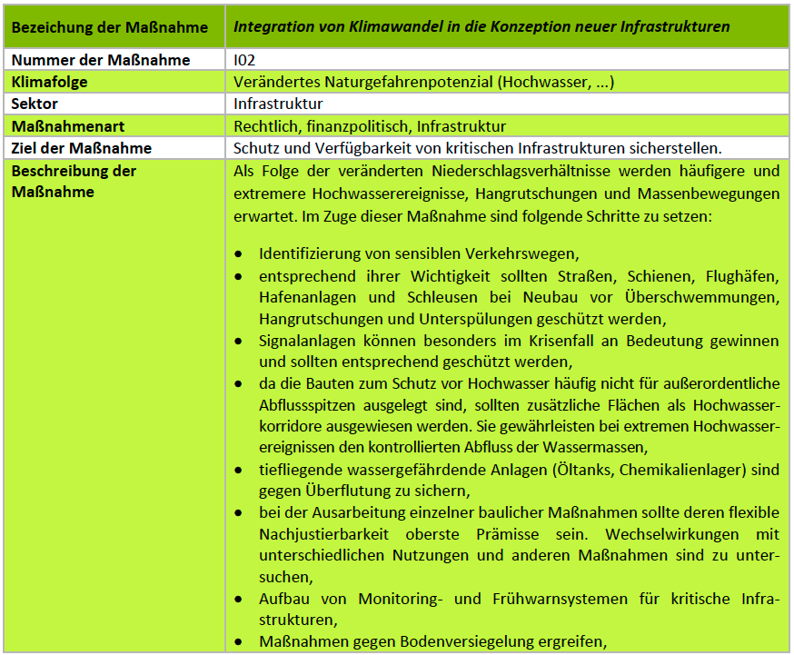
Every recommendation is explained in a table format (see below). It comes with a detailed description, ensuring that a measure follows the climate change adaptation strategy. Key stakeholders to implement recommendations are also detailed.

Despite the comprehensive guidance, measures still need to be translated into the local context by municipalities. This ensures that decisions respect local specificities. It also ensures municipal planning autonomy, a valuable commodity in the Grand Duchy.

The strategy has been adopted by the Luxembourg Government. All public institutions are asked to consider the document in the planning of public projects.

Example of a recommendation in table format from the strategy. Source: MEV, 2021.

Experiences, success factors, risks

Adapting spatial planning to climate change is a difficult task. The strategy contains much useful information for planners and experts, helping to inspire national and local action.

Conclusions

The strategy is a reference document for climate change adaptation from 2018 to 2023. After 2023 it will be revised and updated again, to incorporate new knowledge and new planning legislation.

Contact

Contact: https://environnement.public.lu/fr/support/contact.html

References

Ministry of the Environment, Climate and Sustainable Development, Strategy and action plan for climate change adaptation:

German: https://environnement.public.lu/content/dam/environnement/documents/klima_an_energie/Anpassungsstrategie-Klimawandel-Clean.pdf

French: https://environnement.public.lu/content/dam/environnement/documents/klima_an_energie/Strategie-Adaptation-Changement-climatique-Clean.pdf

Many firms and jobs in the Grand Duchy of Luxembourg are centred around the capital city. Municipalities beyond Luxembourg city and its immediate surroundings have difficulties attracting firms and providing local employment. In addition, the many international companies in Luxembourg mean that prices for office space are challenging for start-ups.

The municipality of Dudelange in the south of the country has initiated ‘Innovation Hub Dudelange’. This incubator is a first step to supporting a new eco-innovation cluster within the municipality and providing affordable office space for start-ups.

Rationale for action

With an ever-increasing number of enterprises and jobs around the capital city, some recent developments have caused difficulties, including the many cross-border commuters working in Luxembourg city. Territories between Luxembourg city and the borders to Belgium, France and Germany have turned into a ‘drive-through country’. With a low municipal business tax rate, Luxembourg city continues to be an unrivalled player in the competition for businesses in the Grand Duchy, leaving little chance for other municipalities to attract firms.

Many international firms rent offices in Luxemburg city, so it has become difficult for start-ups to find affordable office space in the capital area. Start-ups often rely on cheap office space, so where space is expensive less of them can emerge.

Objective

The ‘Dudelange Innovation Hub’ aims to attract and support eco-technology start-ups that will help to establish a new economic cluster in the municipality and the country. Eco-technology approaches, practices and technologies developed in the new cluster can eventually be transferred to municipal departments to improve their services.

This will contribute to local economic development and new jobs. The incubator also aims to shape economic activities towards sustainable and ecological activities in the future ‘NeiSchmelz’ eco-district, a brownfield development within the municipality.

Time frame

The decision to set-up ‘Dudelange Innovation Hub’ in the ‘NeiSchmelz’ district was taken in July 2017. Two months later, the project was presented to the public. With support from several national players, implementation of facilities for the incubator started soon after. In July 2018, just one year after the decision was taken, the incubator opened its doors and welcomed the first enterprises. In 2019, the Incubator welcomed seven start-ups. Three start-ups cooperated closely with the municipality for testing and introducing their products and services in the city of Dudelange.

Key players

‘Innovation Hub Dudelange’ is an initiative of the municipality which chairs and administers the incubator. The provision of facilities and their operation is in cooperation with national players, namely Luxinnovation and Technoport S.A. This innovation agency and business incubator assist the municipality in selecting businesses. Another player is the ‘Fonds du Logement’, the national fund for housing, which owns the land.

Implementation steps and processes

The availability of financial and organisational resources required for the project and the limited number of players involved meant progress on ‘Innovation Hub Dudelange’ was quick. The concept was developed and approved in 2017 and the incubator started operation in July 2018.

Operation of the incubator is ensured by the municipality together with the national innovation agency and the national technology incubator. Start-ups looking to rent office space apply to the national innovation agency. After a pre-selection, a final choice is made by a selection committee of all three key players.

Once the start-ups are welcomed in the ‘Innovation Hub Dudelange’, they receive support in the form of contact building, fundraising and other services provided by the national innovation agency and the business incubator.

Required resources

The municipality rents office spaces from the national fund for housing ‘Fonds du Logement’. In addition to the rent, implementation of the facilities cost EUR 175,000, which was covered up to 80 % by the state.

Results

‘Innovation Hub Dudelange’ includes 14 furbished offices available to eco-technology start-ups. Additionally, the 500 square meters of newly built office space include conference rooms and shared facilities.

Companies can rent the offices for up to five years at a reduced rent. Start-ups less than two years old pay EUR 15 per square meter each month, all other companies pay EUR 20.

At the end of 2019, one year after inauguration, seven of the 14 workplaces were already let. The start-ups cover specialisations including smart irrigation systems, smart LED street lighting systems and active mapping of flood zones using innovative drone technology. Products of these eco-technology firms are transferred to the local administration and will improve the public services provided by the municipality.

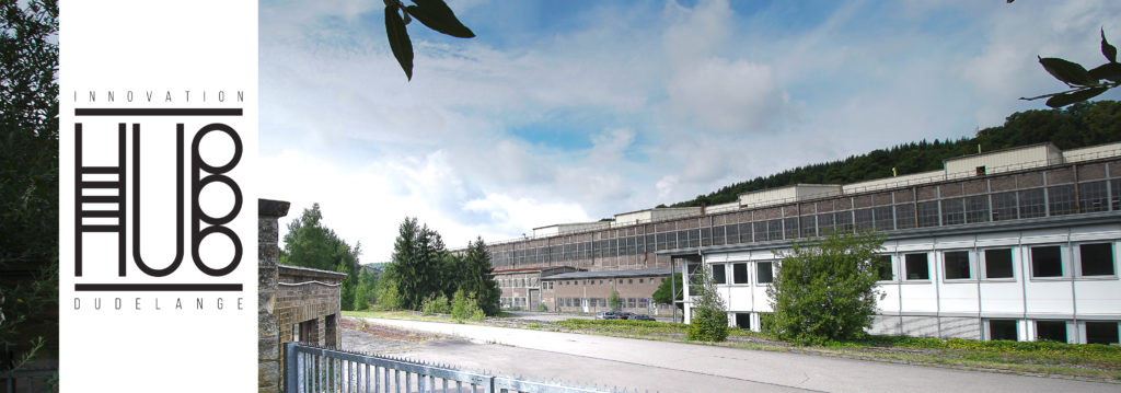
Facilities of the ‘Innovation Hub Dudelange’. Source: Municipality of Dudelange, 2018.

Experiences, success factors, risks

‘Innovation Hub Dudelange’ is an innovative approach offering start-up support to a specific sector in a specific location. The instrument also helps to foster innovation in eco-technology. Although this is frequently in the media, it is not frequently addressed by entrepreneurs.

The instrument is also suitable for interim uses. While the eco-district is developing at full speed, ‘Innovation Hub Dudelange’ was based in a building of a steel mill that halted production in 2005. Occupation of the offices by start-ups is for up to five years, so winding-up the incubator should involve little effort when the services are no longer needed.

Conclusions

‘Innovation Hub Dudelange’ shows that relatively little finance is required to set-up a business incubator. Such initiatives are thus suitable for smaller municipalities with limited human and financial resources. Relying on support from national agencies, the municipality benefits from local economic development incentives from the start-ups as well as from the emerging eco-technology cluster, enabling innovations to be transferred to the municipal administration.  

Contact

Contact address: innovationhub@dudelange.lu

References

Municipality of Dudelange, 2019: ‘Innovation Hub – 3 startups réinventent la ville de demain avec Dudelange!’ (in French):

Luxinnovation, 2019: News – Innovation Hub – one year of supporting eco-technology: https://www.luxinnovation.lu/news/innovation-hub-one-year-of-supporting-eco-technology/

In the Grand Duchy of Luxembourg, 2 + 3 = 1!

The cities of Ettelbruck and Diekirch, both located in the North of the Grand Duchy, are not far from another. The borders of the two cities are only 2 kilometres apart. Their settlement structure and those of the three neighbouring municipalities form a nearly continuous urban fabric. Many decision-makers have raised the question of why not merging forces and territory and creating the new capital city of the North?

Merging the five municipalities into a new economic powerhouse of the North, the so-called NORDSTAD, has been discussed for a long time. Two masterplans were developed, detailing roughly the urban concept for the existing settlements and earmarked areas that will be urbanised.

For various reasons, the idea to create the NORDSTAD has not yet materialised: municipal mergers and the creation of a new city need to be well thought out and the individual steps take time. One of the main hurdles was overcome in summer 2020, when all five mayors signed a memorandum of understanding to become the NORDSTAD. With their signature, the mayors have entrusted a municipal syndicate to further the idea of creating the new city. Thus, it is not a question of ‘if’ but of ‘when’ they will become the NORDTAD.

Masterplan for the creation of the NORDSTAD. Source: NORDSTAD, 2021.

But how does one realise 2 + 3 = 1?

The typology and structure of buildings in Ettelbruck and Diekirch features low densities and pays tribute to their 8,800 and 6,800 inhabitants. Many single-family houses, number of floors seldomly exceeding five stories and a rather old building structure characterise the urban pattern. The three neighbouring municipalities Bettendorf, Erpeldange and Schieren feature many single-family houses. To transform the cities and the municipalities into one major urban pole, a lot of yet unused land will be developed.

When planning for the creation of new districts or new cities in Luxembourg, planners and architects opted for high-density structures during the past. The ‘Belval’ district in Esch-sur-Alzette and the ‘Kirchberg’ district in Luxembourg City are two examples. What makes them distinct of the NORDSTAD is that they are extensions of existing urban tissues with large numbers of inhabitants.

NORDSTAD will be different: Ettelbruck and Diekirch are small cities and high-density developments risk of destroying the areas’ properties and characteristics. For creating the NORDSTAD, a new type of ‘urbanity’ is necessary.

The new type of urbanity for the development of the NORDSTAD needs to meet different criteria: it needs to avoid ‘over-urbanisation’ and ensure high quality of life for future and current residents, provide adequate housing and public places and ensure the integration of existing districts into the new settlement pattern. The village-character of the two cities needs to be preserved for any future development. And finally, a major challenge planners and architects need to solve is “How to create ‘urbanity’ from the drawing board for the areas that ought to be developed?” The reflections and plans drawn up for the NORDSTAD have answered important questions that resulted in a lot of good practices.

Projects like the NORDSTAD, where a significant amount of fallow land is being developed, have become a frequent encounter in Luxembourg. Decision-makers, planners and architects need to make choices at many different levels, from the local land-use plan down to individual buildings. Especially in smaller municipalities with limited staff and expertise in urbanising areas, support and guidance was required, helping municipalities in making better choices.

In comes the so-called “Planungshandbuch”, a guideline for the urbanisation of cities and villages, developed at the example of NORDSTAD. The term is German for ‘Planning Manual’ and the document functions as such: it gives concrete guidance on the future looks, feels and properties of areas that ought to be developed. It is targeted at planners, architects, technicians, decision-makers as well as citizens. The ‘Planning Manual’ is structured in nine overarching chapters that address several topics when planning in urban areas: urban development, functional mix, building layout, public infrastructure, mobility, parking, layout of public spaces, nature protection and quality of housing. Under all these topics, the manual provides concrete design ideas and recommendations in an illustrative way.


The illustration shows a proposed layout for public and semi-public areas from the ‘Planning Manual’. Open places in front of building entrances allow residents to meet and to chat. Narrow streets and limited parking slots while providing good access via soft means of transport, reduces need for motorised forms of mobility. Source: Planungshandbuch, 2021.

The presented ideas were drawn from the experience of urban planners in the NORDSTAD and in other Luxembourgish convention areas. Convention areas are associations between the state and municipalities to ensure territorially integrated development across administrative levels and borders in the country. The ‘Planning Manual’ thus draws from the knowledge and lessons learned from concrete examples.


The illustration shows a proposed green space concept for districts from the ‘Planning Manual’. A mix of private and public gardens creates privacy and areas where residents can meet. Existing trees and hedges are integrated into the districts. Source: Planungshandbuch, 2021.

The document is unique as it gives guidance to planners and architects long before decisions on the exact layout of new districts are taken. Even if districts are planned and implemented by different planners and architects, they will have similar looks and feels and a common character. This will convey a feeling of a common identity amongst future residents of different districts. Such a guideline also allows to include important features such as quality of life or sustainability from the very beginning in district development.


The illustration shows a proposed concept to combine private, mixed and public from the ‘Planning Manual’. Small access paths that connect several private gardens and shared meeting areas for neighbours create transition areas between private and public gardens. Source: Planungshandbuch, 2021.

Also, the ‘Planning Manual’ with its comprehensible texts and numerous illustrations gives planners a new tool for public participation. Breaking down urbanistic guidance from complex 2D and 3D renderings to drawings and pictures allows residents much easier to understand urban design. Residents can thus raise their voice and work together with architects and planners on integrating their wishes and need in the future development. In turn, this helps to reduce often observed phenomenon like ‘NIMBY’ (‘Not In My Back Yard’) and increases identification of residents with their future districts.

The illustration shows a proposed concept for a neighbourhood from the ‘Planning Manual’. Mixed building typology and a central place to meet allows for functional and social mix of areas. Source: Planungshandbuch, 2021.

If you are interested further, please find here the complete planning manual, allowing to get a more comprehensive picture of recommendations and guidance to urban development in Luxembourg.

In conclusion, the “Planungshandbuch” provides orientation to planners, citizens and decision-makers on the future looks and feels of districts that ought to be developed. It clearly points at good practices and things to avoid and capitalises the knowledge created during discussions of planners, architects and decision-makers in the framework of the NORDSTAD project. The manual allows to visualise and include elements of urban design from the very beginning into planning processes. This helps to create high quality urban environments across the country, respecting principles of a sustainable urban development and ensures a high quality of life in future urban districts.

Mondercange is the gateway to the former mining district in the industrial south of the country. As other municialities in Luxembourg, Mondercange has relatively high costs for living. The municipality has identified and implemented a special way of developing affordable housing for its residents.

Rationale for action

Mondercange lies in the densely populated southern part of the country where there is high demand for housing, including high demand for affordable housing. To provide affordable housing for its residents, the municipality of Mondercange has targeted an unused area of 4.15 hectares for development within the town. The objective of this development project, called Molter, is to create a residential district dedicated to affordable housing including a large park.

Objective

In developing this area, the municipality has chosen a special way of creating housing. Issuing building permits in Luxembourg depends on lots being developed with a specific land-use plan (PAP). The PAP specifies aspects of construction, such as density, roof form, parking, etc. and follows provisions laid out in the general land-use plan (PAG), which is valid for the entire municipality. The normal procedure in Luxembourg is for a private developer to create the PAP by contracting an urban planner or an architect. The expert then ensures the public provisions and private plans for the site are compatible. For the Molter PAP, the municipal administration contracted an urban planner. He then planned the new district respecting the public provisions and translating the development concept from the municipality into a concrete development plan. 

PAP Molter, building layout from the specific land-use plan. Source: Municipality of Mondercange.

Time frame

The PAP were developed between 2011 and 2012. After their approval in 2013, construction started until the project was realised in 2017.

Key players

Key players are the municipal administration of Mondercange, urban planning bureaus and SNHBM (the national association for affordable housing).

Implementation steps and processes

The process started with defining criteria for the plot to decide on the future use of the area. The emphasis was put on affordable housing for specific population groups. The allocation of the housing units will depend on the applicant’s age, number of years lived in the municipality and children in the household. Additionally, the housing will be available for families that do not have property yet and that are eligible for a construction premium, as defined by the Ministry of Housing. So, the units are for people in real need of affordable housing. Once the criteria and conditions were established, the municipality tendered the planning procedure. Construction was realised by SNHBM, between 2013 and 2017.

Required resources

Municipalities implementing such approaches must invest more time and money. If a developer creates the PAP, the role of the municipality is limited to the approval procedure. After that it has limited possibilities to influence future use of the plot.

The project illustrates that municipalities creating PAP independently have a strong planning tool at hand. This pre-supposes willingness to invest time and effort. The municipality of Mondercange had to allocate financial resources and labour input to manage the process. The process included managing the procurement and coordinating the cooperation with SNHBM. The urbanistic office (service urbanisme) of Mondercange was in charge of the process. Such a planning process comes at a cost but provides significant added-value for the municipality by making it possible to actively shape developments.

Results

As the municipality has created the PAP, it was possible for the administration to lay out provisions for the site. Mondercange thus created a new district to its own design with 55 single family houses within the municipality. The price per square metre for these houses is lower than the average price for housing in the country of Luxembourg. New and old residents also benefit from a new, large park that was built in the centre of the new district.

Experiences, success factors, risks

The approach is a positive way to develop municipal land. Generally, this requires more efforts (for coordination and procurement of the planning process) but it provides significant opportunities for municipal administrations to actively shape the urban pattern. The case of Mondercange also illustrates how political priorities in the field of affordable housing can be realised through concrete projects in the municipality.

PAP Molter, building layout and the park area from the specific land-use plan. Source: Municipality of Mondercange.

Conclusion

A stable political and administrative framework for local experts and urban planners is key. Such projects usually take longer than a single legislative period. Additionally, the project shows a way of cooperating between different levels of decision-making. SNHBM, a national actor and the municipality of Mondercange as the local stakeholder, have managed to create affordable housing, bypassing market influences. This is important, as private developers are usually less motivated to create affordable housing.

Contacts

Municipal administration of Mondercange: commune@mondercange.lu