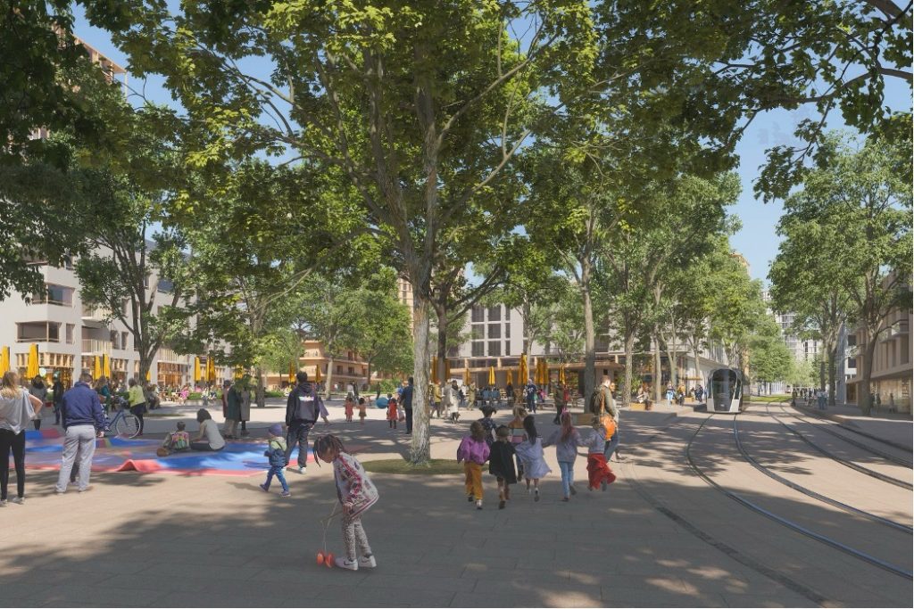
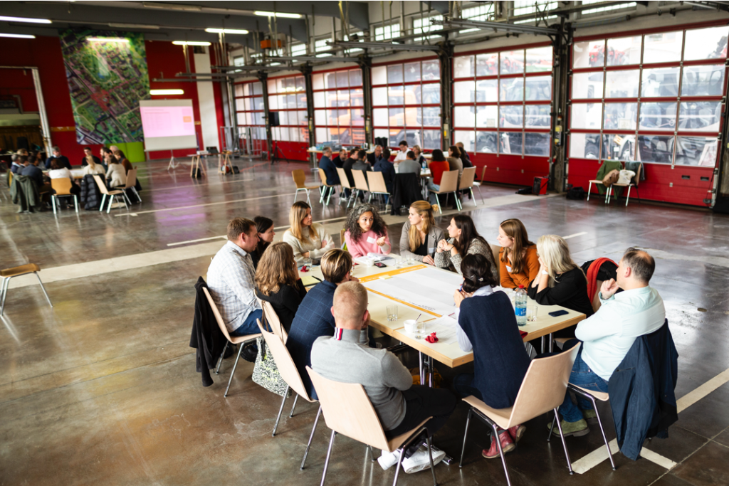
In the dynamic and pressured landscape of Luxembourg’s housing market, innovative solutions are essential to address the growing challenges of affordability and community integration. One promising approach is the housing cooperative model, which offers an alternative to traditional homeownership and renting. These cooperatives emphasise communal living, ecological responsibility, and affordability, providing a sustainable and inclusive solution to the housing crisis. Cedric Metz, the president of Adhoc, Luxembourg’s first non-profit housing cooperative, offers valuable insights into the value of housing cooperatives, their role in Luxembourg’s housing market, and the future prospects for such initiatives in the country.

What are housing cooperatives and what is their added value?

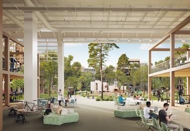
Housing cooperatives are organisations that create and manage housing collectively, based on principles of self-help and self-responsibility. Members of a cooperative actively participate in the planning and design of their living spaces and social interactions. The primary value of these living arrangements lies in fostering community and social cohesion. Additionally, the housing is often constructed with ecological considerations and provides affordable accommodation below market rates, contributing to social stability and promoting sustainable living. Housing cooperatives are one form of community housing, next to co-living, rental house syndicates, and communities of owners. People who wish to live together join forces and jointly operate a building in whose flats they are granted the right to live. If economic profits are excluded, the co-operative operates on a non-profit basis.

What is the state of the housing market in Luxembourg and what role do housing cooperatives play?

The housing market in Luxembourg is characterised by high prices and a shortage of affordable housing. Demand far outstrips supply, leading to increasing rents and property prices. Housing cooperatives offer a valuable alternative in this context. They could create affordable housing and promote new forms of communal living, and like Adhoc can promote and raise awareness about the relevance of members not only receiving housing but also participating in the planning and design of their living environments. This potentially fosters a high level of social integration and mutual support.

What challenges do housing cooperatives and alternative housing models face in Luxembourg?

Housing cooperatives and alternative housing models are facing several hindrances in Luxembourg. One major issue is financing. Since these projects are often non-profit, accessing traditional funding sources can be difficult. Additionally, there is a significant need for political support. The housing market is heavily dominated by economic interests, making it challenging to implement socially oriented housing projects. Directly linked to that, the finding and acquisition of land depicts a significant challenge for implementing alternative forms of housing initiated by housing cooperatives due to low land availability, zoning restrictions and limited financing models. It is important to raise awareness among the public and decision-makers about the benefits of these housing models, and to provide them with adequate tools and competences to guide and support such projects from finding a site over adequate financing to facilitating the integration in the existing neighbourhood.


How does Adhoc operate?

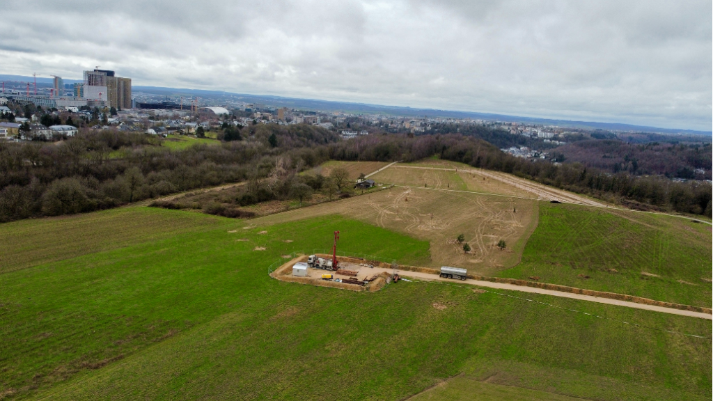
Adhoc is a non-profit housing cooperative dedicated to promoting new housing forms and developing cohousing projects. In general, the cooperative provides members with housing that is ecologically built and socially oriented. Members actively participate in the planning of their homes and the structuring of their communal living. A recent pilot project of community housing in Luxembourg’s business district Kirchberg in cooperation with the public developer Fonds Kirchberg was shut down in beginning of 2021. Fonds Kirchberg established of conditions for the site Réimerwee that Ad-Hoc, as a non-profit cooperative, could not meet, such as selling the apartments and selecting residents based on social status. Thus, Adhoc decided not to participate in the tender and will instead focus on promoting social and ecological housing projects. Additionally, the housing cooperative advises those interested in setting up cohousing projects and informs the public and policymakers about the benefits of communal living. Currently, Adhoc is working on a collaborative housing project in Weiler-la-Tour.

Planned housing project in Weiler-la-Tour (Source: Adhoc)

What support do you see from local authorities and the government?

Political support is essential for the successful implementation of housing projects like those of Adhoc. Municipalities and the government should provide financial resources and establish legal frameworks that facilitate the creation and operation of housing cooperatives. Recognising and promoting the benefits of communal living models is crucial as well as encouraging non-profit organisations as relevant actors on the housing market. This does not only include financial support but also the provision of land, the adaptation of building regulations and adapted public procurement such as concept awarding. Additionally, capacity building regarding technical and regulatory expertise within the municipalities could support housing cooperatives, e.g. through counselling centres for those interested in the foundation process.

What is the future outlook for housing cooperatives in Luxembourg?

The future outlook for housing cooperatives in Luxembourg is promising but also challenging. If the demand on the housing market and political will for communal living is not increasing, it will remain difficult to implement alternative forms of housing. Rising housing costs and a desire for sustainable and socially integrated living contribute to increasing interest in alternative housing models. Adhoc is pursuing an alternative way, demonstrating that communal living is not only possible but also desirable. However, it is important that political frameworks continue to improve to provide sustainable support for these housing models.

Contact

Adhoc: info@adhoc.lu

References

Interview by CIPU with Cedric Metz, 24th May 2024

Adhoc (English, French, German): https://www.adhoc.lu/


In October 2020, a significant milestone was achieved in the southern Luxembourg region, as 11 municipalities under the PRO-SUD syndicate joined the UNESCO Biosphere network, a label renowned as educational hubs for sustainable development. This move accelerates a series of initiatives aimed at actively fostering sustainable development.

One of the key initiatives that followed was the collaborative formulation of a “territorial vision” for the region, harmonised with the objectives outlined in the Luxembourgish National Territorial Development Plan (PDAT). The “territorial vision” strategy is taking shape with the Mission Zero Carbon – 11 municipalities for the ecological transition launched in April 2023 and marked by the signing of a Letter of Intent by PRO-SUD’s 11 municipalities, the Minister of Spatial Planning, and the Minister of Environment.

Aim

The primary goal of Mission Zero Carbone is to foster regional collaboration towards achieving carbon neutrality by 2050, in alignment with the Luxembourgish national territorial development plan (PDAT). To realize this ambition, a range of strategies has been identified, encompassing:

  • Reducing energy consumption: Advocating for energy-saving practices and technologies across public sectors.
  • Increasing renewable energy usage: Promoting the adoption and integration of renewable energy sources, such as solar panels.
  • Enhancing energy efficiency through regional energy planning.
  • Promoting sustainable mobility: Advocating for active transportation modes like cycling and walking and enhancing public transport infrastructure.
  • Safeguarding and restoring natural habitats: Ensuring the preservation of existing ecosystems and rejuvenating degraded areas to amplify their carbon sequestration potential.
  • Educational programs engage students, teachers, and cultural associations in the ecological transition, fostering active participation and awareness to drive sustainable change.

A first concrete project of this regional approach is the bioclimatic map launched in partnership with the Luxembourg Institute of Sciences and Technology (LIST) and Geonet by acquiring vital data and conducting precise analyses on the urban bio-climate of the region.

Concurrently, the Bioclimatic Mapping Project is committed to assessing the urban bio-climate in the southern Luxembourg region. The recommendations derived from this mapping effort will be closely associated with PRO-SUD’s involvement in the Cool Neighbourhood Interreg Northwest programme, which is designed to address urban heat challenges. This initiative marks a significant advancement in fostering the development of sustainable and resilient cities through meticulous data collection and analysis. The results will be publicly available towards the end of 2024.

The localisation of the UNESCO Minett Biosphere (Source: https://minett-biosphere.com/en/our-biosphere/)

Genesis and Composition

After the Luxembourg UNESCO Commission began discussing the first biosphere reserve in the Grand-Duchy in 2016 and followed by 4 years of multidisciplinary work to complete the application, the Minett region was officially recognized as such in October 2020, making Luxembourg part of the scientific Man and the Biosphere (MAB) programme. This programme promotes the conservation of biodiversity by engaging inhabitants, educating, researching, and supporting regional initiatives for sustainable development. The Minett Biosphere presents a fascinating juxtaposition: abandoned mines transformed into biodiversity havens, alongside ongoing human activity within dedicated transition zones. The Minett biosphere encompasses a region significantly impacted by iron ore extraction, leaving behind a distinct industrial legacy evident in its topography and cultural heritage.

PRO-SUD coordinated the application process and organized citizen consultations. Founded in 2003, the syndicate is a regional development union comprising 11 municipalities in southern Luxembourg. PRO-SUD, with the support of the Spatial Planning Department, is committed to promoting sustainable development in the region through various projects encompassing economic development, environmental protection, and social well-being.

Activities

The Minett UNESCO Biosphere advocates for biodiversity conservation and sustainable development, engaging citizens in educational efforts and research. It offers logistical assistance to projects focused on environmental education, multidisciplinary, regional and cross border collaboration with a commitment to fostering socio-culturally and environmentally sustainable economic and human development.

The post-industrial landscape of the region highlights the potential for ecological resilience, with diverse flora and fauna now flourishing in former mining sites. However, managing the delicate balance between environmental protection and ongoing growing human activity remains a huge challenge. To address this, the biosphere employs a strategic zoning system comprised of:

  • Core areas (zone centrale): Dedicated to research and conservation, strictly limiting human intervention.
  • Buffer zones (zone tampon): Surrounding core areas, these zones aim to minimize the impact of human activities.
  • Transition areas (zone de transition): Allow responsible human activities like agriculture and development.
The territory of the UNESCO Minett Biosphere (Source: https://minett-biosphere.com/en/our-biosphere/)

The territorial vision delineates a comprehensive developmental blueprint for the Minett region, encapsulating six pivotal objectives to ensure project alignment with overarching sustainable development objectives:

  1. Sustainable development: Pursuing a holistic approach that integrates environmental, economic, and social dimensions.
  2. Territorial cohesion: Mitigating socio-economic disparities across the region.
  3. Attractiveness and vibrancy: Augmenting the quality of life of residents and businesses.
  4. Ecological transition: Attaining climate neutrality and safeguarding biodiversity.
  5. Governance and participation: Advocating for participatory decision-making processes and citizen involvement.
  6. Resilience and adaptability: Anticipating and preparing for future challenges to ensure sustained regional viability.

The collaborative initiative, Mission Zero Carbone, epitomizes this vision, rallying the 11 municipalities within the Minett Biosphere towards achieving regional carbon neutrality by 2050. Each municipality formulates its action plan in alignment with the mission’s overarching objectives, addressing localized challenges and opportunities. Collaborative endeavours facilitate knowledge exchange, resource consolidation, and joint implementation of impactful projects across the region.

An initial project under this framework is the Bioclimatic Mapping initiative, generating pivotal data and analyses on the urban bio-climate of the Minett Biosphere. Initiated in response to a municipality architect’s request for more precise bioclimatic data to inform sustainable urban development strategies, this mapping project employs climate scenarios—specifically the RCP4.5 scenario—to project climatic conditions. Utilizing the 25th and 75th percentiles of temperature distribution (17.5°C and 19.5°C, respectively) instead of mean values, it offers a nuanced understanding of potential climate impacts.

PRO-SUD has commissioned the Luxembourg Institute of Science and Technology (LIST) to spearhead this project, leveraging diverse methodologies such as remote sensing, on-site measurements, and citizen science initiatives over an 18-month duration until the project’s conclusion in late 2024. The resultant data will inform the development of a comprehensive climate model for the region, guiding decision-makers in formulating effective emissions reduction strategies.

Outlook

Mission Zero Carbone represents a significant challenge, yet it is pivotal for the Minett Biosphere to attain its climate goals and contribute to the Territorial Vision.  he Bioclimatic Map, furnishing invaluable data and analysis, plays a crucial role in guiding strategic actions and ensuring the first mission’s success to develop regional collaboration between the 11 municipalities. For those interested in the UNESCO Biosphere in southern Luxembourg, the website provides insights into its initiatives for achieving climate neutrality and other impactful projects. Further information can be found on the Minett Biosphere’s website.

Contact

Gaëlle Tavernier: prosud@prosud.lu

References

Minett Biosphere: (English, French and German): https://minett-biosphere.com/en/

Mission Zero Carbone: (English): https://minett-biosphere.com/en/news/mission-zero-carbone-kick-off-meeting-3/

Vision territorial (French): https://minett-biosphere.com/lu/projects/vision-territoriale-3/

Project ClimProSud (English and French): https://www.list.lu/fr/recherche/projet/climprosud/?no_cache=1&tx_listprojects_listprojectdisplay%5Barchive%5D=&cHash=ac5bde4a60223253a34e3f5ad42ffb87 Analysing the Urban Bioclimate of the South (Project ClimProSud (English, French, German, Luxembourgish): https://minett-biosphere.com/en/news/analysing-the-urban-bioclimate-of-the-south/

Introducing Kuebebierg, a new urban development in Luxembourg’s Kirchberg area managed by the Fonds Kirchberg, focused on creating a sustainable and inclusive community. With an emphasis on environmental responsibility, social diversity, and economic viability, Kuebebierg aims to set a benchmark for future urban projects. From promoting alternative transportation to supporting local agriculture, Kuebebierg offers a balanced approach to urban living that prioritizes harmony with nature.

Aim

The aim of the Kuebebierg project is to create a vibrant, environmentally conscious neighbourhood that promotes sustainable living, social inclusivity, and economic vitality. Through careful planning and implementation, the project seeks to establish Kuebebierg as a model for future urban developments, both locally and internationally.

Aerial view of the planned neighbourhood (Source: Güller Güller Architecture Urbanism)

The Kirchberg quarter located on the north-eastern plateau of Luxembourg city is the vibrant business district, hosting not only banking and financial organisations but also EU institutions. The Fonds Kirchberg, established in 1961, operates under the supervision of the Minister of Mobility and Public Works and is responsible for urbanisation and development of the Kirchberg Plateau. It manages its operations and investments independently, relying on proceeds from real estate activities. Its main tasks include construction, urban development, and road infrastructure, with a current focus on building affordable housing. The Fund utilizes leasehold and other rights for land development, emphasising sustainability and community involvement in its planning processes.

The Fonds Kirchberg launched a competitive consultation process to develop an urban design charter establishing objectives for the landscape of the Kuebebierg area, a major land reserve belonging to the public organisation. The 33-ha area is located in a so-called deferred development zone (zone d’aménagement différée, or ZAD). The winning team of the consultation process presented its project in March 2022. The consortium is led by the Güller Güller Architecture Urbanism office in Rotterdam and Zurich, cooperating with Zeyen+Baumann, Atelier Alfred Peter, Etienne Ballan, Cabane Partner, RR&A, ZEFCO, Ecolor, Ville en Œuvre and Belvédère.

Illustrated plan of the Kubebierg neighbourhood (Source: Güller Güller Architecture Urbanism)

Activities

With its circular design and ecological focus, Kuebebierg aims to create a vibrant, liveable community that integrates seamlessly with its surroundings. Activities within the neighbourhood are guided by a holistic vision that embraces the area’s natural and urban characteristics, prioritising principles of sustainability and community well-being.

  1. Promoting Active Mobility: Kuebebierg prioritises diverse mobility options to reduce reliance on individual cars. Direct and secure routes for pedestrians and cyclists are integrated, along with the commissioning of a new tram line to enhance public transport accessibility.
  2. Limiting Car Circulation: With only one vehicle access point and a ratio of 0.5 cars per dwelling, Kuebebierg encourages a shift away from car-centric urban planning. Shared spaces accommodate various modes of transportation, fostering a safer and more vibrant urban environment.
  3. Creating Vibrant Public Spaces: The heart of Kuebebierg features a bustling square, reminiscent of traditional city centres, offering a diverse mix of shops, restaurants, and recreational amenities. These vibrant public spaces serve as focal points for social interaction and community engagement. A linear park and the tram line will connect public spaces, crossed by the spaces “Porte Frieden” and the “Place du Kuebebierg”.
  4. Maximising Renewable Energy Production: Kuebebierg embraces energy efficiency by prioritising renewable energy sources. From efficient building design to on-site energy production and storage, the district aims to minimise its carbon footprint while ensuring optimal living conditions for residents.
  5. Fostering Social Diversity: With a balanced mix of housing typologies and amenities, Kuebebierg promotes social inclusivity and diversity. Affordable housing options, coupled with accessible public services and recreational facilities, create an environment where people from all walks of life can thrive.
  6. Living circularity: the planned programme for the site, the architecture and the infrastructures are all aiming for a high standard regarding carbon footprint, local consumption and low energy demands, etc. In this context, the concept includes for example an urban farm and gardening.
  7. Farming in the City: The city farm project aims to maintain agricultural activity on one of the last remaining sites on the Kirchberg Plateau worked by farmers. It promotes biodiversity through more extensive green space management and offers multifunctional farming activities, including grazing, market gardening, and agro-tourism, contributing to economic, environmental, and socio-cultural services within the community.
Place du Kuebebierg (Source: Güller Güller Architecture Urbanism)

Status of Implementation

The implementation of the project started in 2022. At the western tip of the district, where the city farm and orchards are also planned, initial work began at the end of 2023 (planting trees and exploratory drilling for geothermal energy). This part of the district will also be included in the exhibition LUGA – Luxembourg Urban Garden taking place in 2025.

Onsite photo (Source: Fonds Kirchberg)

Outlook

The winning project for Kuebebierg embodies a vision of urban living in harmony with nature. By integrating topography and green spaces, creating pedestrian-friendly environments, and prioritising sustainability, Kuebebierg sets a new standard for future urban developments.

As construction progresses, Kuebebierg aims to become a living testament to the possibilities of sustainable urban planning. The aim is to achieve a district development plan for 2025, build infrastructure in 2027 and initiate the construction of housing in 2029. With its innovative approach and commitment to environmental and social well-being, Kuebebierg represents not just a neighbourhood but a vision of a more sustainable, inclusive, and resilient urban future.

Contact

Fonds Kirchberg: info@fondskirchberg.lu

References

Fonds Kirchberg (French): https://fondskirchberg.public.lu/fr/concepts-urbains/quartiers-futur/kuebebierg.html

Communication of the Luxembourgish government (French): https://gouvernement.lu/fr/actualites/toutes_actualites/communiques/2022/03-mars/02-urbanisation-terrains-kuebebierg.html

Paperjam article (French): https://paperjam.lu/article/kuebebierg-quartier-tourne-ver Record of the project presentation (French): https://www.youtube.com/watch?v=G56wT-yC8mw&t=38s

Willkommen auf der vorübergehenden Seite der Cellule nationale d’information pour la politique urbaine (CIPU). Dies ist eine Austauschplattform, die sich mit stadtpolitischen und urbanen Themen in Luxemburg und in Europa auseinandersetzt. Die Kooperation im Rahmen der CIPU stützt sich auf eine Konvention zwischen dem Ministerium für Wohnungsbau und Raumentwicklung, dem Ministerium für innere Angelegenheiten sowie den vier größten Städten des Landes: Stadt Luxemburg, Stadt Esch-sur-Alzette, Stadt Dudelange und Stadt Differdange. Die aktuelle Konvention hat eine Laufzeit von 2022 bis 2026.

Da sich die Website momentan im Umbau befindet, finden Sie hier die Publikationen, die im Rahmen des Themenjahres 2023 “Funktionsmischung” erarbeitet wurden.

The Master Programme for Spatial Planning in Luxembourg, known as “Programme directeur d’aménagement du territoire” (PDAT) 2023, is the central element of the country’s spatial planning policy. Serving as a framework for a sustainable development of the national territory and for enhancing the quality of life of all citizens, the PDAT defines an integrated strategy for sectorial policies with a territorial impact and defines guidelines, objectives and measures for the government and municipalities. The newly adopted PDAT (21 June 2023), which was prepared by the Department of Spatial Planning in cooperation with an interministerial working group, builds upon a large public participation process in 2018 and the international consultation “Luxembourg in Transition” in 2020—2022.

Structure and objectives

PDAT 2035 (Source: Département de l’aménagement du territoire (DATer) 2023)

In order to frame the strategy, objectives and measures, the PDAT was developed in accordance with the following four guiding principles:

  • Increasing the resilience of the territory
  • Safeguarding territorial, social and economic cohesion
  • Ensuring a sustainable management of natural resources
  • Accelerating the transition of the territory to carbon neutrality

Based on those guiding principles, three policy objectives and a cross-cutting objective have been identified, addressing the development issues highlighted in the spatial analysis as well as the challenges imposed by climate, environmental, geopolitical and health crises:

1. Concentration of development in the most suitable places: Central to the PDAT’s mission is guiding sector policies and supporting municipalities in locating essential functions and services in the most suitable places. This aims to facilitate access to services, anticipate and reduce mobility needs as well as plan for critical infrastructure.

By guiding future development, the PDAT enables efficient infrastructure planning and a cost-effective implementation of sector policies. The territorial strategy encompasses an urban hierarchy based on Central Places (centres de développement et d’attraction, CDA), which is supposed to steer the spatial distribution of population (i.e. development) and employment growth (i.e. attraction) in a sustainable manner.

2. Reducing land take: The PDAT focuses on limiting the process of converting natural, agricultural or forest land into built-up areas. Decreasing land take offers several benefits, including mitigating the effects of climate change, preserving natural and semi-natural areas, minimising flood risks, protecting biodiversity, and fostering carbon sequestration. The goal is to gradually reduce land take from by 2035 and tend towards no net land take (zéro artificialisation nette du sol) by 2050.

Dynamics of soil artificialisation 2007-2018 (Source: Département de l’aménagement du territoire (DATer) 2023)

To achieve this, the PDAT puts forward a planning culture that promotes urban regeneration, multifunctionality and efficient land management.

3. Cross-border spatial planning: Taking into account the functional linkages between Luxembourg and its cross-border functional region, the PDAT recognises the need for a concerted territorial development in the Greater Region (Grande Région). To address ecological and climate transition challenges, the Master Programme promotes territorial development strategies for cross-border functional areas, consultation with neighbouring regions in the framework of planning processes, and cross-border resource management.

4. Collaborative Governance as a cross-cutting objective: In the PDAT, governance is considered to be a cross-cutting objective, emphasising the coordination required for effective spatial planning. This is meant to happen horizontally across sector policies, vertically between the State and municipalities, as well as through public participation.

Time Horizon

The PDAT2023 is meant to unfold in two phases: 2023-2035 and 2035-2050. The first period until 2035 will act as a transition phase, which contributes to reversing the current development trends. Actions will focus on identifying and adopting instruments for the implementation of the Master Programme as well as initiating pilot projects and stakeholder connections.

The second phase, from 2035 to 2050, will ensure a steady transition and reverse the trends in question by the implementation of the strategies, while monitoring the developments as well as adapting approaches as needed.

Programme directeur d'aménagement du territoire 2023 - Stratégies  territoriales - Portail de l'aménagement du territoire - Luxembourg
Vision 2050 in the PDAT (Source: Département de l’aménagement du territoire (DATer) 2023)

Implementation

In order to achieve the above-mentioned policy objectives in the given timeframes, two territorial strategies have been developed at different scales. First, the national territorial development strategy “Leitbild 2050” envisions a carbon-neutral and resilient territory, emphasising green, yellow and blue networks, the concentration of development in accordance with the urban hierarchy, and a sustainable mobility. This national territorial development strategy has also been broken down to so-called action areas (espaces d’action) at a functional-regional level. In this context, territorial visions for the three urban agglomerations have also been developed. Second, the territorial development strategy at the level of the Greater Region promotes cooperation in cross-border action areas, in accordance with the Interreg VI Greater Region programme. This cooperation fosters integrated territorial development in cross-border functional areas, complementing previous approaches by addressing challenges linked to the environment and natural resources. The implementation of strategies will be fostered through the adaptation of existing regulatory instruments and the potential creation of new ones.

Conclusion

The Master Programme for Spatial Planning in Luxembourg sets a forward-looking and ambitious territorial vision. By addressing climate change, resource preservation and sustainable growth, the PDAT paves the way for the ecological transition of the territory. Through clear strategic objectives and cross-sectoral coordination, Luxembourg is taking a further step towards sustainable development and enhancing citizens’ quality of life.

References

Master Programme for Spatial Planning in Luxembourg – “Programme directeur d’aménagement du territoire” (PDAT) 2023 (French): https://amenagement-territoire.public.lu/content/dam/amenagement_territoire/pdat-programme-directeur-damnagement-du-territoire-4072023.pdf

Spatial planning portal (French): https://amenagement-territoire.public.lu/fr/strategies-territoriales/programme-directeur.html

The 3D model featured on the National Geoportal of the Grand-Duchy of Luxembourg provides a comprehensive and detailed representation of Luxembourg’s landscape. This digital rendering aims to serve as a robust and accessible source of geospatial data, facilitating informed decision-making for policymakers, local administrations, and private individuals. The 3D model strives to encapsulate the intricate details of the country, from individual trees and buildings to streets, offering a dynamic platform for diverse applications and insights into Luxembourg’s terrain.

3D scale model of a section of Luxembourg city (https://www.geoportail.lu/en/)

In a groundbreaking move towards comprehensive data representation, the Luxembourgish Geoportal has expanded its services from traditional two-dimensional maps to an immersive three-dimensional model. The meticulous creation of this 3D model involved the precise measurement of Luxembourg from above, capturing 82 billion reference points that define every tree, building, and street in the Grand Duchy. The extensive data collection for the 3D model included aerial imagery, ground elevation, and detailed information about buildings and vegetation.

The general dataset within Geoportail.lu forms the basis for various thematic sections, covering topics such as water management, agriculture, energy, and the recently introduced section dedicated to nature parks. The digital platform proves instrumental in the effective management of nature parks, allowing stakeholders to access pertinent information effortlessly. For instance, those engaged in agriculture can utilise the platform to streamline data retrieval, consequently reducing delays in negotiations related to the management of these critical natural areas.

3D scale model of a section of Luxembourg city with vegetation (https://www.geoportail.lu/en/)

The platform’s significance extends beyond nature conservation, reaching into the realm of spatial planning and policy advice. The Geoportal can simplify complex decision-making processes in the development and sustainability of Luxembourg’s landscape, e.g. aiding in the identification of optimal locations for tree planting, particularly crucial in mitigating the impact of rising heatwaves. With a substantial user base of around 5,000 daily visitors, Geoportail.lu is a helpful tool, catering to the diverse needs of individuals, governmental ministries, and local administrations.

Moreover, the integration of the 3D model into the Geoportal serves as a powerful tool for urbanism, offering urban planners and architects a nuanced understanding of spatial dynamics. This enhanced spatial insight aids in optimising city layouts, infrastructure development, and the creation of more sustainable and liveable urban environments. It can also act as a catalyst for fostering collaborative initiatives. Through facilitating stakeholder engagement, the model allows urban planners, policymakers, and community members to collaboratively envision and refine development projects.

Generation of a map section in STL format on Geoportail.lu (https://3dprint.geoportail.lu/commande)

For those interested in specific data details, the Digital Building Luxembourg website (see below) provides further insights into the creation process of the 3D model. Additionally, the OpenData portal of the State (see below) offers downloadable files and resources related to the 3D model, including terrain models and surface models that can be printed in 3D or utilised in professional drawing or rendering software. The Administration du Cadastre et de la Topographie (see below) offers a detailed breakdown of available formats, use cases, and specific data sources, ensuring transparency and credibility in the utilisation of 3D geospatial information. Adding to this, the act2bim.geoportail.lu, a platform where georeferenced or local 3D files in Collada, IFC, or Sketchup formats can be ordered is set to launch end of January 2024.

Preview of the ACT2BIM Website (Geoportail.lu)

The integration of the 3D model into the Geoportal not only elevates the user experience by offering a more immersive representation of Luxembourg’s landscape but also significantly enhances the platform’s utility across various sectors. This advanced spatial visualisation proves invaluable for urban planning and architectural simulations, providing a three-dimensional perspective that aids in optimising spatial development. Additionally, the 3D model enriches the Geoportal’s functionality for environmental conservation, allowing conservationists and policymakers to make more informed decisions regarding biodiversity preservation and sustainable land use. The synergistic integration of the 3D model into the Geoportal underscores its role as a dynamic and comprehensive tool, fostering improved decision-making processes and contributing to the holistic understanding of Luxembourg’s diverse terrain.

Contact

Geoportail: support@geoportail.lu

Digital Building Luxembourg: contact@crtib.lu

CIPU: cipu@zeyenbaumann.lu

References and further information

National Geoportail of the Grand-Duchy Luxembourg: https://www.geoportail.lu/en/

Digital Building Luxembourg website (FR): https://www.digitalbuilding.lu/fr/actualite/maquette-3d-du-territoire-national-luxembourgeois/

OpenData portal of the State: https://data.public.lu/

3D Print Export generation: https://3dprint.geoportail.lu/

Administration du Cadastre et de la Topographie: https://act.public.lu/fr/cartographie/export-print-3d.html

The second workshop organised by the CIPU office on the 18th of October narrowed down the annual topic of multifunctionality in the city by focusing on the integration of production and crafts in the city. The participants had the chance to delve into the concept of the Productive City from the different perspectives of municipal strategy development, the technical implementation and the regulatory framework.

The event was hosted in the former fire station barracks in Luxembourg city. The afternoon began with introductory presentations by the City of Luxembourg and the Chambre of Crafts (Chambre des Métiers). These included the Schluechthaus project in Hollerich and the development of the site around the fire station barracks and the former stadium. The focus here was on the technical conversion work on the barracks and the old Schluechthaus in order to bring the buildings up to the current safety regulations for public buildings for interim use. The third presentation dealt with the survey results of the Chambre des Métiers regarding the property requirements of craft businesses in the country.

Source: Ville de Luxembourg

The workshop began with an introductory presentation looking back on the previous thematic workshop in June and the excursion to Brussels in August facilitated by the CIPU. The tasks of the three discussion tables were then introduced. This was followed by a phase of group work in which all participants were assigned to a discussion group, each of which dealt with different aspects of the realisation of the productive city. The results of the discussions are explained in more detail in this documentation.

The first group focused on developing a comprehensive strategy for the implementation of the “Productive City” concept in municipalities. The discussion emphasized the need for both national and municipal-level actions, with the proposed national strategy serving as a guide for municipalities, linking them through centralised elements like a registry of businesses and potential mixed-use areas, as well as a crafts agency. The strategy identified the importance of clear goals, typologies in a national register, and the establishment of cross-sector working groups and a national crafts agency to ensure a multifaceted and coordinated approach. Key actors include a National Crafts Agency, municipalities, the Ministry of the Interior, the Crafts Chamber, and Luxembourg, each playing crucial roles in coordination, financial support, local implementation, and regulatory oversight.

Source: Ville de Luxembourg

The second group delved into the technical implementation of the “Productive City” concept, examining two projects within the current regulatory framework. The first project focused on a productive ground floor in an urban setting, aiming to divide 2,600 m² into flexible modules for various tenants, posing challenges related to flexibility, compatibility, and efficient building planning. The second project involved repurposing historic industrial halls for productive use, facing challenges concerning compatibility with other uses, heritage preservation, and operational concepts. The group identified challenges such as stakeholder coordination, urban integration, and flexibility of building structures, proposing solutions like national-level frameworks, internal building concepts, and zoned programming to address these concerns and make these projects feasible and adaptable over time.

The third group focused on the regulatory framework, aiming to identify obstacles and problematic provisions within existing municipal regulations (PAG/PAP QE/RBVS) related to the implementation of mixed-use areas combining residential and artisanal activities. The discussion revealed that challenges extend beyond local regulations, requiring national-level interventions. Key obstacles included the PAG zones’ strong emphasis on functional separation, parking space regulations, and the absence of a national definition for artisanal activities. Proposed solutions included national-level adjustments to the Règlement Grand-Ducal, standardised parking regulations, and clear definitions for artisanal activities to facilitate local implementation. Additionally, the group advocated for enabling densification in existing activity zones, securing existing businesses, and addressing the impact of the current real estate market on the attractiveness of various functions. The need for collaborative decision-making involving municipalities was emphasised throughout the discussion.

Source: Ville de Luxembourg

The workshop shed light on the urban challenges of blending housing and craftsmanship, emphasising the need for collaborative and holistic solutions. Group discussions pinpointed obstacles like technical requirements for buildings, zoning restrictions and parking norms, stressing the call for centralised coordination and requirement analyses. Overall, the workshop underscored the importance of a united effort to craft practical, flexible strategies for fostering dynamic, mixed-use urban spaces.

Contact

CIPU: cipu@zeyenbaumann.lu

References

CIPU website (French and German): https://site.cipu.lu/

“Luxembourg in Transition” (LiT) can be characterised as an innovative process with the aim of rethinking and reshaping the territorial transition of Luxembourg and its neighbouring regions across the border by developing visions for a desirable future until 2050. The territorial visioning approach is innovative in the sense that it goes beyond traditional planning culture and instruments in an interdisciplinary manner and the spirit of coopetition.

Aim

The main objective of this innovative process is to develop different territorial visions, based on ecological transition scenarios, strategic spatial planning solutions and demonstration projects, for a decarbonised and resilient cross-border functional region of Luxembourg until 2050. The ecological transition refers to achieving the objectives of zero carbon emission while:

  • reducing land take;
  • enhancing biodiversity, improving ecosystem quality;
  • integrating the aspects of housing, transport, energy and digitalisation;
  • creating concepts and models for a territory resilient to climate change;
  • promoting an economic development that is stable, equitable and solidarity-based; and
  • strengthening territorial and social cohesion.

The territorial visions are based on the long-term horizon of 2050. By comparing the visions with the business-as-usual scenario, it becomes possible to identify the changes required for achieving the objectives and design a roadmap.

source: Luxembourg in Transition, 2020: Logo

Partnership

The LiT process was initiated by the Department of Spatial Planning of the Ministry of Energy and Spatial Planning. The consultation was accompanied by different committees: The Scientific Committee provided expertise from research and planning practice; the Advisory Committee incorporated the interests of partner and stakeholder organisations from Luxembourg and the Greater Region; the Interministerial Committee engaged all relevant sector ministries and steered the process; and the Citizens’ Committee (Biergerkommitee Lëtzebuerg 2050) introduced the population’s perspective and addressed recommendations to political decision-makers. An external service provider was tasked with the scientific management of the process and overseeing the work of the expert teams.

Activities

The international consultation within the framework of the LiT process was designed as a three-stage cooperative competition (“coopetition”), aiming to engage international experts from various disciplines and stimulate cross-fertilisation among teams. The consultation brought together practitioners, universities and other research organisations and gathered knowledge in the fields of regional and urban development as well as architecture, environmental and social sciences. The initial ten teams started working in October 2020 and the four final teams presented their results in January 2022. The three stages of the consultation aimed to refine and concretise the so-called “transition visions” developed in each preceding phase.

Stage 1: In this stage, the expert teams were tasked with developing a quantitative approach to assess the effectiveness of measures in reducing greenhouse gas emissions. The metrics needed to quantify various aspects related to land use, energy consumption, waste management, food production, water resources or biodiversity.

Stage 2: Building upon their work in Stage 1, the expert teams were required to apply their metrics to the territory and show how innovative concepts in spatial planning could be implemented. The focus was on the cross-border functional region of Luxembourg, exploring the potentials and challenges of implementing measures in a cross-border context.

Stage 3: The final stage called for the expert teams to develop concrete strategies and exemplary projects to anchor the vision both within Luxembourg and across borders. This stage emphasised topics such as energy efficiency, the protection of biodiversity, resilience and climate change adaptation, resource scarcity and food security.

University of Luxembourg et al., 2021: Representation of a converted commercial area

For instance, the team led by the University of Luxembourg presented measures for regenerating industrial parks and commercial areas through conversion, multifunctional usage, the use of local products and renaturing. The experts developed their vision using the example of the commercial area Foetz in Mondercange, Luxembourg.

Further projects and detailed information about the entire LiT process can be found on the website: https://luxembourgintransition.lu/en/

Outlook

The LiT process represents an innovative approach to shaping the future of Luxembourg. By engaging a diverse range of actors, implementing a multi-stage competition, and incorporating cross-border aspects, the process aims to develop a sustainable and resilient Luxembourg in a sustainable and resilient manner. The vision’s long-term horizon of 2050 provides a framework for setting goals, identifying necessary changes, and establishing a roadmap for this development. The next step is to shift from theory to practical implementation, which consists of pilot projects and demonstrating the ability of the functional region Luxembourg to transition towards a carbon-free territory. Additionally, the transferability and application of the LiT process in other territories – cross border or not – is illustrated in the Guidance Note “Cross-Border Spatial Planning: A vision for a cross-border functional region” which is a Pilot Action of the Territorial Agenda. It demonstrates the applied methodology and discusses the implications of decarbonisation and sustainability for spatial planning and its cross-border dimension. Find out more about the pilot action here: https://territorialagenda.eu/pilot-actions/cross-border-spatial-planning/

Contact

Luxembourg in Transition: https://luxembourgintransition.lu/en/contact-2/

References

The European Grouping of Territorial Cooperation (EGTC) Alzette Belval plays a vital role in fostering collaboration between the French and Luxembourgish communities in the Alzette-Belval region. By facilitating cross-border projects and initiatives, the EGTC promotes sustainable development and positions Alzette-Belval as a transnational agglomeration.

Aim

Imagine a world where geographical borders do not limit collaboration between regions but facilitate it. That’s the objective of the EGTC Alzette Belval. By establishing a sustainable framework for cooperation and joint projects, it aims to bridge the administrative borders between Luxembourg and France to develop a shared vision for the future of Alzette Belval and stabilise the cross-border relationship. Additionally, the EGTC enables the transferring of local findings and perspectives to higher administrative levels and informs according regional, national or European institutions about the cross-border challenges.

Inauguration of the Cross-border Steel Curcuit in September 2022
Copyright: GECT ALZETTE BELVAL

Genesis and Composition

After first selective collaborative approaches between the French and Luxembourgish communities in the 1990s the need for a more effective and solid legal framework emerged. Therefore, the EGTC was established on March 8, 2013, with the support of the French and Luxembourgish governments and local authorities. It operates within the regulatory framework of the European Union, specifically the EGTC Regulation (No 1082/2006), which makes it a legal body.

The EGTC is compiled of a Luxembourgish delegation consisting of representatives from the state Luxembourg as well as from the four municipalities Esch-surAlzette, Mondercrange, Sanem and Schifflange. From the French side, representatives from the national level and Communauté de Communes du Pays-Haut Val d’Alzette, Région Grand Est, Conseil départemental de Meurthe-et-Moselle and Conseil départemental de la Moselle are involved.

Discovery of the ABACTIV pedestrian cycle track linking Micheville (F) and Belval (L) in September 2022. Copyright: GECT ALZETTE BELVAL

Activities, Measures, and Current Strategy (2021-2027)

A strategy is an essential instrument for an institutional body to function sustainably and effectively. The EGTC Alzette Belval developed a first strategy in 2014 for the timeframe until 2016. It was updated for the second phase 2017-2020 and the current version accounts for 2021-2027. It builds upon its previous successes and focuses on the following key areas:

  • Health
  • Mobility
  • Everyday life without borders and limitations
  • Alzette Belval: Maintenance and use of green landscapes
  • Alzette Belval: Shared and resilient future
  • Alzette Belval: Laboratory for education
  • Alzette Belval: Symbolic space of French-Luxembourgish collaboration

The EGTC Alzette Belval undertakes various measures and assumes roles to strengthen cross-border collaboration:

  • Information hub: The EGTC serves as a valuable information resource, providing updates on transborder initiatives, projects, and opportunities to the residents and institutions in the region.
  • Local link: Operating independently, the EGTC effectively represents the local interests of the Alzette-Belval community.
  • Facilitator: The EGTC facilitates exchange between stakeholders in the region, strengthening the cross-border network.
  • Project initiator: The EGTC takes the lead in developing and implementing transborder projects, often financed by European funds, e.g. through the Interreg Greater Region programme. These projects contribute to the region’s development and enhance cooperation between neighbouring communities.

A standout project within the EGTC’s portfolio is “Alzette Belval, vivons ensemble!”, which ran from 2014-2020. This initiative was developed to promote the concept of a cross-border agglomeration, aiming to cultivate a sense of belonging and regional identity. Through collaborations with several authorities from France and Luxembourg, the project facilitated cross-border projects in domains like sports, tourism, culture, and agriculture.

Games without borders between the youth centres of Belvaux (L) and Rédange (F) in summer 2022. Copyright: GECT ALZETTE BELVAL

Outlook

The EGTC Alzette Belval is dedicated to cross-border collaboration and sustainable development. By facilitating cooperation, implementing joint projects, and engaging local stakeholders, the EGTC strives to create a dynamic, interconnected, and resilient Alzette Belval that benefits residents, businesses, and institutions. Looking ahead to 2021-2027, the EGTC focuses on integrating cross-border projects and fostering a harmonious cross-border agglomeration. This strategy underscores the transformative power of collaboration, envisioning a future where borders no longer limit progress but instead facilitate collective development.

Contact

EGTC Alzette Belval: contact@gectalzettebelval.eu

References

During the first workshop organised by the CIPU office in 2023 and held on the 27th of June, the participants delved into the concept of multifunctionality in the city, focusing on different scales (building/parcel, district, city). They had the opportunity to explore various planning examples and engage in discussions about the obstacles, potentials, and instruments associated with multifunctional urban use.  

Copyright: Melt Studio, 2023

The day started off with an informative guided tour of the hosting location, the 1535° Creative Hub in the city of Differdange. The location symbolises creativity and innovation in Luxembourg. Established in 2013 by the city of Differdange, the Creative Hub got named after the melting temperature of iron at 1535°C, paying homage to the industrial heritage of the site and the whole city. Today it hosts creative and cultural start-ups, small- and medium-sized enterprises, artists, a co-working space as well as e.g. rentable music studios. More than just the physical space, the 1535° Creative Hub follows a community-driven approach, facilitating collaboration and sharing of expertise among its members. It functions as an open platform fostering synergies and networking, connecting actors from the cultural and creative industry and creating an open-minded environment for the sector.

Copyright: Melt Studio, 2023

After discovering the site, the workshop participants received input on functional mix in urban areas and its current relevance in Luxembourg. As a cross-cutting topic in the Master Programme for Spatial Planning 2023 (Programme Directeur de l’Amenagement du Territoire), it is primarily addressed under the objective of reducing soil artificialisation. In addition to that, the topic is considered under the objective of concentrating of different functions through e.g. creating Centres of development and attraction (Centres de développement et d’attraction). Furthermore, two examples developed during the Luxembourg in Transition Process (LiT) were presented, i. e. the densification strategy for the cross-border town Esch-sur-Alzette (LU) and Audun-le-Tiche (FR) as well as the plan for the commercial area Foetz to be transformed into a mixed-use zone. The local input was complemented with several examples from international multifunctional planning processes form Paris, Bern, Linz, Hamburg, Brussels and Anderlecht.

Copyright: Melt Studio, 2023

Finally, the participants delved into discussions on multifunctionality in urban spaces. The focus was on exploring the potential of integrating multiple functions within city structures on different scales (building/parcel, district, city). Through interactive sessions and planning examples, the workshop shed light on the obstacles, potentials, and instruments associated with multifunctional use in various contexts.

Working in groups, the participants explored multifunctionality in three key areas: commerce and services, production and manufacturing, and the creative sector and culture. These discussions considered the different existing scales, including the city, districts, and individual plots. The fourth group addressed the multifunctional use of housing in combination with schools, shopping centres, and industrial sites. These group sessions provided valuable insights into the challenges and opportunities associated with integrating different functions within urban structures. The results were then presented and discussed in plenum. The results of the discussions will be available on the CIPU Website soon.

Copyright: Melt Studio, 2023

By examining multifunctionality at different scales, the workshop encouraged innovative approaches to urban planning and development. The participants considered the potential of multifunctional spaces to (re-)vitalise communities, optimise resource utilisation, and promote sustainable development. The workshop held within the CIPU framework offered a platform for collaboration and knowledge sharing, bringing together diverse perspectives from local and regional/national stakeholders as well as from thematic experts. It highlighted the importance of considering multifunctionality as a crucial aspect of contemporary city planning as well as which challenges need to be addressed by already existing and potential instruments.

Contact

References