Frequent extreme weather events in Luxembourg in recent years have pushed climate change higher up the public agenda. The call for more public action has become louder in view of the devastating effects of recent tornados and torrential rainfall, followed by flooding and extended drought in the summer noticed by residents and visitors.

Preparing and adjusting to current and future effects of climate change, ‘climate change adaptation’, is one pillar next to climate action that governments around the globe are working on to limit the impact of climate change on societies.

Despite progress made during past years, there are critical gaps in implementation of climate action, where policy ambitions have not yet yielded necessary action. This highlights the need for clear information and guidance to streamline actions to progress towards a shared agenda for practitioners and planners. The ‘Climate Change adaptation strategy’ comprehensively promotes climate change adaptation in Luxembourg.

Rationale for action

According to IPCC scenarios, by the end of the 21st century, Luxembourg will experience today’s climate of Milan. What sounds positive at first glance has serious consequences with average annual temperature rising from 8.8 to 13.1° Celsius and rainfall increasing by 30% over the next 80 years.

These numbers should not distract attention from expectations of more frequent extreme weather events including heat stress, rainfall variability, less available freshwater, lower crop yields, lower soil quality, uncertain energy supply, increasing conflicts of use and less biodiversity. These show the current system is not yet ready to cope with climate change.

Despite these observations, climate change adaptation still appears to be a side note in Luxembourg spatial planning. With municipalities responsible for planning, state institutions depend on municipal decision makers and planners being informed and willing to work towards climate change adaptation. To become more resilient to a changing climate, more attention needs to be given to climate-change adaptation to prepare for inevitable impacts as the current system is not yet prepared.

Objective

Preventing harm to humans and natural ecosystems from climate change requires adapting the built environment. The fundamental assumptions on which local planning and developments have been based for decades have changed, especially for water availability and amount of rainfall.

Much more than simple adaptations are necessary. With changing fundamental assumptions on climate, new techniques and methods are needed. This means new methods to cope with the new reality and to adapt existing systems.

Transition is very complex. It requires modifications to the way we have planned for decades. So planning guidance is essential, along with a national reference framework to detail and measure the effectiveness of actions to induce significant change. The Climate Change Adaptation Strategy provides this guidance. It gives information from Luxembourg planners for Luxembourg planners about climate change adaptation.

Time frame

The strategy has been updated frequently since the first edition in 2012. New planning laws and regulations made an update necessary in 2016 and a new edition was published in 2018 which remains valid today. To assist local decision makers and planners, the new edition also has an implementation strategy.

Key players

The strategy has been developed by the Department for Environment of the Luxembourg Ministry of Energy and Spatial Planning, which is also responsible for implementation. It works towards the Paris Agreement and has been adopted by the Government so it applies to all government institutions.

Cover page of the C-Change strategy. Source: MEV, 2021.

Implementation steps and processes

The climate change adaptation strategy offers a comprehensive catalogue of measures. It covers construction and housing, energy, forestry, infrastructure, civil protection, spatial planning, agriculture, human health, ecosystems and biodiversity, tourism, urban development, water management and the economy. There are also specific recommendations on cross-cutting measures.

There are several measures for each topic and every measure is described in a factsheet. These detail the objective, the type of measure, necessary steps, additional information, stakeholders and success indicators.

With the detailed factsheets, the strategy also offers guidance and information on responsibilities. Municipalities can identify measures based on the desired effects of their actions.

Required resources

The resources used to create the strategy are not known.

Results

The strategy has been developed in a participative process, involving municipal and national planners. Recommendations respect the national and local planning regulations.

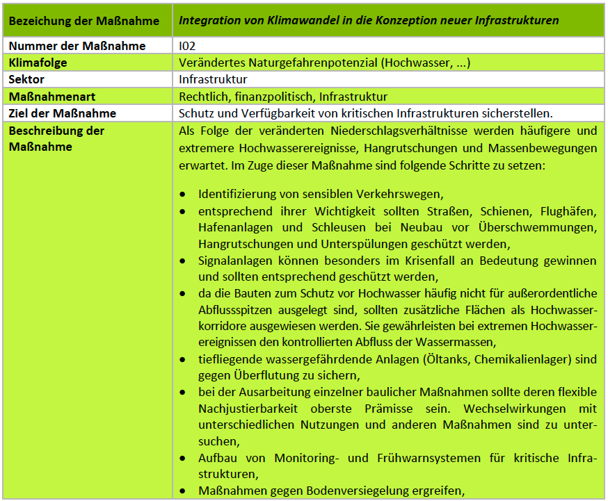
Every recommendation is explained in a table format (see below). It comes with a detailed description, ensuring that a measure follows the climate change adaptation strategy. Key stakeholders to implement recommendations are also detailed.

Despite the comprehensive guidance, measures still need to be translated into the local context by municipalities. This ensures that decisions respect local specificities. It also ensures municipal planning autonomy, a valuable commodity in the Grand Duchy.

The strategy has been adopted by the Luxembourg Government. All public institutions are asked to consider the document in the planning of public projects.

Example of a recommendation in table format from the strategy. Source: MEV, 2021.

Experiences, success factors, risks

Adapting spatial planning to climate change is a difficult task. The strategy contains much useful information for planners and experts, helping to inspire national and local action.

Conclusions

The strategy is a reference document for climate change adaptation from 2018 to 2023. After 2023 it will be revised and updated again, to incorporate new knowledge and new planning legislation.

Contact

Contact: https://environnement.public.lu/fr/support/contact.html

References

Ministry of the Environment, Climate and Sustainable Development, Strategy and action plan for climate change adaptation:

German: https://environnement.public.lu/content/dam/environnement/documents/klima_an_energie/Anpassungsstrategie-Klimawandel-Clean.pdf

French: https://environnement.public.lu/content/dam/environnement/documents/klima_an_energie/Strategie-Adaptation-Changement-climatique-Clean.pdf

Public participation has become an essential part of any public planning endeavour. Many citizens actively seek to be involved in planning processes, to remain informed, provide their knowledge. or to advocate their interests.

To facilitate future public participation, the Luxembourg government has published an online participation portal and the ‘National Portal for Public Inquiries’ can be used free of charge by Luxembourg public institutions.

Rationale for action

Participation is important to increase acceptance of projects. Citizens can be involved at an early stage, enabling mediation and information. So, participation has become an integral part of planning and for many processes it is even required by law.

Participation however is often costly for project implementors as no one solution fits all. Procedures need to be developed from scratch for each endeavour, the scope of participation must also be defined, participants invited, workshops held and results incorporated in the planning process. Participation is sometimes also seen as a risk with unexpected results or even resulting in deadlock.

The unique demographics of Luxembourg also require a special approach to guarantee the democratic legitimacy of public participation. About half the population are not Luxembourg citizens and spoken languages include Luxembourgish, Portuguese, French, German and English among others. Local participation is often organised in Luxembourgish and hence can be exclusive. The spoken language and sometimes also the timing of participation workshops in the evening exclude a large number of citizens.

Objective

Digital approaches to public participation can address this. Informing citizens is easier and feedback in different languages can be sent at any time. Digital platforms can cover larger target groups, potentially increasing the number of informed citizens and the amount of feedback.

To be successful, a digital approach needs to respect citizen involvement. So, the user-perspective needs to be at the very centre. A simple layout, streamlined processes, clear indications for why feedback is required and information on processing the data are key.

A new approach was required to address the weaknesses and to harness the strengths of current participative procedures. To simplify public services and offer more digital services to citizens, the online platform ‘National Portal for Public Inquiries’ was created.

Time frame

The idea for the platform came up in 2018. Since then, it has been developed in close cooperation between two government institutions.

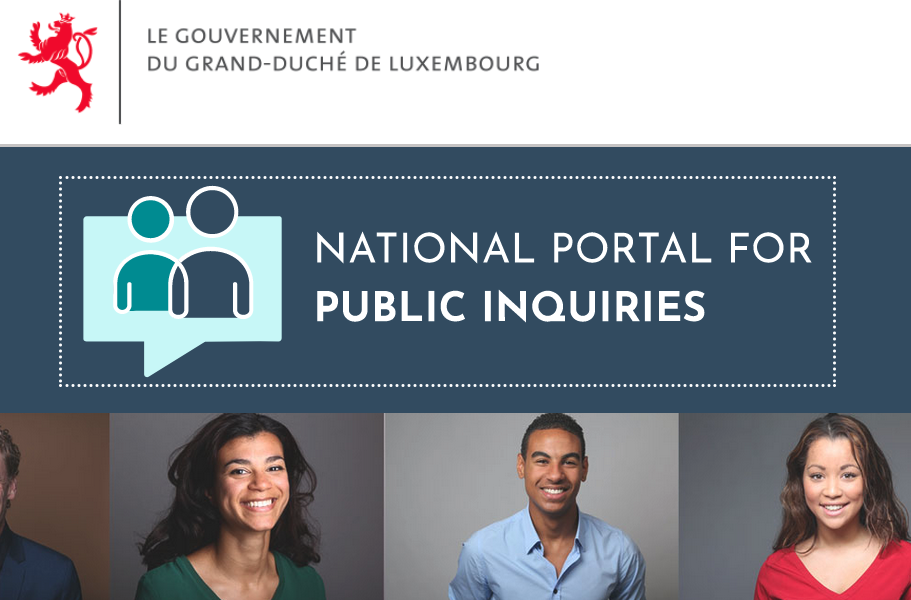
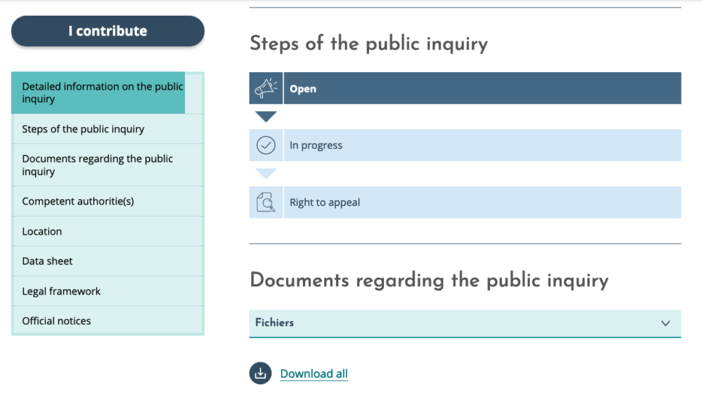
Overview on the menu and pieces of information for each public inquiry. Source: CFUE, 2022.

Key players

Development of the portal was entrusted to the Ministry of Digitalisation, CFUE (“Cellule de facilitation urbanisme et environnement”, French for ‘Urban Planning and Environment Facilitation Unit’). This unit supports exchange and coordination in planning projects between stakeholders. CFUE was created in 2013 and integrated into the Ministry of Digitalisation at the end of 2018.  The portal is also refined continuously by CFUE and is also hosted by the Government IT Centre (CTIE – Centre for information technology of the Luxembourg State).

Implementation steps and processes

The idea came from CFUE. The benefits and added value of a digital participation platform became apparent during its coordination of many planning projects.

Since 2018, the layout and structure of the platform has been developed by CFUE, involving important players from different government institutions. As the idea matured, it became more and more important to design the portal around citizens’ needs. The portal design and processes are modular to enable players from different levels and institutions to post and host participation procedures and notices.

After the design was concluded, the platform was implemented together with CTIE. Since its launch in early 2021, the portal has been an official government service.

Required resources

The resources used to create the portal are not known, but came entirely from CFUE and CTIE.

Results

Since its launch in 2021, the portal has been accessible to the Luxembourg public. In addition to public participation procedures that can be launched and organised through the portal, it informs citizens on planning endeavours through public notices, enables information meetings to be scheduled and held and provides guidance on implementing participation procedures, complying with the applicable laws. 

The portal provides factsheets on different procedures, along with the regulatory background and required public participation delays, which ensures standardised procedures. The portal also offers guidance documents.

A unique feature is that individuals can register for a territorial newsletter and an E-mail is automatically sent notifying any participation procedure in a selected municipality

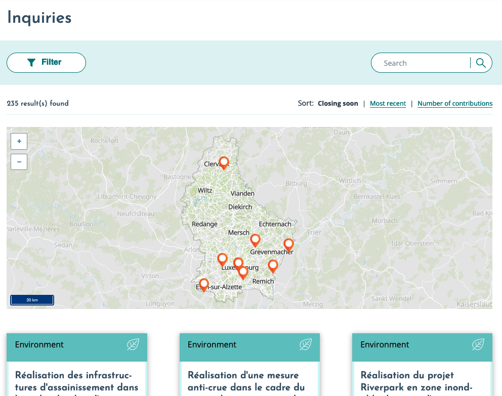
Overview on the geographical location of ongoing public inquiries in Luxembourg. Source: CFUE, 2022.

Experiences, success factors, risks

Right from its official launch, the portal is already widely used with more than 200 procedures registered in November 2021. Most of these are environmental participation processes, which in Luxembourg are complex and difficult to run. So, the portal already brings administrative simplification for authorities and citizens.

CFUE is a neutral coordinator in planning projects, connecting with a large network of local and national planning experts and decision makers. The neutrality and connectedness of the institution ensure impartiality and proper use of the portal.

Conclusions

With the ‘National Portal for Public Inquiries’, the Government has developed a new instrument that facilitates public participation. The portal is easy to understand, and the modular design enables inclusion of participation procedures from all fields and levels in spatial planning.

The possibility to quickly locate planning projects, the customisable newsletter, an ability to switch languages and to easily submit an opinion showcase that the user-dimension has been successfully integrated into the design of the portal.

Contact

A contact form is accessible on: https://enquetes.public.lu/en/support/contact.html

References

Luxembourg Government 2021: National Portal for Public Inquiries: https://enquetes.public.lu/en.html

Luxembourg Ministry of Digitalisation, 2021: Press dossier on the National Portal for Public Inquiries (in French): https://gouvernement.lu/dam-assets/documents/actualites/2021/01-janvier/07-enquetes-publiques.pdf

Many firms and jobs in the Grand Duchy of Luxembourg are centred around the capital city. Municipalities beyond Luxembourg city and its immediate surroundings have difficulties attracting firms and providing local employment. In addition, the many international companies in Luxembourg mean that prices for office space are challenging for start-ups.

The municipality of Dudelange in the south of the country has initiated ‘Innovation Hub Dudelange’. This incubator is a first step to supporting a new eco-innovation cluster within the municipality and providing affordable office space for start-ups.

Rationale for action

With an ever-increasing number of enterprises and jobs around the capital city, some recent developments have caused difficulties, including the many cross-border commuters working in Luxembourg city. Territories between Luxembourg city and the borders to Belgium, France and Germany have turned into a ‘drive-through country’. With a low municipal business tax rate, Luxembourg city continues to be an unrivalled player in the competition for businesses in the Grand Duchy, leaving little chance for other municipalities to attract firms.

Many international firms rent offices in Luxemburg city, so it has become difficult for start-ups to find affordable office space in the capital area. Start-ups often rely on cheap office space, so where space is expensive less of them can emerge.

Objective

The ‘Dudelange Innovation Hub’ aims to attract and support eco-technology start-ups that will help to establish a new economic cluster in the municipality and the country. Eco-technology approaches, practices and technologies developed in the new cluster can eventually be transferred to municipal departments to improve their services.

This will contribute to local economic development and new jobs. The incubator also aims to shape economic activities towards sustainable and ecological activities in the future ‘NeiSchmelz’ eco-district, a brownfield development within the municipality.

Time frame

The decision to set-up ‘Dudelange Innovation Hub’ in the ‘NeiSchmelz’ district was taken in July 2017. Two months later, the project was presented to the public. With support from several national players, implementation of facilities for the incubator started soon after. In July 2018, just one year after the decision was taken, the incubator opened its doors and welcomed the first enterprises. In 2019, the Incubator welcomed seven start-ups. Three start-ups cooperated closely with the municipality for testing and introducing their products and services in the city of Dudelange.

Key players

‘Innovation Hub Dudelange’ is an initiative of the municipality which chairs and administers the incubator. The provision of facilities and their operation is in cooperation with national players, namely Luxinnovation and Technoport S.A. This innovation agency and business incubator assist the municipality in selecting businesses. Another player is the ‘Fonds du Logement’, the national fund for housing, which owns the land.

Implementation steps and processes

The availability of financial and organisational resources required for the project and the limited number of players involved meant progress on ‘Innovation Hub Dudelange’ was quick. The concept was developed and approved in 2017 and the incubator started operation in July 2018.

Operation of the incubator is ensured by the municipality together with the national innovation agency and the national technology incubator. Start-ups looking to rent office space apply to the national innovation agency. After a pre-selection, a final choice is made by a selection committee of all three key players.

Once the start-ups are welcomed in the ‘Innovation Hub Dudelange’, they receive support in the form of contact building, fundraising and other services provided by the national innovation agency and the business incubator.

Required resources

The municipality rents office spaces from the national fund for housing ‘Fonds du Logement’. In addition to the rent, implementation of the facilities cost EUR 175,000, which was covered up to 80 % by the state.

Results

‘Innovation Hub Dudelange’ includes 14 furbished offices available to eco-technology start-ups. Additionally, the 500 square meters of newly built office space include conference rooms and shared facilities.

Companies can rent the offices for up to five years at a reduced rent. Start-ups less than two years old pay EUR 15 per square meter each month, all other companies pay EUR 20.

At the end of 2019, one year after inauguration, seven of the 14 workplaces were already let. The start-ups cover specialisations including smart irrigation systems, smart LED street lighting systems and active mapping of flood zones using innovative drone technology. Products of these eco-technology firms are transferred to the local administration and will improve the public services provided by the municipality.

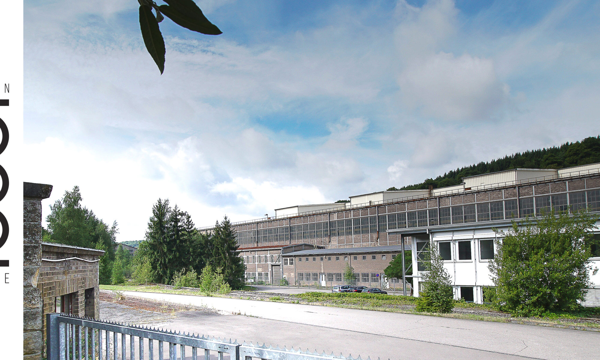
Facilities of the ‘Innovation Hub Dudelange’. Source: Municipality of Dudelange, 2018.

Experiences, success factors, risks

‘Innovation Hub Dudelange’ is an innovative approach offering start-up support to a specific sector in a specific location. The instrument also helps to foster innovation in eco-technology. Although this is frequently in the media, it is not frequently addressed by entrepreneurs.

The instrument is also suitable for interim uses. While the eco-district is developing at full speed, ‘Innovation Hub Dudelange’ was based in a building of a steel mill that halted production in 2005. Occupation of the offices by start-ups is for up to five years, so winding-up the incubator should involve little effort when the services are no longer needed.

Conclusions

‘Innovation Hub Dudelange’ shows that relatively little finance is required to set-up a business incubator. Such initiatives are thus suitable for smaller municipalities with limited human and financial resources. Relying on support from national agencies, the municipality benefits from local economic development incentives from the start-ups as well as from the emerging eco-technology cluster, enabling innovations to be transferred to the municipal administration.  

Contact

Contact address: innovationhub@dudelange.lu

References

Municipality of Dudelange, 2019: ‘Innovation Hub – 3 startups réinventent la ville de demain avec Dudelange!’ (in French):

Luxinnovation, 2019: News – Innovation Hub – one year of supporting eco-technology: https://www.luxinnovation.lu/news/innovation-hub-one-year-of-supporting-eco-technology/

Celebrating the accession of the city of Differdange to the CIPU convention, we interviewed Laura Pregno, alderwoman for urban development and Manuel Lopes Costa, chief planner for the City of Differdange. Differdange is the third-largest city in the Grand Duchy of Luxembourg. The interview covered climate change adaptation and climate action in Luxembourg urban areas.

Interviewer: Measures addressing climate change can reduce hazardous emissions, or deal with the consequences of climate change. What role does local development play in adapting to climate change?

Alderwoman Pregno and chief planner Lopes Costa: Urban development is important to climate change adaptation with municipal measures aligned to broader objectives. The city of Differdange directly contributes to Sustainable Development Goal 11 ‘Make cities and human settlements inclusive, safe, resilient and sustainable’ through a municipal guideline.

Sustainable Development Goal 11. Source: UN, 2021.

The 2018 guideline lays out principles and objectives for renovation and construction of public buildings in Differdange (available here in German). It directly refers to the Sustainable Development Goals, linking municipality measures to global climate change adaptation and climate action. When implementing local measures, it is important to consider these overarching objectives and strategies as this ensures that players at all levels are working towards the same objectives creating synergies and avoiding conflicts.

Linking municipal efforts to broader global policies still leaves municipalities free to adapt their own visions, strategies and objectives. We develop our own visions and strategies for climate change adaptation and climate action through urban and district development in our city. Referring to the global objectives helps us to use monitoring, with measurable effects that are visible for Differdange residents.

Differdange uses municipal planning to involve citizens, associations, public institutions and services as well as businesses. In addition, our starting point for climate change adaptation differs from other places. In Differdange we have different pre-requisites than elsewhere, calling for territorially integrated actions and measures. Urban and district development instruments help us to incorporate local specificities in policy making.

Interviewer: Where do you see priorities and opportunities to use existing or new spatial planning and urban development instruments for climate change adaptation in Luxembourg?

Alderwoman Pregno and chief planner Lopes Costa: Luxemburg municipalities already have a range of instruments to hand that enable climate change adaptation and climate action to be integral in urban development. From our point of view, these instruments are sufficient for such measures.

However, climate change adaptation and climate action often lack clearly defined objectives and measures at municipal level in Luxembourg. In Differdange and other municipalities instruments could not be used to their full potential to carry out projects as there were unclear overarching objectives. These ambiguities have their origin in political disputes or a lack of climate-related strategies at municipal level.

This is why we, the city of Differdange, are working on clear politically approved objectives. An urban strategy is currently under development which will align all urban development projects in Differdange to contribute to climate change adaptation and climate action. The strategy will complement the existing guideline and is being developed jointly with citizens and across political parties, ensuring that all parties will work on its implementation.

Once these clear and politically approved objectives are defined at local level, we can use urban development and planning to their full potential to implement concrete measures. Our strategy will ensure that climate change adaptation and climate action objectives are addressed in urban development. The local zoning plan, PAG (Plan d’aménagement general) will influence land-use in favour of climate change adaptation, with specific land-use plans (Plan d’aménagement particulier)and urbanistic concepts for vacant land (Schémas Directeurs) enabling measures for private or public development projects, such as building layout and even construction materials.  

Interviewer: What role should climate change adaptation play in a sustainable urban development?

Alderwoman Pregno and chief planner Lopes Costa: In Luxembourg, impacts of climate change have become more visible in recent years. More frequent torrential rains, droughts and hazardous events have put climate change back into the population’s awareness. The most important instrument we as the city of Differdange have to counter these changes is sustainable urban development. Changing our urban landscape and making it more fit for the future will guarantee that our city remains liveable. Nevertheless, to make sure that we are all moving into the same direction we need joint visions and strategies. With our climate strategy, we increase leverage of our measures as we commit all political parties to shared objectives and measures.

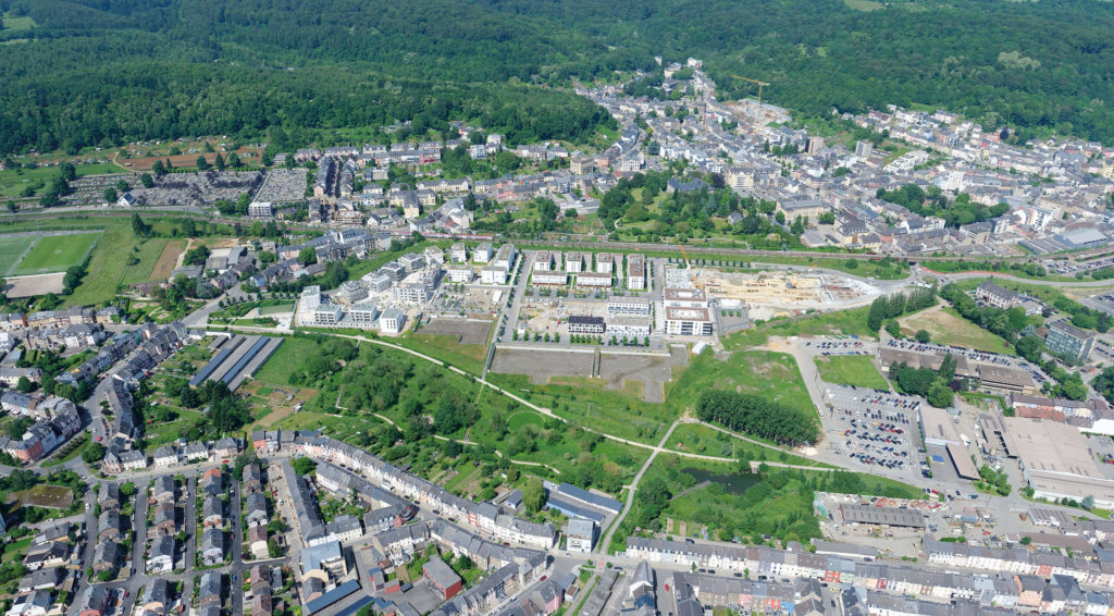
Master plan for the ‘Plateau du Funiculaire’ in Differdange. Source: Dewey Muller, 2020.

Interviewer: Can converting urban brownfields help climate change adaption?

Alderwoman Pregno and chief planner Lopes Costa: We have brownfield conversion experience with the large development project ‘Plateau fu Funiculaire’ in the centre of Differdange. Since 2004, we have been developing this district together with many stakeholders. The brownfield was a former dumpsite for the nearby blast furnace and was developed in a way that connects the city districts of Differdange, Differdange, Oberkorn and Fousbann. We also re-naturalised the river Chiers with special attention on providing natural flooding surfaces.

This large-scale brownfield development has much more freedom compared to developments in existing urban areas. We discussed and balanced measures before they were realised in detail. This has helped to avoid conflicts. Also, planners optimally balance the three pillars of sustainable development; economy, ecology and society at project level.

However, this process takes time. It is important that concerns on climate change adaptation and climate action are considered in the planning process from the very beginning. Only then can the different needs and requirements be balanced through iterative discussions and negotiations between sector experts, so operational concepts can be developed and implemented.

In addition, brownfield development projects such as ‘Plateau du Funiculaire’ serve as testbeds for new approaches and technologies. Its size meant we faced challenges that could not be solved with existing planning approaches. An example is providing heat to the 600 units in the district. The area was planned with a centralised district heat system as early as 2007 to reduce infrastructure costs and to save energy. The idea could only be adopted later, but time is available in such large-scale brownfield developments.

‘Plateau du Funiculaire’ from above during construction. Source: Dewey Muller, 2020.

Interviewer: Thank you and we will definitely cover the ‘Plateau du Funiculaire’ project in our upcoming descriptions of good practices from Luxembourg. What is the role of the CIPU for climate change adaptation in Luxembourg?

Alderwoman Pregno and chief planner Lopes Costa: The National Information Unit for Urban Policy (CIPU) is a platform to liaise partners and other players in Luxembourg on climate change adaptation. In addition to our measures in Differdange, all cities and municipalities across Luxembourg develop and implement climate change adaptation and climate action measures. CIPU events, workshops and related activities help bring this knowledge and experience together to create new knowledge. CIPU also facilitates discussion on difficulties encountered when implementing measures to support climate change adaptation and climate action. Critical reflection in the framework of CIPU events is crucial to designing and implementing changes to improve urban development in the country.

For any questions on the article, please refer to the author: sebastian.hans@spatialforesight.eu

The south of Luxembourg is marked by the heritage of the steel industry and mining. Large active and inactive industrial sites next to urban centres remind residents and visitors of the peak of heavy industry. Located in the south of Dudelange city centre, the Schmelz district was home to a steel mill until 2005. The 40-hectare site is now undergoing a major brownfield reconversion project.

Rationale for action

Following the steel crisis in the 1970’s, more and more steel mills closed. Since then, the ongoing structural change has also affected Luxembourg’s south. In 2005, the former Schmelz steel mill was closed, which created a 40-hectare industrial brownfield site next to the city centre. The municipality saw the opportunity and kick-started a process to convert the site into a new urban district.

Schmelz district during early 20th century. Source: City of Dudelange, 2019.

Objective

The central objective of the NeiSchmelz project is to construct a new district with housing, commercial and cultural areas connecting the districts of Italie and Schmelz to the city centre. Preserving the heritage of heavy industry is particularly important for the municipality. Therefore, the municipality intends to maintain the former industrial character, by preserving industrial artefacts such as the water tower and the floor plan of the factory buildings.

NeiSchmelz will offer approximately 1 000 new housing units. The new district should be multifunctional, mixed and attractive also for locals. By involving the Housing Fund (Fonds du Logement) in the development, housing will also be available for prices below market value, which will further promote a social mix.

The new district will have easy access to Dudelange city centre, to surrounding districts, to green recreation areas and to the national traffic infrastructure. In addition to existing railway lines for example, there will be new traffic infrastructure within the new district and towards the surrounding areas (pathways, bike lanes, roads).

Time frame

The development started in 2008 and is ongoing (2021). The participatory phase started back in 2009 and the interim use concept was developed in 2011. A decontamination study and negotiations between the steel company (Arcelor Mittal) and the state were finalised in 2016. Since then, urbanistic concepts are being developed and implemented.

Key players

City of Dudelange, Housing Fund (Fonds du Logement), Luxembourg state functions (environment and water management administration, public roads and bridges administration (all under the Ministry of sustainable development and Infrastructure), CFL (national railway company)), Luxembourg EcoInnovation Cluster, developers, architects, civil society (community and social enterprises) and private developers.

Positioning of the NeiSchmelz district in relation to Dudelange centre (in the upper half of the picture). Source: City of Dudelange, 2019.

Implementation steps and processes

After the former steel mill closed in 2005, the municipal administration issued a call for proposals in 2006 to gather ideas for future use of the site. In 2008, there was a decision to create a new urban district with a focus on housing. A national call for development proposals was launched in 2009. In 2010, the NeiSchmelz proposal was awarded and planners were contracted to develop the master plan for the district. In parallel, a concept to decontaminate the area was elaborated. In the meantime, an interim use concept was initiated and the master plan was finalised in 2012. Negotiations between the steel company, who owned the site, and the state finished in 2016, transferring ownership of the site to the state-owned Housing Fund.

Alongside implementation, a participatory process involving the public was organised. From 2009 to 2016, local residents and interest groups could incorporate their ideas for the interim use and final state of the conversion. This was achieved through information campaigns, multiple consultations and workshops. Presentations of the project highlight changes introduced through the public consultation procedure to illustrate to citizens how their contribution has influenced the project.

In order to develop the site, the municipal land-use plan (PAG) had to be changed. For the technical implementation, the city will rely on four so-called PAP (partial land-use plans). These act as building permits and were submitted for approval in late 2017.

Required resources

Since the project is implemented stepwise, the required resources cannot be specified. A key aspect for the project, however, was the acquisition of the site from the steel company.

Results

So far, there are few results of the conversion project. 1 000 new housing units will create living space for around 2 000 new residents. Additionally, there will be new commercial areas as well as public and semi-public areas for social and cultural exchange. A large area in the centre of the district will be for businesses, targeting start-ups and innovative enterprises. Building permits, in the form of partial land use plans for the new district were submitted for approval in late 2017 and approved in 2019.

Aerial view of the future district. Source: Fonds du Logement, 2019.

Experiences, success factors, risks

Reconversion provides the opportunity to bring new types of land use into an urban area. NeiSchmelz creates a new residential district with businesses and public spaces. At the same time, the project illustrates how cultural heritage from the steel industry can be preserved while changing the usage of the site.

This industrial reconversion is a large-scale project that benefits from multi-level governance arrangements. In particular for the negotiations with the globally acting industrial companies, it was important to involve a national player.

The project is similar in size to other conversion projects in Luxembourg. For most of these projects, the sheer size in relation to the immediate surroundings and existing urban fabric poses special challenges for planners and architects.

Conclusions

NeiSchmelz illustrates that participatory processes, if implemented thoughtfully, have an impact on the length of a planning process. Participation, however, is key to acceptance of the new project and should thus represent a central pillar in the planning process. A good project requires effort and time.

Contacts

Ms Eva Gottschalk, Chief planner of the City of Dudelange: Eva.Gottschalk@dudelange.lu

References

City of Dudelange, 2021: project website: http://www.dudelange.lu/fr/projets-urbains/projet-neischmelz

City of Dudelange, 2013: participation report: http://www.dudelange.lu/fr/Documents/2013_Neischmelz-Rapport.pdf

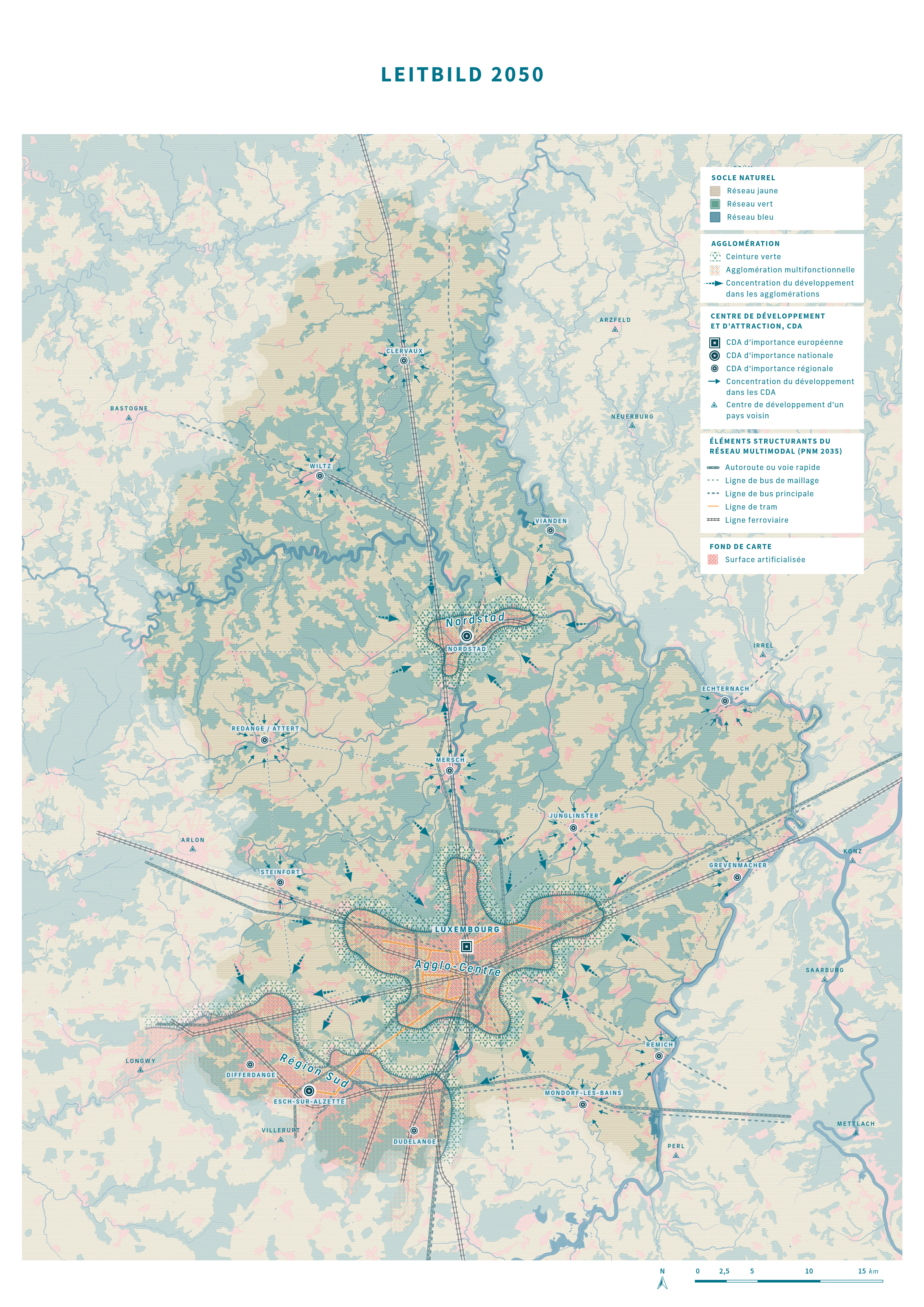
Public administrations are usually more reluctant to adopt processes based on new and innovative technologies than private actors. This is because these processes can have shortcomings or pitfalls that are not immediately apparent. Also, new processes can raise new questions and challenges for public decision-makers such as data security and protection against hacking. Public actors however must keep pace with the digitalisation in the private sector not to create bottlenecks for digitalisation in the country.

Géoportail’ (Geoportal) is an online platform providing and summarising geographic data for multiple user groups. Set up by the land register and topographic administration of the Grand Duchy of Luxembourg, it was launched in 2011 to increase transparency, digitalising information and making it more accessible for users.

Different thematic sections in Géoportail.

Rationale for action

Geographic data used by public administrations is often not simply accessible to the public. Some data is classified as confidential, some is not confidential but is unavailable to the public. This can be due to missing platforms, complex query processes, etc. New communication technologies can make such data easily accessible.

Data often lie in different repositories without being coordinated and combined. Making them accessible, with a focus on standardising data types, data categories, metadata and so on, creates a database from which more than the public benefits.

The Géoportail was set up provide open source access to publicly owned, geographic information. Making this available follows the European Union policies in the INSPIRE directive (INfrastructure of SPatial InfoRmation in Europe) from 2007. By making data openly accessible, free to use and reuse, governance processes and decisions become more transparent for citizens.

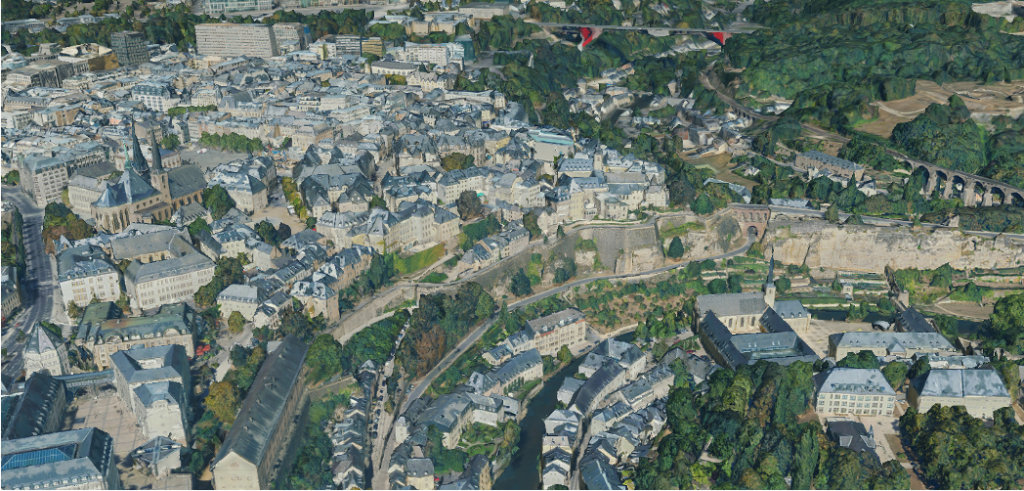
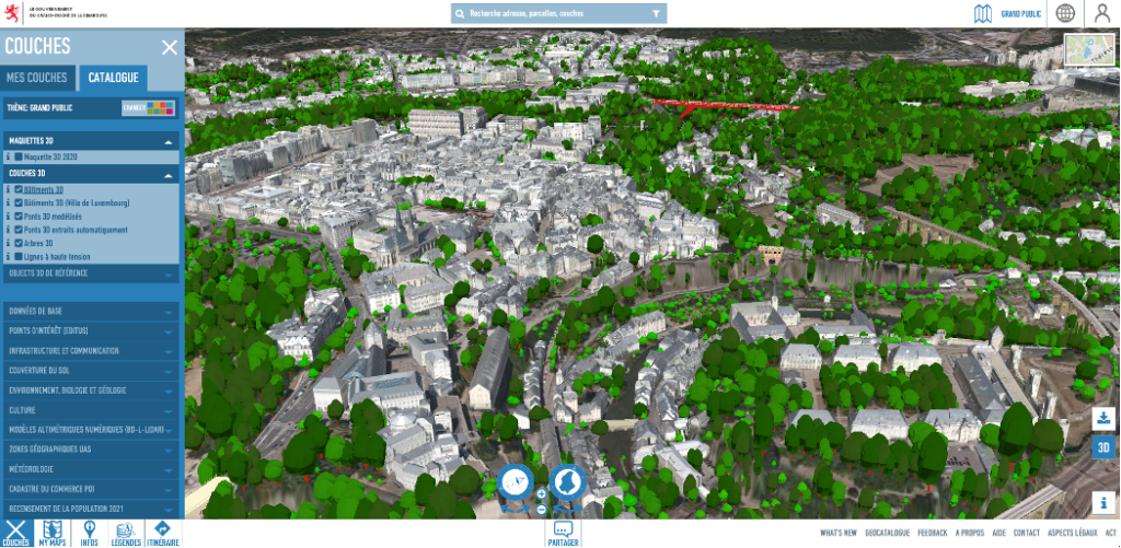
Digital Elevation Model in Géoportail.

Objective

The idea behind Géoportail is to harmonise public geodata from different institutions (i.e. the environment ministry and the ministry in charge of the land register). The online geodata system provides individual users, professional users and developers with multiple functionalities. Individuals can for example easily access cadastral, topographic information and also information on infrastructure, environment, tourism, land use plans. Information displayed on the Géoportail can be exported to either PNG or PDF format for individual users.

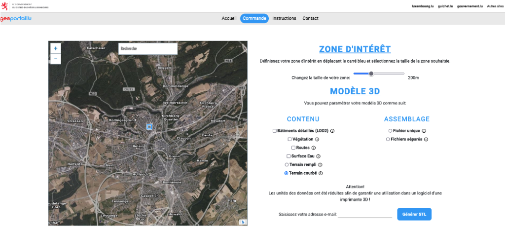
In addition to this, professionals and developers can use other functionalities the Géoportail provides. These are for example the applications of MAP API and MAP APIV3 that allows spatial information to be retrieved for the use on external websites, access aerial images, plan routes, track a surveying request and much more.

Not only the geodata is made available to the public by storing it in the Géoportail, it also assists state services by giving them additional information through a multi-level access system. For example, notaries in Luxembourg can query the full information of land owners on the land register, whereas the public would see only the name and post code of the owner.

Time Frame

2011 – ongoing (2021), constant updates

Key players

Ministries, especially the Ministry of the Interior, the Ministry of Energy and Spatial Planning, the Ministry of the Environment, Ministry of Agriculture, plus the land register and topographic administration, data suppliers and municipalities.

Implementation steps and processes

In 2010, development started, which was finalised January 2011 when the Géoportail was published. In May 2011, the application for mobile devices was released. Regular updates continue to improve the platform and introduce new functionalities, such as the possibility to measure distances and surfaces, introduced in 2015. Géoportail was implemented through tendering for the required services.

Land zoning plans in Géoportail.

Results

Géoportail is accessible through the web. The modular platform can be used for multiple forms of spatial data. For the Tour de France 2017, Géoportail was used to show the route of the race in Luxembourg for example. It has also stored information on the road network and infrastructure, built-up environments, water courses, soil types, locations of public infrastructure, land register parcels, hunting areas, points of interest and much more. It recently incorporated points of interest from the Editus portal, the yellow pages in Luxembourg. The platform provides different information for different users. Private individuals can access all the above material and professionals working with geodata such as notaries for instance can access more data.

Following the reform of the spatial planning law in 2003 and the step-by-step finalisation of the PAG (local land-use plans), the portal also provides information on planned land-use. Municipalities must upload their local land-use plans onto the platform in a special format so the results of participation and planning processes are available to the public. The PAG are uploaded for each municipality so the entire country is covered.

Experiences, success factors, risks

Géoportail is a successful and user-friendly attempt to make public data accessible. It represents a platform that makes it possible to integrate any type of spatial data in the future to different user groups. It also permits for the integration of data on specific events such as the Tour de France.

Soil typology map on Géoportail.

Conclusion

Key to successful implementation of such an online platform is user-friendliness. A complicated portal risks becoming a ‘data dustbin’ where data is provided but not used. Simple design and layout are important. This applies not only for individuals who can export data in a common file format (PDF, PNG, JPG, etc.) but also professionals, who need to work with exported information (SHP, TIFF, GDB, etc.). Géoportail is also fully integrated into the OpenData Portal of Luxembourg, making it possible to easily amend or complement information.

Contact

E-mail address of the land register and topographic administration: support.geoportail@act.etat.lu

References

Géoportail website: https://www.geoportail.lu/en/

Website of the land register and topographic administration of the Grand Duchy of Luxembourg: https://act.public.lu/fr/index.html