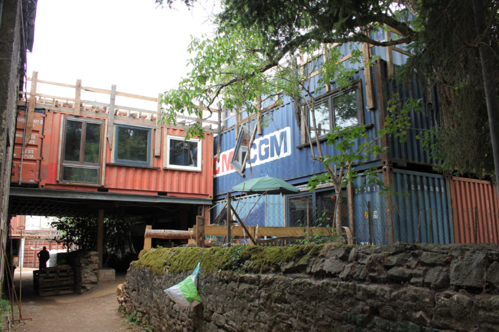
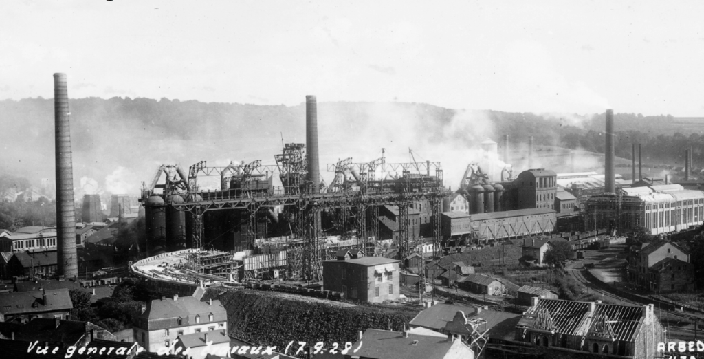
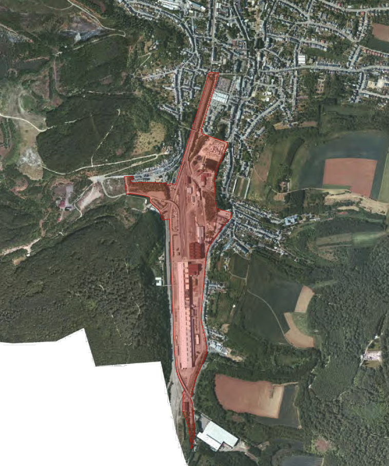
The south of Luxembourg is marked by the heritage of the steel industry and mining. Large active and inactive industrial sites next to urban centres remind residents and visitors of the peak of heavy industry. Located in the south of Dudelange city centre, the Schmelz district was home to a steel mill until 2005. The 40-hectare site is now undergoing a major brownfield reconversion project.

Rationale for action

Following the steel crisis in the 1970’s, more and more steel mills closed. Since then, the ongoing structural change has also affected Luxembourg’s south. In 2005, the former Schmelz steel mill was closed, which created a 40-hectare industrial brownfield site next to the city centre. The municipality saw the opportunity and kick-started a process to convert the site into a new urban district.

Schmelz district during early 20th century. Source: City of Dudelange, 2019.

Objective

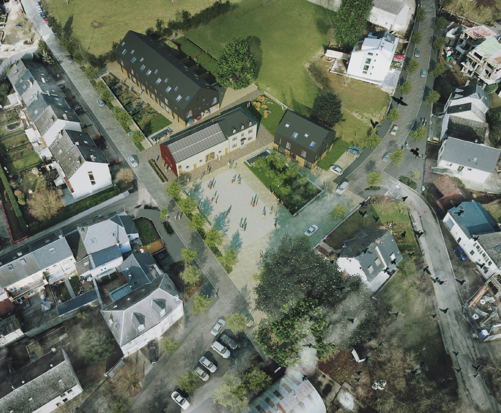
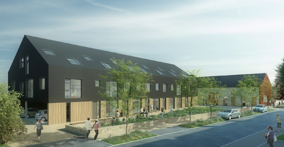
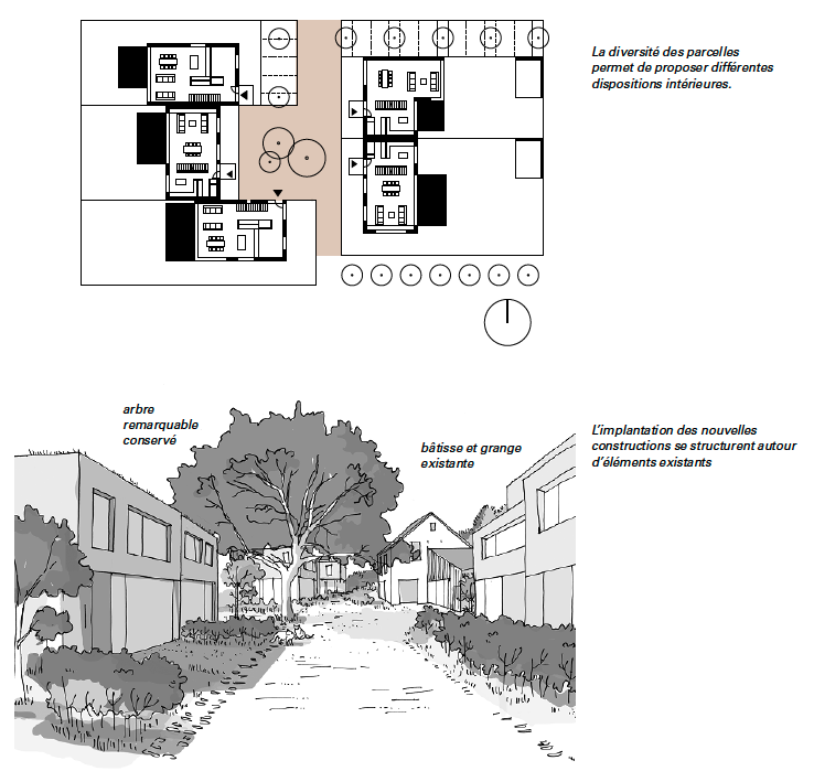
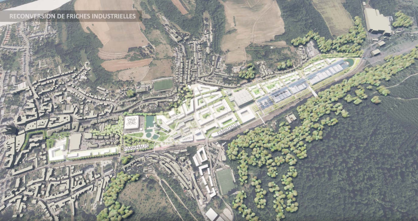
The central objective of the NeiSchmelz project is to construct a new district with housing, commercial and cultural areas connecting the districts of Italie and Schmelz to the city centre. Preserving the heritage of heavy industry is particularly important for the municipality. Therefore, the municipality intends to maintain the former industrial character, by preserving industrial artefacts such as the water tower and the floor plan of the factory buildings.

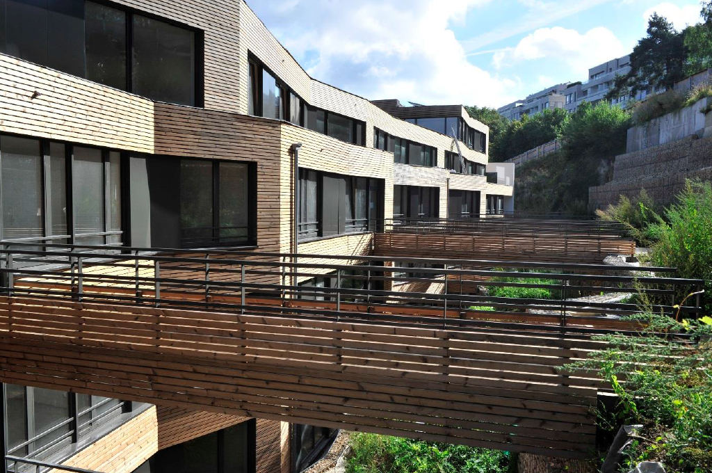
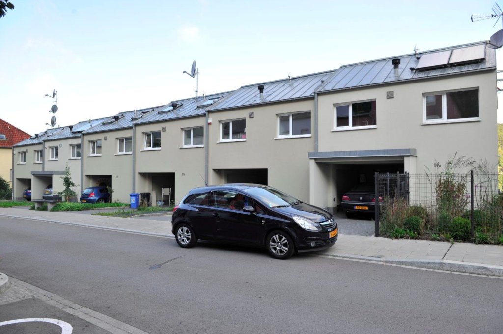
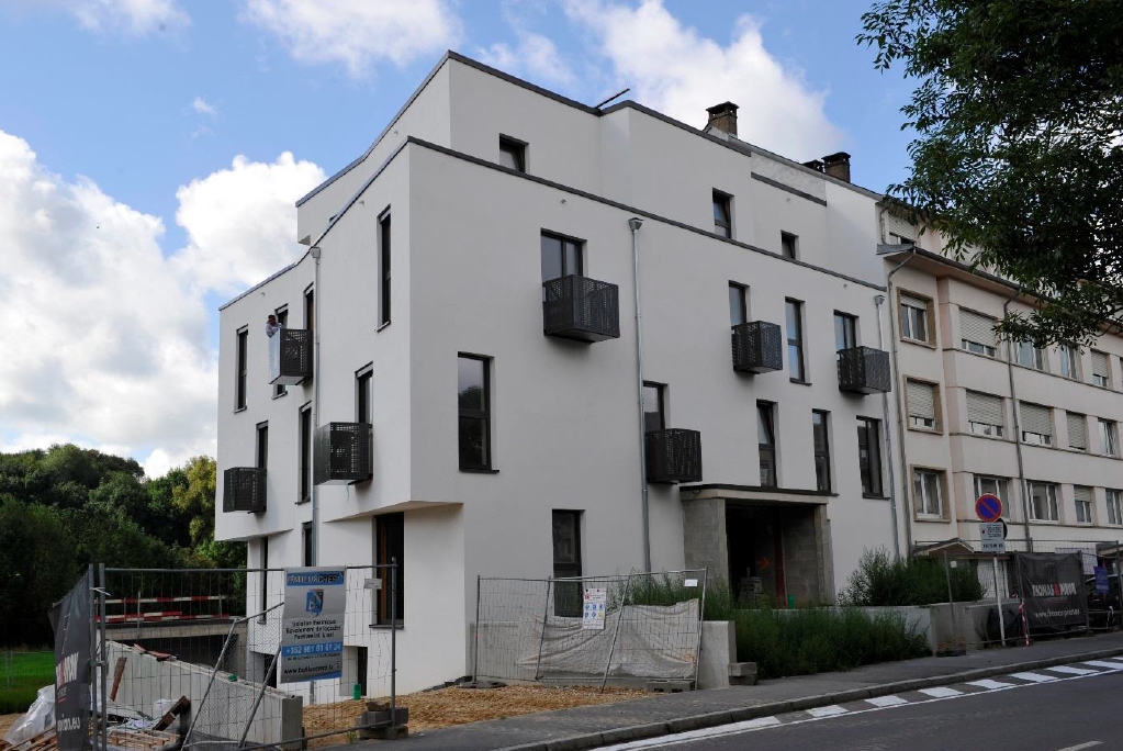
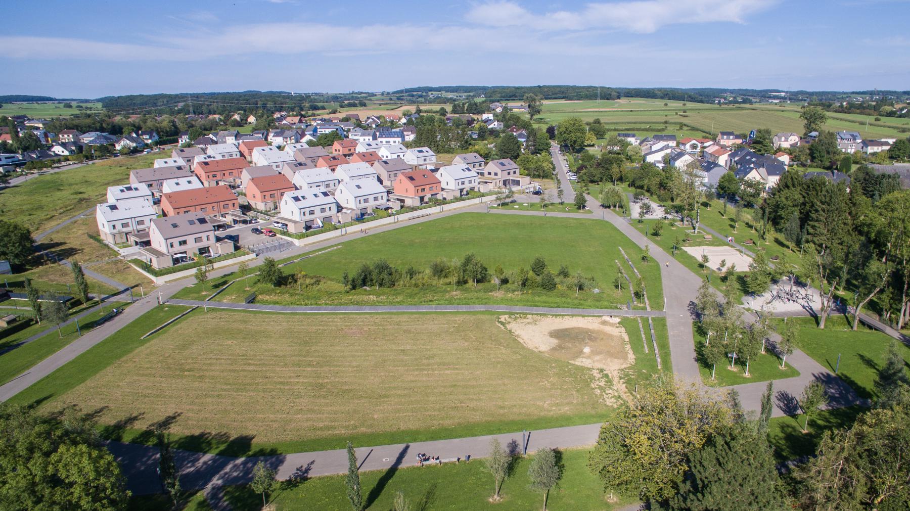
NeiSchmelz will offer approximately 1 000 new housing units. The new district should be multifunctional, mixed and attractive also for locals. By involving the Housing Fund (Fonds du Logement) in the development, housing will also be available for prices below market value, which will further promote a social mix.

The new district will have easy access to Dudelange city centre, to surrounding districts, to green recreation areas and to the national traffic infrastructure. In addition to existing railway lines for example, there will be new traffic infrastructure within the new district and towards the surrounding areas (pathways, bike lanes, roads).

Time frame

The development started in 2008 and is ongoing (2021). The participatory phase started back in 2009 and the interim use concept was developed in 2011. A decontamination study and negotiations between the steel company (Arcelor Mittal) and the state were finalised in 2016. Since then, urbanistic concepts are being developed and implemented.

Key players

City of Dudelange, Housing Fund (Fonds du Logement), Luxembourg state functions (environment and water management administration, public roads and bridges administration (all under the Ministry of sustainable development and Infrastructure), CFL (national railway company)), Luxembourg EcoInnovation Cluster, developers, architects, civil society (community and social enterprises) and private developers.

Positioning of the NeiSchmelz district in relation to Dudelange centre (in the upper half of the picture). Source: City of Dudelange, 2019.

Implementation steps and processes

After the former steel mill closed in 2005, the municipal administration issued a call for proposals in 2006 to gather ideas for future use of the site. In 2008, there was a decision to create a new urban district with a focus on housing. A national call for development proposals was launched in 2009. In 2010, the NeiSchmelz proposal was awarded and planners were contracted to develop the master plan for the district. In parallel, a concept to decontaminate the area was elaborated. In the meantime, an interim use concept was initiated and the master plan was finalised in 2012. Negotiations between the steel company, who owned the site, and the state finished in 2016, transferring ownership of the site to the state-owned Housing Fund.

Alongside implementation, a participatory process involving the public was organised. From 2009 to 2016, local residents and interest groups could incorporate their ideas for the interim use and final state of the conversion. This was achieved through information campaigns, multiple consultations and workshops. Presentations of the project highlight changes introduced through the public consultation procedure to illustrate to citizens how their contribution has influenced the project.

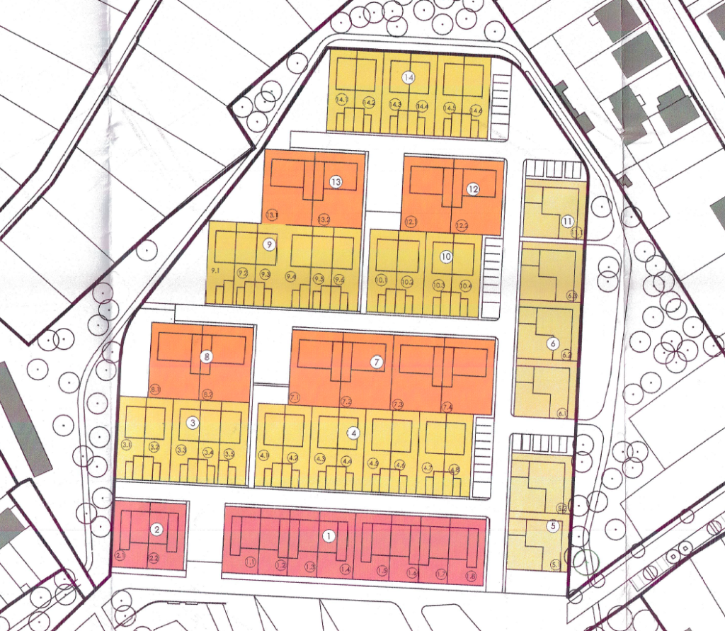
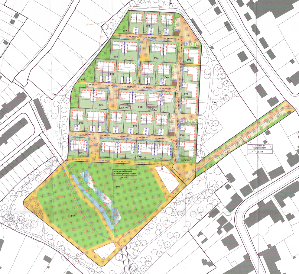
In order to develop the site, the municipal land-use plan (PAG) had to be changed. For the technical implementation, the city will rely on four so-called PAP (partial land-use plans). These act as building permits and were submitted for approval in late 2017.

Required resources

Since the project is implemented stepwise, the required resources cannot be specified. A key aspect for the project, however, was the acquisition of the site from the steel company.

Results

So far, there are few results of the conversion project. 1 000 new housing units will create living space for around 2 000 new residents. Additionally, there will be new commercial areas as well as public and semi-public areas for social and cultural exchange. A large area in the centre of the district will be for businesses, targeting start-ups and innovative enterprises. Building permits, in the form of partial land use plans for the new district were submitted for approval in late 2017 and approved in 2019.

Aerial view of the future district. Source: Fonds du Logement, 2019.

Experiences, success factors, risks

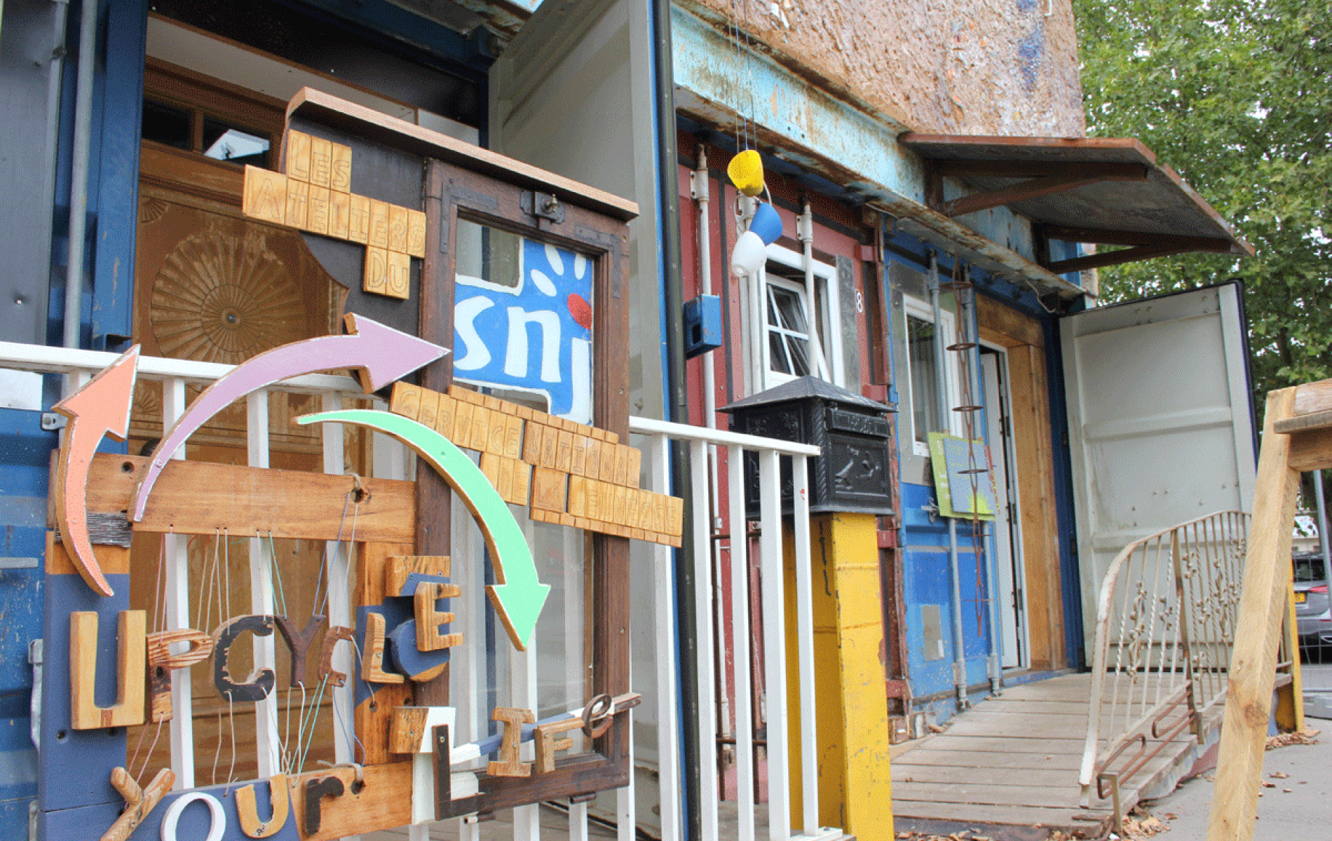
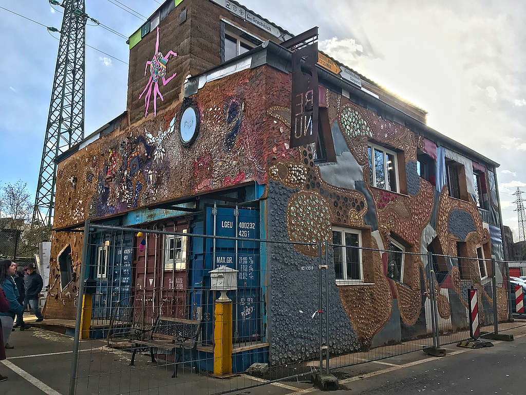
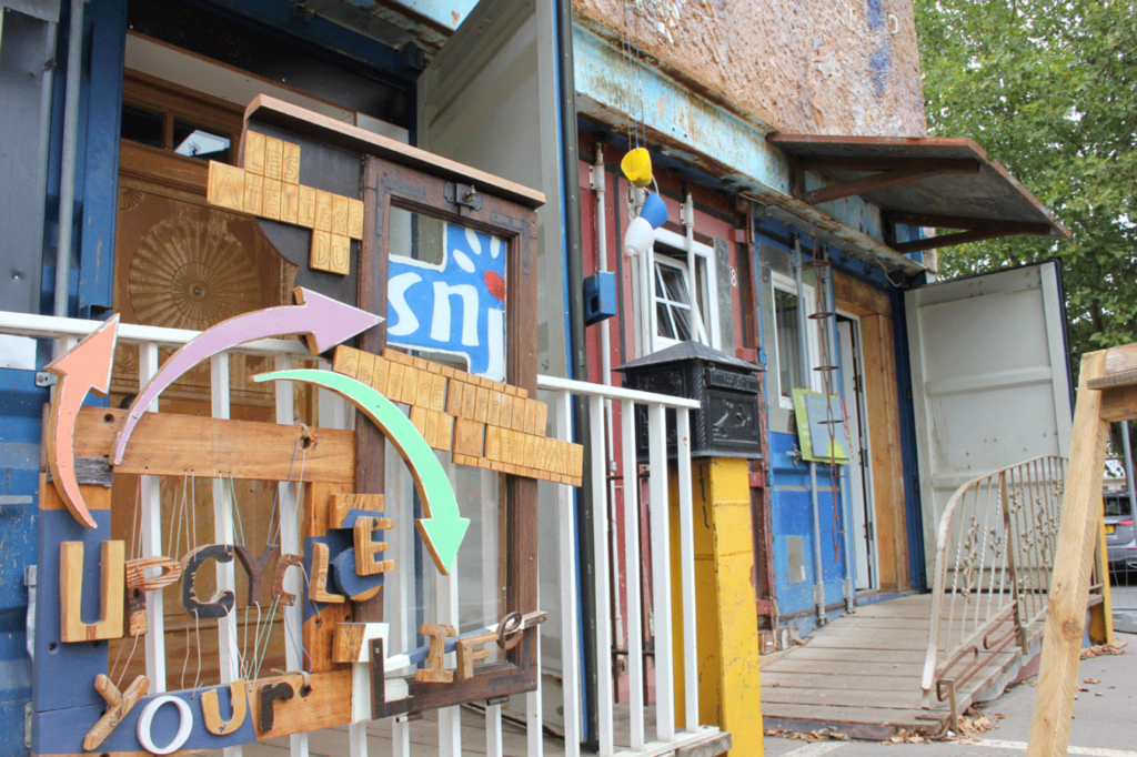
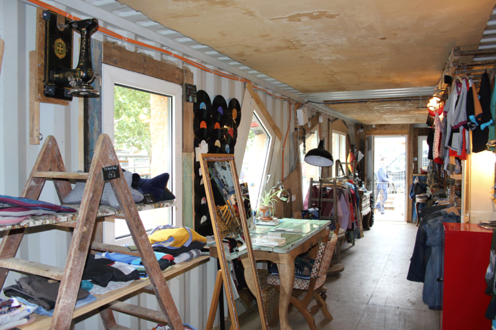
Reconversion provides the opportunity to bring new types of land use into an urban area. NeiSchmelz creates a new residential district with businesses and public spaces. At the same time, the project illustrates how cultural heritage from the steel industry can be preserved while changing the usage of the site.

This industrial reconversion is a large-scale project that benefits from multi-level governance arrangements. In particular for the negotiations with the globally acting industrial companies, it was important to involve a national player.

The project is similar in size to other conversion projects in Luxembourg. For most of these projects, the sheer size in relation to the immediate surroundings and existing urban fabric poses special challenges for planners and architects.

Conclusions

NeiSchmelz illustrates that participatory processes, if implemented thoughtfully, have an impact on the length of a planning process. Participation, however, is key to acceptance of the new project and should thus represent a central pillar in the planning process. A good project requires effort and time.

Contacts

Ms Eva Gottschalk, Chief planner of the City of Dudelange: Eva.Gottschalk@dudelange.lu

References

City of Dudelange, 2021: project website: http://www.dudelange.lu/fr/projets-urbains/projet-neischmelz

City of Dudelange, 2013: participation report: http://www.dudelange.lu/fr/Documents/2013_Neischmelz-Rapport.pdf

Cities are hot spots of ecological disruption due to excessive consumption of natural resources and high pollution by inhabitants. At the same time, cities are also creative spaces where existing models and rules are challenged, and alternatives are developed and tested.

‘Eco-districts’ and ‘eco-villages’ are new approaches and concepts that are being tested in urban areas. With principles such as ‘zero-waste’ and the circular economy becoming increasingly popular, these initiatives currently experience a renaissance with great interest of the public, decision-makers and urban planners.

Rationale for action

Circular economy has become a trend topic in Luxemburg during recent years. Decision-makers, urban planners and building research investigate new techniques and materials to render urban construction following the ‘zero-waste’ principle and the principle of circular economy.

At the same time, the demand for products that are produced in an ecologically and socially viable way increases. Alternatives to our established consumption model become more mainstream and promote alternatives to the linear economy of today. Many grassroot initiatives benefit from this recent trend towards a more circular approach in construction and an increasing demand for alternative products. BENU village has committed itself to this idea and in doing so has become the first eco-village of the Greater Region.

Outside view on BENU village. Source: https://www.greenpeace.org/luxembourg/fr/actualites/4321/benu-village-esch-un-ecovillage-au-luxembourg/

Objective

BENU village, (neologism for “Be New”) is the name of a grassroot movement in Esch-sur-Alzette. Its objective is to showcase that alternative models to the mainstream way of building and consuming are possible, and so in Luxembourg.

In this regard, the construction of the first eco-village of the Greater Region follows circular economy principles and also the economic activities are committed towards recycling, reusing and upcycling.

Time frame

The idea to create the BENU village first came up in 2015. A private person had the idea, which soon came to realisation. In 2017, the construction of BENU village started and the first building was finalised at the end of 2019.  

View of the entrance of BENU village. Source: https://www.moien.lu/benu-village-franz-fayot/

Key players

To formalise the idea and to increase its visibility towards the public, the city and the state, an association was founded to endorse the implementation of the eco-village: “BENU Village Esch ASBL”. The association is financially supported by the municipality and the state.

During the realisation, other state players became interested in the project. Businesses and state services use the premises of BENU village. For example, the national integration service for young adults organises learning programmes in BENU village.

Implementation steps and processes

All building materials used for the construction of BENU village derived from either re-use or recycling. Since the start of the construction in 2017, many volunteers have supported the building of the first house, which was finalised at the end of 2019. In addition to the volunteers, the project was supported by local craftsmen and other businesses that provided knowledge and materials.

In the building process of the village, considerable attention was devoted to the use of recycled materials. During the construction, only the screws were purchased new, the remaining materials, for example the windows, the wood used for framing, the insulation and the exterior shell of the houses, were entirely recycled from waste.

Soon after the first building was realised, shops moved in. The founder and initiator of BENU village opened “BENU Couture”, a tailor shop that produces clothing from used materials and second-hand articles. The premises continue to grow and were opened for other interested professionals.

A Charta, the so-called “BENU Charta” formulates shared values that ought to be respected by all businesses and professionals working in the eco-village, was developed. The Charta puts an emphasis on the ‘zero-waste’ principle, the recycling and upcycling of materials and commits future economic activities in the eco-village to act in an environmentally and socially responsible and transparent way.

Inside view of the shopping area of BENU village. Source: https://www.moien.lu/benu-village-franz-fayot/

Required resources

BENU village benefits from seed funding of the Ministry of Energy and Spatial Planning and the City of Esch-sur-Alzette, where the initiative is located. Apart from the financial support, the project was realised with the support of volunteers, that helped in the building and organisation of BENU village. As the building materials were mostly recycled, no material costs arised from the implementation of the project.

Results

The numbers speak for the success of the eco-villager: in 2019, a turnover of EUR 210,000 was generated, with 18 persons working for BENU village. About EUR 80,000 were generated from upcycled clothing and accessories. And BENU village will soon grow further. In 2021, when more surfaces of BENU village will become available, they will be rented to professionals pursuing similar ideas. Interested businesses, that act in line with the BENU Charta, can then rent these spaces. This way, BENU village will develop into a coworking space of likeminded professionals and businesses.

BENU village shows that there are different interpretations of the often referred-to ‘circular economy’. In addition to the mainstream definition, applied mostly at regional and national level, the definition of BENU village is different. BENU village shows an alternative reading to circular economy that functions at small scale and yields more than just a decrease in material consumption.

Outside view of the container structure of BENU village. Source: https://www.moien.lu/benu-village-franz-fayot/

Experiences, success factors, risks

As with many grassroot movements, the private commitment to the underlaying idea is important for the success of a project. The idea for BENU village was initiated and implemented by a private person. The continued lobbying and defence of the idea has successfully yielded the interest of elected officially, such as several national ministers and even the Grand Duke of Luxembourg.

In 2021, the project was awarded with the European Climate Star from the Climate Alliance in the category ‘Saving resources’. A short video is available here.

Conclusions

BENU village shows an alternative to our current living and working in an affluent society. Ideas such as ‘zero waste’ can also be successfully implemented with relatively little resources at district level. However, for doing so one needs pioneers and “BENU is a pioneer”, as described by the national Minister for Energy and Spatial Planning, Turmes.

The idea behind BENU is versatile and can be applied for more than just material production. During 2021, a restaurant, following the BENU Charta will open at the premises of BENU village.

Contact

General E-Mail address of BENU village Esch asbl: benu@benuvillageesch.lu

References

BENU, 2020: Website of BENU village Esch (in English): http://benu.lu/en/

Taylor Aiken, Schulz & Schmid, 2020: The community economies of Esch-sur-Alzette: rereading the economy of Luxembourg (scientific article in English): https://orbilu.uni.lu/handle/10993/42602

In 2013 there were some 995 hectares of vacant building land in Luxembourg which are classified as ‘Baulücken’. They are connected to infrastructure such as electricity and waste water. In principle, they are immediately available for construction and thus can tackle short- and intermediate-term needs for housing. To stimulate the use of these plots, the state has initiated the so-called ‘Baulückenprogramm’ (vacant lot identification and mobilisation programme). In Dudelange, the first project under the national programme is now underway.

Rationale for action

Tackling the housing shortage is a key priority on the political agenda in Luxembourg. By constructing more housing units, the shortage of living space can be reduced and prices could drop. Additionally, developing the vacant lots avoids urban sprawl. However, a limiting factor is their ownership structure as developing the lots for housing requires a consent of the owner. Only 6 % of these 995 hectares belong to public actors (state, municipalities and public funds). 94% belong to the private sector.

Owner structure of ‘Baulücken’ in Luxembourg: the majority is owned by private individuals (82.2%), followed by businesses (11.7%), municipalities (4.3%) and the state (0.7%). The structure shows the need to inform and cooperate with private owners in mobilising ‘Baulücken’ for urban development. Source: Ministry of Housing, 2016.

Objective

The national ‘Baulückenprogramm’ aims at activating these lots for the construction of housing. Developing these areas does not require long administrative procedures and it is possible to develop them relatively quickly. A first objective of the programme is to identify the lots and to make owners aware of how their lots could contribute in satisfying the demand for housing. In this process, municipalities act as intermediaries between the state and private owners.

Time frame

2014 – today

Key players

Land owners, municipalities as intermediaries and the state (Ministry for Housing) setting political targets and contracting external consultants. During the implementation of the programme, private and public landowners are and will be involved.

Implementation steps and processes

In 2014, the programme was initiated by the Ministry of Housing alongside other measures to revitalise housing construction and to address the shortage of housing in Luxembourg. Among these other measures are hereditary leaseholds, pre-emption rights for public actors, tax reform for housing, renting subsidies and ‘Baulandverträge’ (building land contracts).

Fictional example of the information brochure: the yellow ‘Baulücken’ provide the same surface as the red greenfield development. Source: Ministry of Housing.

The Ministry of Housing launched the programme, external consultants conducted the analysis and municipalities have to validate the results. Addressing private owners by providing information on the added value of the property and explaining the concrete advantages of mobilising specific lots should stimulate development. Public authorities should act as an interlocutor and advise owners to develop their property privately.

Experience from Germany has shown that information campaigns helped to convince 25% of private owners to develop their plots within the building perimeter.

Required resources

The process consists of multiple parts, so the resources required are unknown. The process is implemented by multiple actors with different motives and means, and thus estimating the required resources is not possible.

Results

The ‘Baulückenprogramm’ has just started and has not yet provided additional tangible results. The analysis of the municipal building pattern to identify vacant lots has not yet been completed for all municipalities in Luxembourg.

Communicating the identified vacant lots to municipalities is realised through an online platform providing tailor-made access. A first pilot under the national vacant lot mobilisation programme is realised in Dudelange, in the south of the country. To develop the 0.4 hectares of land in Dudelange, a first call for tender for proposals was launched in 2016. The call was organised in cooperation with the Ministry for Housing and the municipality of Dudelange, incorporating the Fonds du Logement (the national Housing Fund). The winning concept Um Bierenger Haff proposes transforming the former farm into 16 apartments for families and single households. It keeps the rural character of the district and has multiple meeting places for new and old residents.

Facade of the new units at ‘Bierenger Haff’ in Dudelange. Source: Ministry of Housing, 2017.

Experience, success factors, risks

Mobilising private owners of vacant lots through information campaigns is decisive where land is privately owned and inaccessible for developing housing. It is also essential that public stakeholders lead by example by developing vacant lots on publicly owned land.

However, it remains to be seen whether the programme will be successful without financial incentives.

Conclusions

The first project Um Bierenger Haff in the framework of the national ‘Baulückenprogramm’ is a pilot to see how vacant lots can be used quickly without an excessive administrative burden. It is also the first opportunity to test the connection between different levels of decision-making and different economic rationales on matters of housing (private, municipal, state). The experience will help future mobilisation of vacant lots.

Contact

Ms Carmen Wagener, Ministry of Housing: Carmen.Wagener@ml.etat.lu

Ms Eva Gottschalk, municipality of Dudelange: Eva.Gottschalk@dudelange.lu

References

Ministry of Housing, Fonds du Logement, ville de Dudelange, 2017 – Concours “Baulücke” à Dudelange (in French): https://gouvernement.lu/dam-assets/fr/actualites/communiques/2017/07-juillet/24-hansen-dudelange/Dossier-de-presse-_pdf_.pdf

Ministry of Housing, 2016: Lücke sucht Wohnung, neue Chancen für den Wohnungsbau (in German): https://gouvernement.lu/dam-assets/fr/actualites/communiques/2016/07-juillet/08-dudelange-bauluecken/SKMBT_C22416070511540.pdf

Production and consumption in today’s food systems are spatially separated with transport often being long and resource-intensive. Bringing production closer to consumers can help reduce the environmental impact of food production.

In Luxembourg, agricultural land is under pressure. To safeguard the ecosystem and biodiversity more and more agricultural areas are under environmental protection. In addition, urbanisation drives urban sprawl at the expense of agricultural land around the country’s cities. With a population of up to 1 million expected by 2060, effective measures are required to increase domestic production while maintaining agricultural land at current levels. The National Urban Farming Strategy is an initiative to enhance production in cities, providing a range of advantages and complementing traditional agriculture in the country.

Rationale for action

However, a shift to more innovative practices has proven difficult. Conventional agriculture accounts for more than 9 % of Luxembourg’s greenhouse-gas emissions today. Most food is produced in rural parts of the country and exported. Current vegetable and fruit production in Luxembourg satisfies only about 3 % of domestic demand. Increasing domestic food production through urban farming can help decrease food imports and bring production closer to consumers, reducing environmental impact.

In times of climate change and scarce green urban areas, urban farming is seen as a potential lever to render urban areas more resilient and as an innovative solution to accelerate the transition to a circular economy. Greening rooftops and facades, increasing water retention, improving air quality, creation of synergies (e.g. through heat recovery from buildings), supplying consumers through short circuits (thus reduction of transport and CO2 emissions) and reducing heat island effects are just some of the ecosystem services and advantages urban farming can bring to cities.

There are some pilot projects that showcase the benefits of urban farming at local scale. Yet, a comprehensive catalogue addressing the nuances and peculiarities of urban farming was needed. This should provide an overview of the policy and regulatory background, as well as the players involved.

Synergies of urban farming in a city building. Source: Neobuild S.A..

Objective

The need for information fuelled the idea for the National Urban Farming Strategy. First and foremost, the strategic study provides an overview of the new field, underlining advantages, potential, risks and business models. It should also raise awareness of the public and decision-makers.

The strategic benefit of enhancing urban farming in Luxembourg cities is to increase the resilience of urban areas. The imminent effects of more biomass in cities include:

  • Rainwater as a resource for urban farms, increasing retention in cities and reducing the heat island effect on hot days,
  • Reducing pollution, with more biomass increasing air purification and binding greenhouse-gas emissions,
  • Valorising urban space more efficiently by implementing urban farming activities on some 160 hectares of suitable rooftops in Luxembourg.

Urban farming holds significant potential, but there was hardly any knowledge available. The National Urban Farming Strategy addresses this gap and answers many questions about urban farming in Luxembourg.

Time frame

The strategy development started in 2018 and was presented and published in 2019 by the Minister for the Environment, Climate and Sustainable Development Carole Dieschbourg. Since then, the knowledge has been further developed and is offered by two companies, cdecNeobuild and key players in urban farming.

strategy development started in 2018 and was presented and published in 2019 by the Minister for the Environment, Climate and Sustainable Development Carole Dieschbourg. Since then, the knowledge has been further developed and is offered by two companies, cdec and Neobuild and key players in urban farming.

Key players

The authors capitalised on the broad knowledge of a wide range of players. A series of workshops, including public and private actors, gathered and processed the information underlying the National Urban Farming Strategy.

Implementation steps and processes

Urban farming can take many shapes including suburban farming, indoor farming, community gardens, rooftop gardens and greenhouses, vertical farms and mixed-form parks. Conditions and opportunities for realising urban farms differ depending on the building type, business model, etc. The National Urban Farming Strategy is a source of knowledge on urban farming in the country. It includes a series of recommendations and a checklist to set up an urban farm and covers technical requirements, organisational set-up, regulations and possible partners. It also helps to clarify implementation steps.

Required resources

Required resources are unknown.

Pilot project of the GROOF Interreg project in Luxembourg. Source: STEINMETZDEMEYER, 2019.

Results

The strategy provides a comprehensive framework for urban farming including concepts, partners and techniques. It is the first strategy of its kind in Europe.

The strategy supports people interested in becoming urban farmers. Two organisations, Green SURF and Neobuild, offer advice during all steps of an urban farming project from the feasibility study and the economic, technical and financial analysis, to coordination of the construction, water management and exploitation of greenhouses. The two companies help to facilitate new urban farms, where experience is currently limited.

A pilot project tested the technology with the building codes. The headquarters of a partner organisations involved in developing the National Urban Farming Strategy, Neobuild in Bettembourg, was equipped with a rooftop greenhouse. The installation contains everything required to run the greenhouse including rainwater collection and automatic watering. A larger rooftop greenhouse is currently planned in Luxembourg, to not only close water but also heat cycles between the greenhouse and the building below. 

Experiences, success factors, risks

With the National Urban Farming Strategy, Luxembourg leads the way in promoting urban farming. The strategy provides an overview of potential, context, regulatory background and urban farming in Luxembourg. The strategy includes existing projects, further potential, regulations and things to respect when realising urban farms.

Conclusions

The strategic study provides a comprehensive and sound overview of urban farming in general and Luxembourg in particular and it has mobilised many of key players in this field. This generated new knowledge and also resulted in consultancy services for interested entrepreneurs.

To gather additional knowledge on the matter, the players involved in developing the National Urban Farming Strategy joined forces with other European players in the EU-funded Interreg project GROOF. The project helps finance pilot projects to test technical and economic feasibility and to increase public awareness about the approach.

Contact

General contact of cdec (involved in developing the strategy): contact@cdec.lu

References

Government of Luxembourg, 2019: Luxembourg urban farming strategy website (in French): https://www.urbanfarming.lu/

Construction 21 International, 2020: Datasheet on the Neobuild Innovation Centre (with the Greenhouse test installation): https://www.construction21.org/case-studies/lu/neobuild-innovation-centre.html

Conventions are contractual agreements that foster cooperation between municipalities and the State in Luxembourg. Conventions can cover a multitude of topics in the field of spatial planning and urban development.

Rationale for action

In Luxemburg, the national level sets the general political objectives and orientations of spatial planning and development. To a large extent, the competence for urban planning and development lies with the municipalities. An intermediate level between the state and the municipalities is missing; there is no regional level requiring neighbouring municipalities to coordinate their spatial planning procedures or future development options. Yet cooperation and coordination among all levels of government (vertical dimension) and with relevant actors at the same level (horizontal level) is necessary to achieve the objectives of a sustainable spatial development.

Objective

Conventions promote inter-municipal and multilevel cooperation to foster sustainable regional development, promote integrated planning and address specific development issues. In this context, conventions facilitate the vertical cooperation between the State and municipalities with the aim of implementing the objectives established in territorial strategies, such as the Master Programme for Spatial Planning (PDAT), the Integrated Transport and Spatial Planning Concept (IVL) and the Global Strategy for Sustainable Mobility (MoDu 2.0).

Time frame

The first convention of territorial cooperation was created on an ad-hoc basis in 2005. Since then, five more conventions have been signed. The process was formalised in 2013 with the Law of 30 July 2013 on Spatial Planning, which defined the procedure for concluding conventions with territorially contiguous municipalities. In the new Law of 17 April 2018 on Spatial Planning, conventions are defined as a proprietary instrument for the implementation of the objectives of spatial planning.

Key players

Municipalities and national authorities (in particular the Department of Spatial Planning and Development in the Ministry of Energy and Spatial Planning). Membership is voluntary and there are no explicit statistical, geographical or morphological criteria for joining. With the new Law of 17 April 2018 on Spatial Planning, municipalities do not need to be territorially contiguous anymore. The membership of a municipality is solely based on functional criteria: all municipalities in a convention area have a shared understanding of common challenges and opportunities.

Implementation steps and processes

A convention represents a contractual agreement between municipalities and the State. In accordance with the Law of 17 April 2018 on Spatial Planning, the initiative to establish a convention can come from either the interested municipalities or the Minister responsible for Spatial Planning. Following the approval by the Council of Government, the Minister can sign a convention with these municipalities. The actors draft the text of the convention in which the mission and objectives, the joint projects, the organisational structure, the procedural setup, and the budgetary provisions are defined. A convention area is managed by a so-called ‘Political Committee’ that is composed of two elected representatives per municipality (usually the mayor and an alderman/alderwoman) and the Minister responsible for Spatial Planning. This Political Committee defines the political priorities of the convention and approves the annual work programme. The discussions and decisions at the political level are generally prepared by a ‘Technical Board’ that is composed of the municipal officers responsible for urban planning and policy experts from the Department of Spatial Planning and Development and, depending on the subject, other ministries. The day-to-day business and the follow-up of projects is, in some cases, managed by a Coordination Unit. Convention areas are not recognised as an official territorial unit and there is no formal delegation of competences to the Coordination Units.

Required resources

Conventions of territorial cooperation establish an organisational structure and a financial framework for the duration of the agreement. The allocated budget may vary depending on the willingness of partners to contribute and on the resources required to resolve a specific issue. The Department of Spatial Planning and Development financially contributes to the budget of each convention area, with the rest of the budget coming from the municipalities.

Results

Conventions are an instrument allowing to bridge decision-making levels. Conventions are often a first step to initiate territorial cooperation to work on an identified issue and lead to more institutionalised forms, such as municipal syndicates. Therefore, as of 2021, there’s only one active convention remaining:

  • CIPU is a convention between the Ministry of Energy and Spatial Planning, the Ministry of Housing and the municipalities of Luxembourg, Esch-sur-Alzette, Dudelange and as of 2022, the municipality of Differdange. The convention acts as a platform for exchange on urban policies for the partners and other municipal, national and European actors. The first convention was established in 2010 and the second one became effective in 2016 and will be extended in 2022.

The following conventions have lead to more institutionalised forms of cooperation:

  • the Nordstad convention has set the political basis for developing the Nordstad, a new urban region in the North. Members include the municipalities of Bettendorf, Colmar-Berg, Diekirch, Erpeldange-sur-Sûre, Ettelbrück, Schieren and the Ministry of Energy and Spatial Planning. In 2006, the first convention was signed, which was active until 2014. The second period of the convention covers the period from 2014 until 2019. In 2019, the convention led to the foundation of the inter-municipal Nordstad syndicate, organising the municipal services of the future Northern agglomeration.
  • the objective of the PRO-SUD convention was to promote the development of the South region, which is composed of eleven municipalities in the southern part of the country. The first convention for an integrated territorial development was signed in 2015 and expired in 2020, leading to the foundation of the PRO-SUD syndicate.

More conventions existed but did not lead to fixed forms of cooperation:

  • DICI was a convention that addressed inter-municipal spatial planning and development in the South-West region around Luxembourg-City. Members included the municipalities of Luxembourg, Bertrange, Hesperange, Leudelange, Strassen and the Ministry of Energy and Spatial Planning. The first convention was signed in 2005 and the second one in 2010, the latter of which ran until the end of 2018. The convention was not extended after 13 years of inter-municipal cooperation.
  • Air Regioun was a convention between the State and municipalities East of Luxembourg City. Its objective was to weaken the expected territorial development pressure of a fastly growing Luxembourg City and to coordinate economic development in the region. It was active from 2008 to 2013.
  • Convention Uelzechtdall between the State and the five municipalities north of Luxembourg City Lintgen, Lorentzweiler, Mersch, Steinsel and Walferdange was a convention active between 2007 and 2017. Its aim was to coordinate territorial development by streamlining municipal land-use plans.

Experiences, success factors, risks

The main factor in the conclusion of conventions is the political willingness to cooperate. Moreover, continued political commitment is necessary to sustain the cooperation and to implement projects. As the basis for political commitment, a shared understanding of common challenges and opportunities at the political level is required.

An important incentive for the municipalities to participate is the enhanced cooperation with the State as well as the implementation of joint projects. In terms of regional planning, the municipalities do not delegate planning competences to the Coordination Unit. Nonetheless, there is coordinated planning and development in some fields. This degree of coordination varies from one convention area to another with different coordination mechanisms and procedures. This leads to a differentiated pattern of results. All conventions have non-binding spatial development concepts. The Nordstad convention area, for instance, has a so-called Masterplan.

This form of cooperation fosters communication and builds trust among partners. In most cases, State and municipal actors use conventions to structure coordination mechanisms.

Conclusions

Due to their flexibility, conventions can be used to tackle problems in a unique way. The implication of national authorities helps to ensure funding where the municipal contribution is not sufficient, but the State can also act as a moderator or mediator. The national authorities are actively supporting the establishment of conventions. It is also important to provide the Coordination Unit, charged with the management of day-to-day business, with enough competences to successfully implement and carry out projects. Political willingness and commitment are necessary to sustain the cooperation and to implement projects.

Contacts

Ms Myriam Bentz, Ministry of Energy and Spatial Planning: Myriam.Bentz@mat.etat.lu

About 30% of land in the city of Luxembourg is owned by the municipality. Only about 246 of the publicly owned 1 600 hectares are classified in the local land use plan as building land, being connected to infrastructure and available for construction. With continuously increasing pressure on the housing market, the municipality is creating affordable housing for its citizens, through developing the ‘Baulückenprogramm’.

Rationale for action

Tackling the housing shortage is a key priority in Luxembourg overall, but especially in the capital, Luxembourg city, which is the main pole of attraction for people and businesses. By constructing affordable housing, the municipality can select tenants and owners from specific socio-economic groups. Developing vacant lots within the city can also avoid urban sprawl.

Houses built during the 1st iteration of the ‘Baulücken’ programme in 53-59, rue Schetzel.

Objective

The Luxembourg city ‘Baulückenprogramm’ uses vacant lots owned by the municipality to construct affordable housing. Developing such areas does not require long administrative procedures so construction can begin relatively quickly. More housing units can be created without developing land outside the existing urban fabric.

Time frame

There have been three rounds from 2006 to today (2021). The ‘Baulückenprogramm’ was first initiative of its kind in the country.

Key players

A joint working group of the municipality of Luxembourg (political players and municipal employees), Ministry of Housing and OAI (an organisation of architects and consulting engineers) organise the process and decide on proposals.

With the ‘Baulückenprogramm’, the municipality cooperates with private enterprises, architects and property developers. Developing concepts and plans for the vacant lots, while construction is organised through public procurement. Architects submit proposals for the housing design and private developers for the construction.

Implementation steps and processes

The ‘Baulückenprogramm’ is an umbrella term covering several implementation steps. The programme identifies vacant lots and implementation involves several rounds of planning and construction.

The municipality began identifying vacant lots based on information from satellite imagery, the land register and the local land-use plan. 73 potential sites were identified, for which district and individual records were created. Based on this information, the sites were presented to a working group, which selected the vacant lots to be developed.

The units are planned and realised in cooperation with architects and private real estate developers who build and sell the accommodation. The obligations and duties of developers are laid down in a contract with the municipality, clarifying the terms and conditions of transferring the units to future owners.

The units are allocated to residents through predefined selection criteria. A comprehensible and transparent checklist for each applicant allocates points based on individual socio-economic factors. A higher score indicates a greater possibility of being chosen as a future owner.

The selection criteria include the applicant’s age, family situation, working location and number of consecutive years lived in the city. There is a maximum score of 19 points (< 30 years of age, > 3 children, working in Luxembourg, living consecutively in the city for more than five years) and a minimum score of three points (> 45 years of age, no children, not working in Luxembourg, not living consecutively for more than five years in the city).

The units are sold through heredity leaseholds of 99 years. On a single lump-sum payment, the building land is transferred from the municipality to the developer (and finally to the future owner) and an annual user fee is required for the accommodation. Owners must personally reside in the units and cannot rent the property to a third person. The municipality also keeps a preemption right on all accommodation.

Apartment house built during the 2nd iteration of the ‘Baulücken’ programme in 1-13, rue des Forains.

Results

The first round of the ‘Baulückenprogramm’ was in 2006 for nine vacant lots. Construction finished in 2010. The second round was initiated in 2010 for four lots, which was finalised in 2015. The last and current round started in 2013 for five lots and construction have been finalised in 2018.

During the first round (2006-2010), 75 accommodations were built including 18 single family homes. The second round created 58 apartments (2010-2015) and in the third round 64 units were completed in 2018. In all 197 accommodations have been realised through the ‘Baulückenprogramm’ so far. All units built during the first two rounds were sold to individuals. About half the accommodation in the third round will also be sold with the rest to be rented as social housing or affordable housing. All units follow state of the art building techniques and design principles.

Experiences, success factors, risks

The ‘Baulückenprogramm’ shows that municipalities in Luxembourg have an effective instrument to directly shape the supply of affordable and social housing. Emphasising building quality and design ensures residential buildings are integrated into their surroundings.

The programme was realised on vacant lots owned by the municipality. The majority of vacant lots in Luxembourg city are however owned by private individuals. The ‘Baulückenprogramm’ is a useful instrument to address the shortage of affordable housing in publicly owned areas. To mobilise private lots, other instruments and steps might be necessary.

Apartment house built during the 2nd iteration of the ‘Baulücken’ programme in 39bis, rue de Cessange.

Conclusions

The ‘Baulückenprogramm’ has seen the municipality pro-actively create affordable housing for residents. This enables the municipality to select future owners individually, offering affordable housing for specific socio-economic groups.

Contact

Urban development service,City of Luxembourg: urbandevelopment@vdl.lu

References

Presentation Ville de Luxembourg “Baulückenprogramm” (in French): https://docplayer.fr/23010248-Baulucken-historique.html

Fonds du Logement is the national fund for housing. It was established in 1979 and acts as a residential development company for Luxembourg.

Rationale for action

Housing prices in Luxembourg have increased steadily over the past 20 years. Among other reasons this is caused by a mismatch in supply and demand. High demand and limited supply had a multiplying effect on prices for housing. It has become increasingly difficult for large parts of the population to find housing, as the increase of their household incomes does not match the increase in property prices.

In 2013, a study identified that approximately 30 000 households need affordable housing within the country. This compares to a total of 4 000 subsidised units currently offered by public authorities.

Objective

With the creation of Fonds du Logement, the state implemented a public institution. The Fund follows the principle of a non-profit organisation that acts on behalf of the general public interest.

The Fund fulfils several tasks:

  1. Renting out housing to people who are financially disadvantaged (i.e. providing social housing) and selling housing to people that are eligible for a housing construction premium (i.e. providing subventioned housing) through sale, leasehold or a combination of both.
  2. The above task includes supporting the tenants and the family members of social housing units the Fund provides. In other words, the Fund assists tenants in fulfilling their obligations as renters. This reduces conflicts between tenants and ensures harmonious cohabitation within the buildings of Fonds du Logement and integration into the residential surrounding.
  3. The Fund can also execute all other tasks in relation to housing projects of general public interest. The involvement is subject to agreement between the state and Fonds du Logement.
  4. To guarantee functional and social mix in the districts where the Fund implements its tasks, Fonds du Logement can acquire, create, renovate, sell, rent or transfer surfaces of commercial, social or professional purposes. This applies for social, subventioned and non-subventioned housing. In complexes where Fonds du Logement sells or rents individual parts, it can act as trustee.
  5. Implementing its tasks, the Fund can act individually or in cooperation with any other public or private entity. It is also equipped with the possibility to apply preemption and redemption rights on all of its sales for up to 99 years.
  6. In accordance with the European Commission regulation on state-aid rules the mission of Fonds du Logement on general public service provision is limited to 99 years.

In general, the Fonds du Logement enlarges and maintains through its actions the public housing inventory dedicated for sale and for rentals. The Fund has the legal autonomy to develop by itself or in cooperation with municipalities, housing within the framework of existing municipal land-use plans.

Fonds du Logement logo. Source: Fonds fu Logement.

Time frame

1979 – today (2021)

Key players

Municipalities where projects are implemented, the state through the Ministry of Housing, architects and building companies in charge of implementation.

Implementation steps and processes

Fonds du Logement, in its capacity as a public residential development company, benefits from several legal advantages. It is attributed with a preemption right on land sales. For the units it has built, the Fund has the autonomy to contractually implement preemption, repurchase and redemption rights. The corresponding sales price is evaluated for each unit individually. By developing and enlarging the inventory of publicly owned subsidised housing, the Fund exercises the function of a public developer.

Tenants and buyers of units provided by Fonds du Logement benefit from subsidised prices. The Fund also leases units without intermediaries, supervising and supporting tenants of the social housing units. It therefore acts not only as a public developer but also executes social tasks.

Required resources

The Fund benefits from an annual budget provided by the state. During 2019, the budget amounted to EUR 507 million. More information can be accessed on the website of the Fund.

Results

The Fund owns and administers currently approximately 2 000 housing units and since its establishment, it has sold about 1 700 accommodations. With the recently initiated large-scale development projects, the number of housing units is expected to increase significantly during the coming years. Fonds du Logement is currently a major stakeholder in three major urban development projects, notably in Wiltz (Wunne mat der Wooltz), Esch-sur-Alzette (Nonnewisen) and Dudelange (‘NeiSchmelz’).

The Fund also guarantees a mix between functions in the projects it implements. An example therefore is the newly created district Nonnewisen in the city of Esch-sur-Alzette. Fonds du Logement was involved in creating housing as well as commercial surfaces for shops and businesses.

Experiences, success factors, risks

The recent rise in public development projects is expected to address the demand for affordable housing incrementally. Therefore, Fonds du Logement is also working on large-scale projects. Ongoing large-scale projects ‘Nonnewisen’, ‘Neischmelz’ and ‘Wunne mat der Wooltz’ in which the Fund is involved, will each accommodate between 1 800 and 2 000 residents. These projects will substantially help to satisfy parts of the demand for housing in the areas where they are implemented. The large-scale projects are implemented through innovative urban development techniques and processes that are based on the principles of circular economy.

In general, it is difficult for large-scale projects to integrate easily into the surrounding urban and social pattern. The sheer size of such developments in comparison to the surrounding creates new challenges. For example, ‘Wunne mat der Wooltz’ will create housing for 1 800 people, increasing the current population of the municipality of Wiltz in the north of the country by some 30%.

Conclusions

A public agency serving as a counterweight to the housing market is essential to provide social and affordable housing. Because of lower profit margins, private developers usually have little interest in creating housing for lower income households, leading to a market failure. Public institutions such as Fonds du Logement must mitigate this to avoid segregation and social marginalisation.

Contact

General E-mail address: info@fondsdulogement.lu

References

2019 Fonds du Logement annual report (in French)

Fonds du Logement Website

Public administrations are usually more reluctant to adopt processes based on new and innovative technologies than private actors. This is because these processes can have shortcomings or pitfalls that are not immediately apparent. Also, new processes can raise new questions and challenges for public decision-makers such as data security and protection against hacking. Public actors however must keep pace with the digitalisation in the private sector not to create bottlenecks for digitalisation in the country.

Géoportail’ (Geoportal) is an online platform providing and summarising geographic data for multiple user groups. Set up by the land register and topographic administration of the Grand Duchy of Luxembourg, it was launched in 2011 to increase transparency, digitalising information and making it more accessible for users.

Different thematic sections in Géoportail.

Rationale for action

Geographic data used by public administrations is often not simply accessible to the public. Some data is classified as confidential, some is not confidential but is unavailable to the public. This can be due to missing platforms, complex query processes, etc. New communication technologies can make such data easily accessible.

Data often lie in different repositories without being coordinated and combined. Making them accessible, with a focus on standardising data types, data categories, metadata and so on, creates a database from which more than the public benefits.

The Géoportail was set up provide open source access to publicly owned, geographic information. Making this available follows the European Union policies in the INSPIRE directive (INfrastructure of SPatial InfoRmation in Europe) from 2007. By making data openly accessible, free to use and reuse, governance processes and decisions become more transparent for citizens.

Digital Elevation Model in Géoportail.

Objective

The idea behind Géoportail is to harmonise public geodata from different institutions (i.e. the environment ministry and the ministry in charge of the land register). The online geodata system provides individual users, professional users and developers with multiple functionalities. Individuals can for example easily access cadastral, topographic information and also information on infrastructure, environment, tourism, land use plans. Information displayed on the Géoportail can be exported to either PNG or PDF format for individual users.

In addition to this, professionals and developers can use other functionalities the Géoportail provides. These are for example the applications of MAP API and MAP APIV3 that allows spatial information to be retrieved for the use on external websites, access aerial images, plan routes, track a surveying request and much more.

Not only the geodata is made available to the public by storing it in the Géoportail, it also assists state services by giving them additional information through a multi-level access system. For example, notaries in Luxembourg can query the full information of land owners on the land register, whereas the public would see only the name and post code of the owner.

Time Frame

2011 – ongoing (2021), constant updates

Key players

Ministries, especially the Ministry of the Interior, the Ministry of Energy and Spatial Planning, the Ministry of the Environment, Ministry of Agriculture, plus the land register and topographic administration, data suppliers and municipalities.

Implementation steps and processes

In 2010, development started, which was finalised January 2011 when the Géoportail was published. In May 2011, the application for mobile devices was released. Regular updates continue to improve the platform and introduce new functionalities, such as the possibility to measure distances and surfaces, introduced in 2015. Géoportail was implemented through tendering for the required services.

Land zoning plans in Géoportail.

Results

Géoportail is accessible through the web. The modular platform can be used for multiple forms of spatial data. For the Tour de France 2017, Géoportail was used to show the route of the race in Luxembourg for example. It has also stored information on the road network and infrastructure, built-up environments, water courses, soil types, locations of public infrastructure, land register parcels, hunting areas, points of interest and much more. It recently incorporated points of interest from the Editus portal, the yellow pages in Luxembourg. The platform provides different information for different users. Private individuals can access all the above material and professionals working with geodata such as notaries for instance can access more data.

Following the reform of the spatial planning law in 2003 and the step-by-step finalisation of the PAG (local land-use plans), the portal also provides information on planned land-use. Municipalities must upload their local land-use plans onto the platform in a special format so the results of participation and planning processes are available to the public. The PAG are uploaded for each municipality so the entire country is covered.

Experiences, success factors, risks

Géoportail is a successful and user-friendly attempt to make public data accessible. It represents a platform that makes it possible to integrate any type of spatial data in the future to different user groups. It also permits for the integration of data on specific events such as the Tour de France.

Soil typology map on Géoportail.

Conclusion

Key to successful implementation of such an online platform is user-friendliness. A complicated portal risks becoming a ‘data dustbin’ where data is provided but not used. Simple design and layout are important. This applies not only for individuals who can export data in a common file format (PDF, PNG, JPG, etc.) but also professionals, who need to work with exported information (SHP, TIFF, GDB, etc.). Géoportail is also fully integrated into the OpenData Portal of Luxembourg, making it possible to easily amend or complement information.

Contact

E-mail address of the land register and topographic administration: support.geoportail@act.etat.lu

References

Géoportail website: https://www.geoportail.lu/en/

Website of the land register and topographic administration of the Grand Duchy of Luxembourg: https://act.public.lu/fr/index.html

In the Grand Duchy of Luxembourg, 2 + 3 = 1!

The cities of Ettelbruck and Diekirch, both located in the North of the Grand Duchy, are not far from another. The borders of the two cities are only 2 kilometres apart. Their settlement structure and those of the three neighbouring municipalities form a nearly continuous urban fabric. Many decision-makers have raised the question of why not merging forces and territory and creating the new capital city of the North?

Merging the five municipalities into a new economic powerhouse of the North, the so-called NORDSTAD, has been discussed for a long time. Two masterplans were developed, detailing roughly the urban concept for the existing settlements and earmarked areas that will be urbanised.

For various reasons, the idea to create the NORDSTAD has not yet materialised: municipal mergers and the creation of a new city need to be well thought out and the individual steps take time. One of the main hurdles was overcome in summer 2020, when all five mayors signed a memorandum of understanding to become the NORDSTAD. With their signature, the mayors have entrusted a municipal syndicate to further the idea of creating the new city. Thus, it is not a question of ‘if’ but of ‘when’ they will become the NORDTAD.

Masterplan for the creation of the NORDSTAD. Source: NORDSTAD, 2021.

But how does one realise 2 + 3 = 1?

The typology and structure of buildings in Ettelbruck and Diekirch features low densities and pays tribute to their 8,800 and 6,800 inhabitants. Many single-family houses, number of floors seldomly exceeding five stories and a rather old building structure characterise the urban pattern. The three neighbouring municipalities Bettendorf, Erpeldange and Schieren feature many single-family houses. To transform the cities and the municipalities into one major urban pole, a lot of yet unused land will be developed.

When planning for the creation of new districts or new cities in Luxembourg, planners and architects opted for high-density structures during the past. The ‘Belval’ district in Esch-sur-Alzette and the ‘Kirchberg’ district in Luxembourg City are two examples. What makes them distinct of the NORDSTAD is that they are extensions of existing urban tissues with large numbers of inhabitants.

NORDSTAD will be different: Ettelbruck and Diekirch are small cities and high-density developments risk of destroying the areas’ properties and characteristics. For creating the NORDSTAD, a new type of ‘urbanity’ is necessary.

The new type of urbanity for the development of the NORDSTAD needs to meet different criteria: it needs to avoid ‘over-urbanisation’ and ensure high quality of life for future and current residents, provide adequate housing and public places and ensure the integration of existing districts into the new settlement pattern. The village-character of the two cities needs to be preserved for any future development. And finally, a major challenge planners and architects need to solve is “How to create ‘urbanity’ from the drawing board for the areas that ought to be developed?” The reflections and plans drawn up for the NORDSTAD have answered important questions that resulted in a lot of good practices.

Projects like the NORDSTAD, where a significant amount of fallow land is being developed, have become a frequent encounter in Luxembourg. Decision-makers, planners and architects need to make choices at many different levels, from the local land-use plan down to individual buildings. Especially in smaller municipalities with limited staff and expertise in urbanising areas, support and guidance was required, helping municipalities in making better choices.

In comes the so-called “Planungshandbuch”, a guideline for the urbanisation of cities and villages, developed at the example of NORDSTAD. The term is German for ‘Planning Manual’ and the document functions as such: it gives concrete guidance on the future looks, feels and properties of areas that ought to be developed. It is targeted at planners, architects, technicians, decision-makers as well as citizens. The ‘Planning Manual’ is structured in nine overarching chapters that address several topics when planning in urban areas: urban development, functional mix, building layout, public infrastructure, mobility, parking, layout of public spaces, nature protection and quality of housing. Under all these topics, the manual provides concrete design ideas and recommendations in an illustrative way.


The illustration shows a proposed layout for public and semi-public areas from the ‘Planning Manual’. Open places in front of building entrances allow residents to meet and to chat. Narrow streets and limited parking slots while providing good access via soft means of transport, reduces need for motorised forms of mobility. Source: Planungshandbuch, 2021.

The presented ideas were drawn from the experience of urban planners in the NORDSTAD and in other Luxembourgish convention areas. Convention areas are associations between the state and municipalities to ensure territorially integrated development across administrative levels and borders in the country. The ‘Planning Manual’ thus draws from the knowledge and lessons learned from concrete examples.


The illustration shows a proposed green space concept for districts from the ‘Planning Manual’. A mix of private and public gardens creates privacy and areas where residents can meet. Existing trees and hedges are integrated into the districts. Source: Planungshandbuch, 2021.

The document is unique as it gives guidance to planners and architects long before decisions on the exact layout of new districts are taken. Even if districts are planned and implemented by different planners and architects, they will have similar looks and feels and a common character. This will convey a feeling of a common identity amongst future residents of different districts. Such a guideline also allows to include important features such as quality of life or sustainability from the very beginning in district development.


The illustration shows a proposed concept to combine private, mixed and public from the ‘Planning Manual’. Small access paths that connect several private gardens and shared meeting areas for neighbours create transition areas between private and public gardens. Source: Planungshandbuch, 2021.

Also, the ‘Planning Manual’ with its comprehensible texts and numerous illustrations gives planners a new tool for public participation. Breaking down urbanistic guidance from complex 2D and 3D renderings to drawings and pictures allows residents much easier to understand urban design. Residents can thus raise their voice and work together with architects and planners on integrating their wishes and need in the future development. In turn, this helps to reduce often observed phenomenon like ‘NIMBY’ (‘Not In My Back Yard’) and increases identification of residents with their future districts.

The illustration shows a proposed concept for a neighbourhood from the ‘Planning Manual’. Mixed building typology and a central place to meet allows for functional and social mix of areas. Source: Planungshandbuch, 2021.

If you are interested further, please find here the complete planning manual, allowing to get a more comprehensive picture of recommendations and guidance to urban development in Luxembourg.

In conclusion, the “Planungshandbuch” provides orientation to planners, citizens and decision-makers on the future looks and feels of districts that ought to be developed. It clearly points at good practices and things to avoid and capitalises the knowledge created during discussions of planners, architects and decision-makers in the framework of the NORDSTAD project. The manual allows to visualise and include elements of urban design from the very beginning into planning processes. This helps to create high quality urban environments across the country, respecting principles of a sustainable urban development and ensures a high quality of life in future urban districts.

Mondercange is the gateway to the former mining district in the industrial south of the country. As other municialities in Luxembourg, Mondercange has relatively high costs for living. The municipality has identified and implemented a special way of developing affordable housing for its residents.

Rationale for action

Mondercange lies in the densely populated southern part of the country where there is high demand for housing, including high demand for affordable housing. To provide affordable housing for its residents, the municipality of Mondercange has targeted an unused area of 4.15 hectares for development within the town. The objective of this development project, called Molter, is to create a residential district dedicated to affordable housing including a large park.

Objective

In developing this area, the municipality has chosen a special way of creating housing. Issuing building permits in Luxembourg depends on lots being developed with a specific land-use plan (PAP). The PAP specifies aspects of construction, such as density, roof form, parking, etc. and follows provisions laid out in the general land-use plan (PAG), which is valid for the entire municipality. The normal procedure in Luxembourg is for a private developer to create the PAP by contracting an urban planner or an architect. The expert then ensures the public provisions and private plans for the site are compatible. For the Molter PAP, the municipal administration contracted an urban planner. He then planned the new district respecting the public provisions and translating the development concept from the municipality into a concrete development plan. 

PAP Molter, building layout from the specific land-use plan. Source: Municipality of Mondercange.

Time frame

The PAP were developed between 2011 and 2012. After their approval in 2013, construction started until the project was realised in 2017.

Key players

Key players are the municipal administration of Mondercange, urban planning bureaus and SNHBM (the national association for affordable housing).

Implementation steps and processes

The process started with defining criteria for the plot to decide on the future use of the area. The emphasis was put on affordable housing for specific population groups. The allocation of the housing units will depend on the applicant’s age, number of years lived in the municipality and children in the household. Additionally, the housing will be available for families that do not have property yet and that are eligible for a construction premium, as defined by the Ministry of Housing. So, the units are for people in real need of affordable housing. Once the criteria and conditions were established, the municipality tendered the planning procedure. Construction was realised by SNHBM, between 2013 and 2017.

Required resources

Municipalities implementing such approaches must invest more time and money. If a developer creates the PAP, the role of the municipality is limited to the approval procedure. After that it has limited possibilities to influence future use of the plot.

The project illustrates that municipalities creating PAP independently have a strong planning tool at hand. This pre-supposes willingness to invest time and effort. The municipality of Mondercange had to allocate financial resources and labour input to manage the process. The process included managing the procurement and coordinating the cooperation with SNHBM. The urbanistic office (service urbanisme) of Mondercange was in charge of the process. Such a planning process comes at a cost but provides significant added-value for the municipality by making it possible to actively shape developments.

Results

As the municipality has created the PAP, it was possible for the administration to lay out provisions for the site. Mondercange thus created a new district to its own design with 55 single family houses within the municipality. The price per square metre for these houses is lower than the average price for housing in the country of Luxembourg. New and old residents also benefit from a new, large park that was built in the centre of the new district.

Experiences, success factors, risks

The approach is a positive way to develop municipal land. Generally, this requires more efforts (for coordination and procurement of the planning process) but it provides significant opportunities for municipal administrations to actively shape the urban pattern. The case of Mondercange also illustrates how political priorities in the field of affordable housing can be realised through concrete projects in the municipality.

PAP Molter, building layout and the park area from the specific land-use plan. Source: Municipality of Mondercange.

Conclusion

A stable political and administrative framework for local experts and urban planners is key. Such projects usually take longer than a single legislative period. Additionally, the project shows a way of cooperating between different levels of decision-making. SNHBM, a national actor and the municipality of Mondercange as the local stakeholder, have managed to create affordable housing, bypassing market influences. This is important, as private developers are usually less motivated to create affordable housing.

Contacts

Municipal administration of Mondercange: commune@mondercange.lu